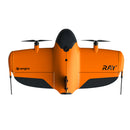
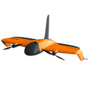
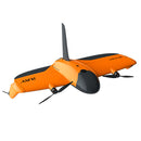
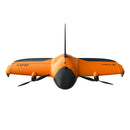
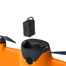
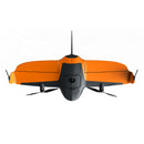
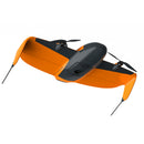
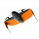
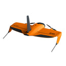
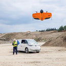
WingtraRAY is a modular VTOL survey drone delivering survey-grade accuracy in record time. Certified parachute, adaptive cruise 16–22 m/s, and interchangeable 61 MP, LiDAR, and multispectral payloads unlock safe urban OOP and large-scale mapping. Process end-to-end in WingtraCLOUD for same-day deliverables.
WingtraRAY is the next-generation VTOL mapping drone that delivers survey-grade results on the very first flight. Its modular airframe, certified safety features, and all-in-one workflow let you quote more work, finish it faster, and keep crews safe—whether you’re threading downtown corridors or mapping 1,000-acre (400 ha) job sites.
Peace of Mind in Every Flight
Parachute add-on certified for Operations Over People
The factory-installed parachute meets Cat 3 OOP (U.S.) and C6 (EU) standards, unlocking surveys across 98 % of U.S. land without waivers or road closures.
Obstacle avoidance & adaptive geofence
Forward-looking sensors and real-time geofencing steer clear of cranes, power lines, and buildings while requiring only a 6.6 × 6.6 ft (2 × 2 m) launch/landing pad.
Redundant power & BVLOS telemetry
Dual hot-swap batteries keep you airborne even if one pack fails, while simultaneous radio + LTE links maintain command, video, and health data beyond visual line of sight.
Faster Data, Lower Costs
40% faster than WingtraOne Gen II
Survey a 250 ac (100 ha) site in 10-min and deliver processed data in under two hours—up to 10× quicker than multicopters and 30× faster than terrestrial crews.
Adaptive cruise 36–49 mph
Smart speed control shortens flight windows, letting you work between weather fronts or tight air-traffic slots and still deliver same-day orthos, DSMs, and point clouds.
End-to-end workflow in WingtraCLOUD
Plan, fly, process, QA, and share in a single platform so field teams, office analysts, and clients stay aligned—eliminating costly re-flights.
| WingtraRAY | WingtraOne Gen II | Multicopter |
| 250 ac mapped 10 min flight |
250 ac mapped 14 min flight |
250 ac mapped 60–90 min flight |
| Data delivered < 2 hrs |
Data delivered ~ 4 hrs |
Data delivered 1–2 days |
One Tool, More Jobs
SURVEY61 — 0.2 in/px accuracy

61 MP nadir RGB sensor achieves < 0.4 in (1 cm) horizontal RMS without GCPs and covers 766 ac (310 ha) per sortie from 400 ft AGL.
MAP61 — accelerated 3D mapping

Oblique 61 MP camera with fast trigger speed reduces overlap requirements, producing dense, photorealistic meshes of corridors, quarries, and open-pit mines in record time.
INSPECT — 0.1 in/px detail

Telephoto 61 MP payload resolves millimeter-level defects on runways, rails, and facades from 200 ft AGL while still mapping 250 ac per flight.
SURVEY24 — budget-friendly coverage

24 MP nadir camera maps up to 815 ac (330 ha) at 0.94 in/px (2.4 cm/px) GSD—ideal for general topo and stockpile work where price sensitivity matters.
RedEdge-P multispectral

Five narrow bands plus a 5.1 MP panchromatic sensor deliver 0.8 in/px (2 cm/px) crop-health insights for agronomy, forestry, and environmental studies.
LiDAR — 19 pts/ft² bare-earth

High-energy laser penetrates foliage to capture accurate ground models for flood risk, corridor design, and cut-fill calculations.
Add-Ons That Expand Your Airspace
Parachute kit
Manual trigger plus a one-year OOP license keep flights compliant and property safe; install or remove in minutes.
Heavy-Flyer bundle
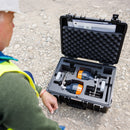
Three extra battery sets, vehicle charger, spare props, landing fins, SD cards, and tools—everything you need for dawn-to-dusk operations in a single rugged case.
All performance figures assume calm sea-level conditions. Actual results may vary with terrain, weather, and payload selection.
WingtraRAY is the next-generation VTOL mapping drone that delivers survey-grade results on the very first flight. Its modular airframe, certified safety features, and all-in-one workflow let you quote more work, finish it faster, and keep crews safe—whether you’re threading downtown corridors or mapping 1,000-acre (400 ha) job sites.
Peace of Mind in Every Flight
Parachute add-on certified for Operations Over People
The factory-installed parachute meets Cat 3 OOP (U.S.) and C6 (EU) standards, unlocking surveys across 98 % of U.S. land without waivers or road closures.
Obstacle avoidance & adaptive geofence
Forward-looking sensors and real-time geofencing steer clear of cranes, power lines, and buildings while requiring only a 6.6 × 6.6 ft (2 × 2 m) launch/landing pad.
Redundant power & BVLOS telemetry
Dual hot-swap batteries keep you airborne even if one pack fails, while simultaneous radio + LTE links maintain command, video, and health data beyond visual line of sight.
Faster Data, Lower Costs
40% faster than WingtraOne Gen II
Survey a 250 ac (100 ha) site in 10-min and deliver processed data in under two hours—up to 10× quicker than multicopters and 30× faster than terrestrial crews.
Adaptive cruise 36–49 mph
Smart speed control shortens flight windows, letting you work between weather fronts or tight air-traffic slots and still deliver same-day orthos, DSMs, and point clouds.
End-to-end workflow in WingtraCLOUD
Plan, fly, process, QA, and share in a single platform so field teams, office analysts, and clients stay aligned—eliminating costly re-flights.
| WingtraRAY | WingtraOne Gen II | Multicopter |
| 250 ac mapped 10 min flight |
250 ac mapped 14 min flight |
250 ac mapped 60–90 min flight |
| Data delivered < 2 hrs |
Data delivered ~ 4 hrs |
Data delivered 1–2 days |
One Tool, More Jobs
SURVEY61 — 0.2 in/px accuracy

61 MP nadir RGB sensor achieves < 0.4 in (1 cm) horizontal RMS without GCPs and covers 766 ac (310 ha) per sortie from 400 ft AGL.
MAP61 — accelerated 3D mapping

Oblique 61 MP camera with fast trigger speed reduces overlap requirements, producing dense, photorealistic meshes of corridors, quarries, and open-pit mines in record time.
INSPECT — 0.1 in/px detail

Telephoto 61 MP payload resolves millimeter-level defects on runways, rails, and facades from 200 ft AGL while still mapping 250 ac per flight.
SURVEY24 — budget-friendly coverage

24 MP nadir camera maps up to 815 ac (330 ha) at 0.94 in/px (2.4 cm/px) GSD—ideal for general topo and stockpile work where price sensitivity matters.
RedEdge-P multispectral

Five narrow bands plus a 5.1 MP panchromatic sensor deliver 0.8 in/px (2 cm/px) crop-health insights for agronomy, forestry, and environmental studies.
LiDAR — 19 pts/ft² bare-earth

High-energy laser penetrates foliage to capture accurate ground models for flood risk, corridor design, and cut-fill calculations.
Add-Ons That Expand Your Airspace
Parachute kit
Manual trigger plus a one-year OOP license keep flights compliant and property safe; install or remove in minutes.
Heavy-Flyer bundle
Three extra battery sets, vehicle charger, spare props, landing fins, SD cards, and tools—everything you need for dawn-to-dusk operations in a single rugged case.
All performance figures assume calm sea-level conditions. Actual results may vary with terrain, weather, and payload selection.
WingtraRAY Specifications
Hardware
| Drone type | Tailsitter VTOL (vertical take-off & landing) |
| Max. take-off weight | 5.2 kg (11.5 lb) |
| Payload capacity | 1 250 g (2.75 lb) |
| Wingspan | 125 cm (4.1 ft) |
| Battery capacity / type | Two 99 Wh smart Li-poly packs (UN3481) |
| Radio link (primary) | 2.4 GHz, 10 km (6 mi) LOS* |
| Radio link (secondary) | LTE, unlimited within cellular coverage |
| On-board GNSS | GPS (L1/L2), GLONASS (L1/L2), Galileo (L1), BeiDou (L1) – redundant |
| Drone dimensions | 125 × 68 × 12 cm (49.2 × 26.8 × 4.8 in) |
| Transport case | 130 × 70 × 34 cm (51.2 × 27.6 × 13.4 in) • 14.4 kg (32 lb) |
| Transport (shipping) | 134 × 74 × 37 cm (52.8 × 29.1 × 14.6 in) • 18.6 kg (41 lb) |
| *Line-of-sight; obstacles reduce range. | |
Operation
| Adaptive cruise speed | 16 – 22 m/s (36 – 49 mph) |
| Climb / sink (cruise) | 8 m/s up / 8 m/s down (17.9 mph) |
| Climb / sink (hover) | 6 m/s up / 2.5 m/s down (13.4 / 5.6 mph) |
| Wind resistance | 12 m/s (27 mph) sustained • 18 m/s (40 mph) gusts |
| Ground wind limit | 8 m/s (19 mph) |
| Max. flight time | 59 min (RGB / MS) • 45 min (LiDAR) |
| Temperature range | -10 – +40 °C (14 – 104 °F) |
| Max. take-off altitude | 4 800 m (15 700 ft) (high-alt drivetrain) • 1 500 m (4 900 ft) standard |
| Max. flight altitude | 5 000 m (16 400 ft) (high-alt) • 2 000 m (6 600 ft) standard |
| Weather rating | IP53 – avoid rain, fog & snow |
| GCPs required | None with PPK (3 checkpoints recommended) |
| Auto-landing accuracy | < 2 m (< 7 ft) |
Results
| Metric | MAP61 | SURVEY61 |
| Max coverage @ 400 ft* | 550 ha (1 360 ac) • 2.7 cm/px (1.06 in/px) | 310 ha (760 ac) • 1.3 cm/px (0.51 in/px) |
| Max coverage @ lowest GSD* | 240 ha (600 ac) • 1.2 cm/px (0.47 in/px) | 120 ha (300 ac) • 0.5 cm/px (0.20 in/px) |
| Field time – 100 ha* | 15 min | 30 min |
| Field time – 1 000 ha* | 2 hrs | 4 hrs |
| Lowest GSD | 1.2 cm/px (0.47 in/px) @ 180 ft | 0.5 cm/px (0.20 in/px) @ 150 ft |
| Absolute accuracy (PPK) | 3 cm (0.1 ft) RMS (X, Y, Z) | |
| Relative accuracy (PPK) | 0.005 % | 0.003 % |
| *Calm conditions, 70 % side-overlap. | ||
WingtraCLOUD Software
| Core function | End-to-end cloud platform: plan → capture → process → share |
| Key benefits | Real-time team sync • Automated planning • Secure storage • Scalable |
| Supported inputs | WingtraRAY imagery, flight plans, WMS, .dxf / .kml / .geojson / .csv |
| Outputs | Orthos & DSM (.tif) • Point clouds (.laz) • Mesh (.obj) • Quality report (.pdf) |
| Integration | Export to ArcGIS, AutoCAD, etc. • WMS overlays • Auto PPK data sync |
| Languages | English |
Tablets
| Spec | Samsung Tab Active 3 (Included) | Premium Tablet (Add-On) |
| Display | 8 in • 480 nit | 10.1 in • 1 000 nit (sun-readable) |
| Battery | 5 050 mAh (swappable) | 17 840 mAh hot-swap (all-day) |
| Temp. range | 32 – 122 °F (0 – 50 °C) | -22 – 131 °F (-30 – +50 °C) |
| Connectivity | Wi-Fi | 5G + Wi-Fi 6E |
| Rugged rating | IP68 • MIL-STD-810 | IP66 • MIL-STD-810H |
Data Links
| Primary link | WingtraRAY Telemetry 2.4 GHz – FHSS, 19.8 dBm EIRP, 10 km LOS |
| Secondary link | LTE telemetry, global bands, BVLOS fallback |
Parachute Add-On
| Module name | WingtraRAY Parachute |
| Activation | Automatic (loss-of-control) / Manual trigger |
| Sink rate | 4.5 m/s (10 mph) |
| Min. deploy altitude | 30 m (98 ft) |
| Manual trigger range | Up to 4 km (US/EU/AUS-BRA/JP ISM bands) |
Battery
| Module | WingtraRAY Battery 1 (WRB01) |
| Capacity / type | 99.8 Wh Li-poly (pair required) |
| Nominal voltage | 30.8 V • 8s |
| Weight / size | 525 g (1.2 lb) • 108 × 69 × 55 mm |
| Charge time | 1 hr per pair |
| Operating temps. | Take-off +50 – +104 °F (+10 – +40 °C) • In-flight to +140 °F (60 °C) |
| Protections | Shock • Over/under-V • Over-T • Short-circuit |
Battery Charger
| Module | WingtraRAY 4-Channel Dock |
| Input (AC) | 110 – 240 V • 200 W |
| Input (DC) | 11 – 36 V • 200 W (24-36 V) / 50 W (12 V) |
| Modes | Charge / Storage (4 hr) |
| USB-C outputs | 2 × 5 V / 2.1 A |
| Dimensions / weight | 190 × 150 × 40 mm • 680 g |
Full Mapping Flexibility
| Modular payloads | Tool-less twist-lock swap (≤ 30 s) |
| Power supply | Up to 80 W from airframe |
| Payload protection | Fully enclosed, shock-isolated, VTOL landings |
| Supported sensors | MAP61 • SURVEY61 • INSPECT • SURVEY24 • RedEdge-P • LiDAR-M2X |
| Additional payloads | Cat 3 parachute |
| PPK equipped | Centimeter-grade GNSS in every drone |
RGB Sensors
| Spec | MAP61 Efficient 3D |
SURVEY61 Survey-grade |
INSPECT MM detail |
SURVEY24 Economy |
| Resolution | 61 MP | 61 MP | 61 MP | 24.2 MP |
| Sensor size | Full-frame | Full-frame | Full-frame | APS-C |
| Lens | 17 mm (15° oblique) | 35 mm nadir | 85 mm nadir | 20 mm nadir |
| Payload weight | 585 g | 585 g | 585 g | 550 g |
| GSD @ 400 ft | 2.7 cm/px | 1.3 cm/px | 0.5 cm/px | 2.4 cm/px |
| Lowest GSD | 1.2 cm/px | 0.5 cm/px | 0.25 cm/px | 1.2 cm/px |
| Max coverage @ 400 ft | 550 ha | 310 ha | 100 ha | 330 ha |
| Absolute accuracy | 3 cm RMS (PPK) | |||
GSD Overview – RGB Sensors
| Scenario | MAP61 | SURVEY61 | INSPECT | SURVEY24 |
| @ 400 ft (120 m) | 2.7 cm • 550 ha | 1.3 cm • 310 ha | 0.5 cm • 100 ha | 2.4 cm • 330 ha |
| Lowest GSD* | 1.2 cm • 240 ha @ 180 ft | 0.5 cm • 120 ha @ 150 ft | 0.25 cm • 50 ha @ 200 ft | 1.2 cm • 120 ha @ 200 ft |
| @ 1 970 ft (600 m) | 13.2 cm • 2 280 ha | 6.5 cm • 1 550 ha | 2.5 cm • 500 ha | 12 cm • 1 100 ha |
| *70 % side-overlap. | ||||
LiDAR System
| Payload weight | 1 060 g (2.34 lb) |
| Point density @ 150 ft | ≈110 pts/m² (single) • ≤ 660 pts/m² (triple) |
| Coverage @ 150 ft* | 245 ha (605 ac) • 30 % overlap |
| Vertical accuracy | 3 cm (1.2 in) RMS @ 300 ft |
| Scanner / IMU | Hesai XT32M2X • Inertial Labs Tactical-IMU |
| Outputs | LAS / LAZ via Wingtra LiDAR App |
| *Without parachute; with PRS coverage slightly reduced. | |
Multispectral Sensor – RedEdge-P
| Payload weight | 502 g (1.11 lb) |
| Bands | RGB, Red-edge, NIR + 5.1 MP panchromatic |
| GSD @ 400 ft | 4 cm/px (1.6 in/px) |
| Lowest GSD | 2 cm/px (0.8 in/px) @ 200 ft |
| Max coverage @ 400 ft | 180 ha (440 ac) |
| Absolute accuracy | 6 cm (0.2 ft) RMS (PPK) |
GSD Overview – Multispectral
| Altitude | GSD | Coverage* |
| 400 ft | 4 cm/px | 180 ha |
| 200 ft | 2 cm/px | 80 ha |
| 590 ft | 6 cm/px | 240 ha |
| 1 970 ft | 20 cm/px | 600 ha |
| *70 % side-overlap. | ||
WingtraGROUND – GNSS Kit
| Kit contents | 2× Reach RS3, 2× tripods, 6× targets, nails & hammer, hard case |
| Base logging | Relative (known point) • Absolute PPP (coming) |
| Checkpoint logging | 30 s per point • ≤ 6 mi (10 km) baseline |
| Cloud sync | Auto upload RINEX, checkpoints & imagery to WingtraCLOUD |
Reach RS3 Receiver
| Accuracy (PPK) | H 5 mm + 0.5 ppm • V 10 mm + 1 ppm |
| Signals | GPS, GLONASS, BeiDou, Galileo (dual-freq.) |
| Channels | 184 |
| Weight / size | 950 g • 126 × 126 × 142 mm |
| Rugged rating | IP67 •-20 – +65 °C (-4 – +149 °F) |
| Battery life | Li-ion, > 2 000 cycles • 16 GB storage |
Specifications subject to change without notice; see advexure.com for the latest data.
WingtraRAY Bundle
(1) Wingtra UAV, ready to fly (“WingtraRAY”)
(1) Tablet TabActive 3
(1) Telemetry module (2.4 GHz)
(2) Flight batteries (one set—two batteries required per flight)
(1) Flight-battery charger with dock & cables
(1) T10 Torx screwdriver for drivetrain, parachute, and repairs
(1) USB-C / SD-card adapter
(1) Rugged drone hard case
(1) PPK module
(1) Drone operating-system license
(1) Wingtra apps suite (tablet, desktop, browser — Essential plan)
(1) Three-year software updates & tier-3 support
WingtraRAY Bundle + MAP61 Payload
(1) Wingtra UAV, ready to fly (“WingtraRAY”)
(1) WingtraRAY MAP61 Payload
(1) Tablet TabActive 3
(1) Telemetry module (2.4 GHz)
(2) Flight batteries (one set—two batteries required per flight)
(1) Flight-battery charger with dock & cables
(1) T10 Torx screwdriver for drivetrain, parachute, and repairs
(1) USB-C / SD-card adapter
(1) Rugged drone hard case
(1) PPK module
(1) Drone operating-system license
(1) Wingtra apps suite (tablet, desktop, browser — Essential plan)
(1) Three-year software updates & tier-3 support
WingtraRAY Bundle (Hardware Only)
(1) Wingtra UAV, ready to fly (“WingtraRAY”)
(1) Tablet TabActive 3
(1) Telemetry module (2.4 GHz)
(2) Flight batteries (one set—two required per flight)
(1) Flight-battery charger with dock & cables
(1) T10 Torx screwdriver for drivetrain, parachute, and repairs
(1) USB-C / SD adapter
(1) Rugged drone hard case
NOTICE: Hardware only! To operate WingtraRAY, a valid software license is required
Do I need Wingtra PRO to fly WingtraRAY?
No. WingtraRAY works with any Wingtra subscription plan—Essential, Pro, or Unlimited.
Is WingtraRAY compatible with the current Wingtra workflow?
Yes. It integrates with WingtraGROUND and WingtraCLOUD. Select WingtraOne payloads work on WingtraRAY when upgraded via the payload-upgrade kit; new SURVEY61 and INSPECT sensors are RAY-only.
Which payload should I choose?
Consult the payload-positioning guide for project-specific recommendations.
How do I fly WingtraRAY in urban or suburban U.S. airspace?
Once the FAA grants WingtraRAY a Cat 3 Operations-Over-People certificate, you can operate under Part 107—with no waivers—provided you avoid open-air assemblies and follow standard restrictions (airport NFZs, military bases, etc.).
EU guidance is in preparation and will be published closer to certification.
What are the C3 and C6 certifications?
Under EASA rules, WingtraRAY is
• C3 (Open Category, A3) — VLOS flights ≤ 120 m AGL, ≥ 150 m from populated areas.
• C6 (Specific Category, STS-02) — BVLOS flights with observers over sparsely populated controlled ground areas.
Adding the parachute simplifies SORA approval for dense-area BVLOS missions.
What is the adaptive-speed function?
WingtraRAY automatically selects the optimal cruise speed (16 – 22 m/s) to maximise coverage while preventing motion blur or missed triggers, using live sensor and mission-profile feedback.
Where can I find the full tech specs?
The complete spec sheet will appear in the Partner Toolkit folder just before launch.
How long will WingtraOne GEN II remain available?
GEN II support continues until further notice. Payloads & accessories remain on sale for ≥ 12 months after WingtraRAY launch; replacement parts for ≥ 24 months. MAP61, LiDAR, and RedEdge-P payloads can be upgraded to WingtraRAY.
What should I do with my GEN II demo or stock units?
Contact your RSM to sell remaining units by 10 July. GEN II will still appeal to price-sensitive customers—use the price gap to your advantage, and upgrade eligible demo payloads to WingtraRAY where needed.
Customer Reviews
Payment & Security
Your payment information is processed securely. We do not store credit card details nor have access to your credit card information.


