


|
|
|
|
|


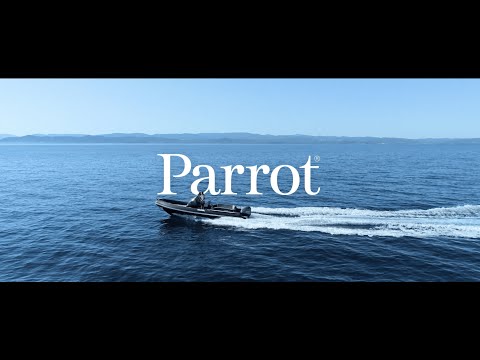
The Parrot ANAFI USA is a highly secure, rugged, and versatile small unmanned aircraft system designed and manufactured in the USA for enterprise and government use. Developed with input from the U.S. Army’s Short-Range Reconnaissance (SRR) program, it combines advanced imaging capabilities (including a triple-sensor 4K/thermal camera system) with strict security and data privacy features. ANAFI USA is BlueUAS program approved and fully NDAA & TAA compliant, containing no components from restricted countries. Weighing just 500 g and deployable in under a minute, this drone is tailored for first responders, defense, public safety, inspection, and industrial missions that demand a reliable eye in the sky.
With a 32× zoom electro-optical camera setup and a FLIR thermal sensor, ANAFI USA can capture detailed visuals and heat signatures from safe stand-off distances. Its compact foldable airframe is rated IP53 for dust and rain resistance, enabling operations in tough environments. End-to-end encryption and no default data sharing mean sensitive information stays protected on-board. In sum, ANAFI USA delivers a powerful aerial intelligence solution in a hand-portable package, purpose-built for critical operations and the most demanding professional users.
Key Features
- Made in USA, Secure & Compliant: Built in the United States, approved under the DoD Blue sUAS program, and compliant with NDAA & TAA regulations for trusted deployment in government and defense applications.
- Triple-Sensor Camera Payload: Integrated dual 21 MP visible cameras plus a FLIR Boson thermal camera on a 3-axis gimbal, providing up to 32× continuous zoom and combined thermal/EO imaging.
- 32× Hybrid Zoom: High-resolution zoom system (two 1/2.4″ CMOS sensors) lets operators observe details from a safe standoff distance and identify targets at long range while maintaining stable footage.
- Thermal Imaging: LWIR thermal sensor (320×256 px) detects heat signatures and temperature differences with selectable color palettes and hotspot detection modes for firefighting, SAR, and inspection.
- Extended Flight Performance: Up to 32-minute flight time per battery; maximum speed of about 14.7 m/s and solid wind resistance for robust outdoor operation.
- Rapid Deployment: Flight-ready in under 55 seconds from packed to airborne, no geofencing required, enabling immediate takeoffs even indoors or in GPS-denied environments.
- Rugged & Weatherized: IP53-rated against dust and light rain; operable in temperatures down to about -36°C and up to +50°C, ensuring mission continuity in adverse conditions.
- Low Noise Signature: Extremely quiet operation (~79 dB at close range), minimizing disturbance and detection for sensitive or tactical missions.
- Data Security & Encryption: Zero data shared by default; all recordings can be AES-XTS 512-bit encrypted on the SD card. Secure WPA2-encrypted link and signed firmware protect against interception or tampering.
- Enterprise Ecosystem & SDK: Open-source SDK and broad software compatibility (Pix4D, DroneSense, etc.) allow deep integration into enterprise workflows, from mapping to real-time streaming.
Triple Sensor Payload (EO + Thermal)
ANAFI USA carries a 3-camera payload consisting of two electro-optical (EO) cameras and one infrared thermal camera, all stabilized on a common gimbal. This triple-sensor array allows simultaneous capture of high-resolution visible imagery and thermal data for comprehensive situational awareness. The dual EO cameras are both 1/2.4″ 21-megapixel sensors – one with a wide-angle lens and one with a telephoto lens – that work together to achieve a seamless 32× zoom range. The wide camera provides broad context for short-range reconnaissance, while the tele camera delivers long-range detail zoom, with an automatic transition between lenses to maintain continuous zoom without interruption. The third sensor is a FLIR Boson longwave infrared camera (320×256 resolution), enabling the drone to detect heat signatures and temperature differences that are invisible to the naked eye.
This tightly integrated triple-sensor payload is mounted on a 3-axis stabilized gimbal, which compensates for drone motion and wind to keep images steady. The gimbal can tilt from straight down (nadir) to forward angles, giving operators flexibility to inspect structures or survey terrain from various perspectives. Parrot’s hybrid stabilization system couples the mechanical gimbal with electronic image stabilization (EIS) on all three camera feeds, achieving remarkably stable video even at full 32× zoom. This means ANAFI USA can capture clear, usable imagery at long distances or during dynamic maneuvers, critical for missions like overwatch, search & rescue, and inspection of distant or elevated targets.
Imaging & Zoom Capabilities
The ANAFI USA’s imaging system provides exceptional zoom and visual detail, leveraging its dual EO cameras for continuous magnification from wide-angle to telephoto. The drone can achieve up to 32× continuous zoom, allowing it to surveil from a safe distance without loss of detail. Operators can see critical details clearly at significant stand-off ranges. The zoom is lossless through much of its range (5× lossless in 4K, 10× in 1080p, and up to 15× in 720p HD), then transitions to digital up to 32×. Even at high zoom levels, images retain a solid resolution.
Maintaining stable, usable video at these zoom levels is a major technical achievement for a 500 g class drone. ANAFI USA’s gimbal and EIS work in tandem to ensure the zoomed image remains steady. This stability allows operators to read details like license plates or utility pole tags from a great distance. The cameras support 4K HDR video (at 24/30 fps) and 21 MP stills in the visible spectrum, producing crisp footage for documentation or evidence. Operators can easily toggle zoom levels or switch between wide, zoom, and thermal views in the controller interface. The live video feed can display blended thermal and visible imagery, so you can zoom in on an area while simultaneously observing its thermal profile – extremely useful for identifying hotspots or persons in darkness.
Thermal Sensor Capabilities
The ANAFI USA’s FLIR Boson thermal camera adds a critical layer of information for firefighting, law enforcement, and industrial inspections. This sensor detects heat energy in the longwave infrared band (7.5 – 13 µm). It captures thermal still images at 320×256 px resolution and outputs live thermal video at 1280×720 (upscaled) at 9 Hz framerate, with a high thermal sensitivity. It’s calibrated for a broad measurable temperature range, enabling detection of both very cold and extremely hot objects.
Operators can choose from multiple thermal viewing modes and palettes. The drone supports both “relative” and “spot” thermography modes – relative mode highlights the full temperature gradient in the frame, while spot mode colorizes only the hottest or coldest points. The camera can blend thermal and visible imagery in real time, useful for pinpointing details that aren’t visible in the thermal spectrum alone. Recorded thermal imagery is fully synchronized with the RGB footage, enabling post-mission analysis with side-by-side or overlay comparisons. This is vital for tracking missing persons at night, identifying electrical hotspots, or assessing disaster scenes.
Flight Performance
The ANAFI USA delivers robust flight performance in a compact package, giving operators the agility and endurance needed for demanding missions. It offers a maximum flight time of about 32 minutes per battery, allowing extended overwatch or large-area surveys. The drone’s propulsion enables a top speed up to around 14.7 m/s (33 mph), useful for quickly reaching a scene or tracking moving subjects. Despite its small size, it can handle windy conditions (approximately 15 m/s).
Rapid deployment is a key attribute: the drone can be unfolded, booted up, and ready to take off in under 55 seconds. This is vital for first responders and military teams where time is critical. ANAFI USA includes no built-in no-fly zones, offering authorized pilots the freedom to fly subject to local regulations. It can even take off indoors or in GPS-denied environments, thanks to its visual and ultrasonic sensors. Its low noise signature (~79 dB at close range) also helps avoid drawing attention. The drone’s service ceiling is around 5,000 m above sea level, and it’s tested for operation in temperatures from -36°C to +50°C, ensuring consistent performance in extreme climates.
Security & Compliance
Security is a cornerstone of ANAFI USA’s design, making it trusted for sensitive operations. It is fully compliant with the NDAA and TAA, satisfying federal procurement standards for use by military and government agencies. This ensures it meets stringent supply chain requirements and contains no untrusted hardware or software.
By default, ANAFI USA does not transmit flight data, photos, or videos to any external servers. All data stays local unless users opt in. Recorded media can be protected by 512-bit AES-XTS encryption on the drone’s microSD card. Once encrypted, footage is unreadable without the key. The wireless link between drone and controller uses WPA2 (AES-CCMP) encryption, and the drone’s firmware is digitally signed by Parrot to prevent unauthorized alterations. These measures — NDAA compliance, on-board encryption, secure links, and signed software — ensure ANAFI USA meets the cybersecurity needs of defense, public safety, and critical infrastructure users.
Compact, Rugged Design & IP Rating
ANAFI USA is built to handle field operations. Its ultra-compact, foldable design allows it to fit easily into a backpack or small case. Weighing around 500 g, it’s effortless to carry multiple units or batteries. Despite this small form, the airframe is IP53-rated against dust and rain, making it suitable for harsh environments. The drone’s polycarbonate and carbon fiber construction can withstand bumps and minor drops, and it’s specified for temperatures between about -36°C and +50°C.
All critical components are hardened. Motors and electronics are tested to sustain performance in difficult conditions, from sub-freezing winters to hot desert climates. The foldable design and quick prop replacement help field teams rapidly deploy or pack up. Because it’s so lightweight and portable, operators can perform hand launches or catches if terrain is unsuitable for normal takeoffs. Overall, ANAFI USA’s rugged form factor provides the portability of a consumer drone with enterprise/military-level durability.
Controllers & Live Streaming
Parrot offers dedicated controller options for ANAFI USA. The standard Skycontroller 3 is a folding remote that uses your mobile device as the display. It provides a reliable Wi-Fi control link up to about 4 km and a 720p HD live video feed. With an ergonomic design and integrated battery, it’s lightweight and easy to transport.
For more advanced needs, the Skycontroller USA is a ruggedized, all-in-one controller with a built-in 8-inch screen and extended battery life. Fully NDAA/TAA compliant in its components, it’s rated IP53 for dust/rain and has multiple connectivity options, including Ethernet for external video sharing. It also supports an optional Microhard radio module in the drone for enhanced range and penetration. Both controllers link securely to ANAFI USA using WPA2 encryption, and the 720p live feed can display the thermal, visible, or blended view.
Battery Specs & Smart Charging
Each ANAFI USA drone is powered by a high-density, smart LiPo battery (3S, 3400 mAh). This pack provides around 32 minutes of flight per charge. A built-in battery management system tracks voltage, temperature, and health for safer operation. Charge status is indicated by four LEDs on the battery.
Charging is simplified via USB Type-C. Users can employ any USB-PD charger (for example, a laptop charger) to top up the battery in about two hours. The battery is also quick-swappable: land, swap packs, and take off again in under a minute. This helps keep downtime minimal during multi-sortie operations. The battery system even includes an auto-discharge feature (wintering mode) if left unused, preserving cell health over time. In enterprise kits, multiple batteries are typically included so you can rotate packs and remain airborne through extended missions.
Flight Modes & Software Ecosystem
The ANAFI USA platform is supported by a robust software ecosystem that enhances capabilities for various missions. Parrot’s FreeFlight 6 (USA) app provides an intuitive interface for piloting, camera control, and advanced features like smart return-to-home (RTH) and one-touch cinematic shots. FreeFlight 6 operates fully offline and does not share data unless the user opts in, ensuring mission privacy.
ANAFI USA also integrates with a wide range of third-party software through open protocols and a flexible SDK. This includes mapping tools (Pix4Dcapture, Pix4Dreact), public safety incident management (DroneSense), fleet and data management solutions (DroneLogbook), and more. QGroundControl compatibility allows for open-source control and mission planning. Whether it’s asset inspections, search & rescue, or tactical reconnaissance, users can choose specialized software to match their needs. This open approach makes ANAFI USA a highly adaptable drone that fits into existing enterprise workflows or command-and-control platforms.
SDK & Third-Party Integrations
Parrot provides an open Software Development Kit (SDK) for ANAFI USA, allowing developers to create custom applications or integrations. The Ground SDK gives programmatic access to flight controls, camera settings, video streaming, and telemetry. Since it’s open-source, it benefits from community contributions and transparency. Developers can build custom mobile apps, feed the drone’s data into existing enterprise systems, or automate missions based on external triggers.
The drone supports standard protocols like MAVLink for telemetry and RTP/RTSP for video streaming, making it interoperable with many existing ground control stations and command software. This high degree of flexibility ensures ANAFI USA can be tailored to evolving operational requirements, from AI-driven analytics to secure real-time data sharing with command centers. It is, in essence, a platform that agencies and businesses can shape to their unique mission profiles.
ANAFI USA Drone
| Dimensions (Folded) | 252 × 104 × 84 mm |
| Dimensions (Unfolded) | 282 × 373 × 84 mm |
| Weight | 500 g (1.1 lb) |
| Max Flight Time | Up to 32 minutes (per battery) |
| Max Horizontal Speed | ~14.7 m/s (33 mph) |
| Max Ascent/Descent Speed | Up to 4 m/s ascent / 3 m/s descent (6 m/s ascent on Gov editions) |
| Wind Resistance | Up to ~15 m/s (30+ mph) |
| Service Ceiling | ~5000 m above MSL |
| Operating Temperature | -36 °C to +50 °C |
| IP Rating | IP53 (dust-protected, light rain resistant) |
Imaging & Gimbal
| EO Cameras | Dual 21 MP 1/2.4″ CMOS (Wide + Tele) with up to 32× hybrid zoom |
| Thermal Camera | FLIR Boson 320×256 LWIR |
| Video Resolution | Up to 4K UHD @24/30 fps (visible), 1280×720 @9 Hz (thermal) |
| Photo Resolution | 21 MP (visible), 320×256 px (thermal) |
| Gimbal Stabilization | 3-axis hybrid (mechanical + electronic) |
| Gimbal Tilt Range | +110° to -140° mechanical range |
Communication & Control
| Control Links | Wi-Fi 802.11 (2.4/5 GHz), AES-encrypted WPA2 |
| Max Control Range | Up to ~4 km (FCC), extended with MIL radio modules |
| Live Video Feed | 720p HD @30 fps to controller/device (low latency) |
| Remote Controllers | Skycontroller 3 (foldable), Skycontroller USA (rugged, built-in screen) |
Security & Data
| Onboard Data Storage | microSDXC card (up to 256 GB), optional AES-XTS 512-bit encryption |
| Media Encryption | AES-XTS 512-bit file encryption with user-managed key |
| Firmware Security | Digitally signed firmware (preventing unauthorized code) |
| Compliance | NDAA & TAA compliant |
Battery & Power
| Battery Type | Smart LiPo 3S (3400 mAh) |
| Flight Time | Up to ~32 minutes |
| Charging Port | USB-C (USB-PD fast charge compatible) |
| Charging Time | ~2 hours with PD charger |
(1) ANAFI USA Aircraft
(1) Skycontroller 4
(1) 1 multi-port fast USB charger
(1) Additional set of propeller blades
(1) Multi-Port USB Charger (USB-PD capable)
(4) USB-A/USB-C cables
(1) USB-C/USB-C cable
(1) Hard Case
Is the ANAFI USA part of the U.S. DoD “Blue sUAS” program?
No.
Does ANAFI USA support geofencing or no-fly zone restrictions?
No, ANAFI USA does not enforce geofencing or no-fly zones by default. Operators must follow local regulations and ensure safe, authorized flights.
How long can the ANAFI USA fly on a single battery?
Under ideal conditions, each smart battery can provide up to 32 minutes of flight time.
Can ANAFI USA be used for night operations and thermal imaging?
Absolutely. The FLIR Boson thermal camera enables nighttime ops and can detect heat signatures in low-visibility conditions.
Does ANAFI USA encrypt recorded data?
Yes. It supports AES-XTS 512-bit encryption on the microSD card. Data remains inaccessible without the user-generated key.
Can I use third-party apps for mapping or inspection missions?
Yes. The open SDK and compatibility with tools like Pix4D, DroneSense, and QGroundControl allow you to integrate with various workflows.
How portable is the ANAFI USA kit?
Weighing about 500 g and folding down to a compact form, ANAFI USA is highly portable. The included hard case or backpack makes transport and rapid deployment easy.
Is the drone assembled/manufactured in the USA?
Yes. ANAFI USA is produced in the United States, meeting NDAA standards and supply chain security requirements.
Customer Reviews
Payment & Security
Your payment information is processed securely. We do not store credit card details nor have access to your credit card information.