
Located in the heart of Southern California, Rio Hondo College has been an epicenter of learning and innovation for nearly six decades. One of the standout programs is its Geographic Information Systems (GIS) Program, a field that is revolutionizing data collection across multiple industries, including public safety and health. With a commitment to practical applications and industry collaboration, Rio Hondo College's GIS Program is a beacon for professionals and aspiring technicians alike.
Warren Roberts, a 25-year veteran professor at Rio Hondo College, serves as the coordinator for the GIS program and teaches several courses. He recalls his own academic journey, which began with his graduate studies in Oregon, and speaks of his work with industry professionals from various fields including fire and police. His earliest exposure to GIS came while analyzing the fallout from the Chernobyl nuclear disaster. "GIS is revolutionary in all different areas. It's a game-changer," says Roberts.
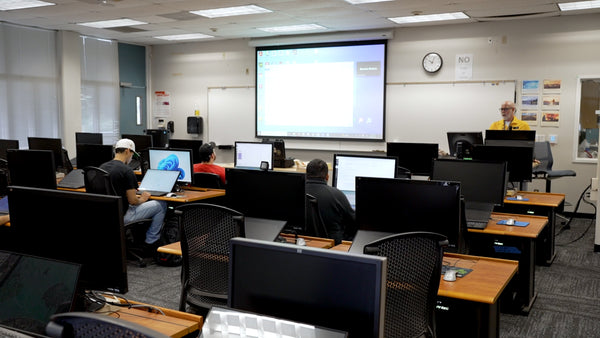
Warren S. Roberts teaching a GIS fundamentals class at Rio Hondo College in Whittier, CA.
The GIS Program at Rio Hondo College originated in the early 2000s to meet an acute need within Los Angeles County, which lacked GIS professionals at the time. The program began with grant funding and has grown exponentially, even evolving to offer an Associate Degree in GIS as of Fall 2019. The program focuses on practical and applied aspects of GIS, offering courses guided by advisory boards and professionals in the field. Over 350 students—many of them already working professionals—enroll annually, and the program awarded 50 GIS Certificates of Achievement in the 2018-2019 academic year alone.
The GIS Program at Rio Hondo College encompasses a range of topics that go far beyond mere cartography and geography. It offers an extensive curriculum that serves working professionals from various fields, including law enforcement, public health, ecology, and forestry.
One of the standout features of the program is its adaptability. With Rio Hondo being a community college, courses are offered online to accommodate working professionals, making it convenient and affordable. It's this commitment to flexibility and real-world application that sets their GIS Program apart from others.
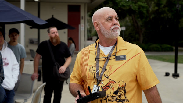
Warren Roberts teaches students about UAS fundamentals and drones for data collection for GIS at Rio Hondo College
In recent years, the program has embraced Unmanned Aircraft Systems (UAS) and drones, for data collection. Drones offer a remarkable advantage in collecting geospatial data, providing high-resolution, real-time data collection options that are both efficient and cost-effective. Integrating UAS data collection into GIS, you not only gather data more efficiently but can apply it in real-time scenarios, which is invaluable across multiple industires.

GIS overlay analyzing crime in LA county
At Advexure, we're particularly interested in how UAS technology is being harnessed in educational settings to impact industries like public safety, environment, and health. For those considering implementing a GIS program with integrated UAS technology, Advexure's team of experts, former public safety professionals, and Part 107 licensed drone pilots are ready to assist you.
Contact us today to learn more.


