Advexure Insider's Blog


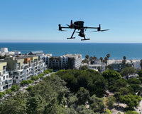
LiDAR and Drones: A New Era in Topographical Mapping & Surveying
Table of Contents
Introduction to LiDARIndustry Applications for Drone LiDAR MappingCost Considerations for Drone LiDAR MappingChoosing the Right D...

Drones for Roof Inspections - Safer, Quicker, and Smarter
In today's rapidly evolving technological landscape, the method of conducting roof inspections has seen a significant transformation, moving away f...

Advexure's Story: Making Drone Technology Accessible to All
What do you look for in a drone solutions provider? Maybe you care about the company's reputation within the industry. Perhaps price and product availability are your biggest considerations. These are some of the questions Travis Waibel, considered when he founded Advexure. Read More

The Countering CCP Drones Act: What you Need to Know
In the evolving landscape of drone legislation, the Countering CCP Drones Act (H.R.6572) represents a pivotal moment that could redefine drones and...

Combating Organized Retail Crime (ORC) with Technology: Drones, LPRs, and Real-Time Crime Centers
In recent years, the retail landscape has faced a formidable and escalating challenge: organized retail crime (ORC). However, technology like drones, LPRs and RTCCs are helping law enforcement fight back. Read our latest blog.

Understanding the American Security Drone Act (ASDA)
In the ever-evolving landscape of drone technology, the American Security Drone Act (ASDA), included within the National Defense Authorization Act (NDAA), has emerged as a pivotal piece of legislation with significant implications for public safety, federal entities, and other government agencies. Learn More.

DJI Maintenance Program: A Comprehensive Guide
DJI Maintenance Program: A Comprehensive Guide In the dynamic world of UAS, maintaining the operational integrity of your drones is essential. At Advexure, we understand the role that regular maintenance plays in the lifecycle of your drone, ensuring its performance, safety, and reliability. Read our Guide.

Leading Japanese Drone Maker ACSL Announces Pricing, Availability and Authorized Dealers of NDAA-Compliant SOTEN Drone in U.S.
Affordable and capable, SOTEN uses a swappable camera and robust encryption processes, ideal for wide range of missions including critical infrastructure projects. Could the SOTEN become the NDAA-compliant alternative to DJI? Read More.

Hog Hunting with Drones: Merging Technology with Tradition
Hog Hunting with Drones The surge of feral hog populations across the United States has posed significant ecological and agricultural challenges. As traditional hunting methods grapple with this rapidly growing issue, a new player enters the field – drones. Learn More.

Thermal vs IR: Understanding the Spectrum of Infrared Technologies
In the rapidly evolving world of UAS, understanding the nuances of different sensor technologies as it applies to your particular industry or use cases is important. There's a common misconception that thermal and infrared (IR) technologies are interchangeable concepts. Learn the Differences.

The ACSL SOTEN - A Japanese Drone set to Revolutionize the Industry?
The ACSL SOTEN (or Blue Sky in Japanese), is a groundbreaking drone from ACSL, a leading Japanese drone manufacturer. As the drone industry evolves...

Addressing the Critical Firmware Issue Affecting LP12 & DJI Matrice 30 Users
Many of our customers using the CZI LP12 Spotlight & Speaker with their DJI Matrice 30 drones are encountering a critical error. This issue stems from the latest firmware update by DJI, which has inadvertently corrupted the firmware on the LP12, rendering the unit non-functional. Read More.

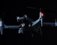
Elevating Precision in Aerial Surveying: The DJI Zenmuse L2 Vs. L1 LiDAR Sensors
The realm of aerial surveying and mapping has witnessed a transformative upgrade with the launch of DJI's Zenmuse L2 LiDAR sensor, building upon the solid foundation established by its predecessor, the Zenmuse L1. Learn More.

DJI Unveils the All-New DJI Dock 2 and Matrice 3D Series Drones
In the ever-evolving world of UAS technology, DJI has once again pushed the envelope with the release of DJI Dock 2. With its official launch in China on Nov 8th, 2023, and eventual release in other markets, Dock 2 is set to revolutionize industries like surveying, inspections, and public safety. Learn More.

The Complex Landscape of Drone Deer Recovery
Drone Deer Recovery: A Viable Solution? As hunting season gets underway, a growing number of hunters are considering drones equipped with thermal sensors as a potential solution for locating and recovering deer. You may be asking, "Is using drones for deer recovery legal?" Find Out in our Latest Blog.

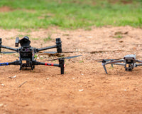
Advexure Spotlight: Rio Hondo College's GIS Program & UAS for Data Collection
Located in the heart of Southern California, Rio Hondo College has been an epicenter of learning and innovation for nearly six decades. One of the standout programs is its Geographic Information Systems (GIS) Program. Learn More.