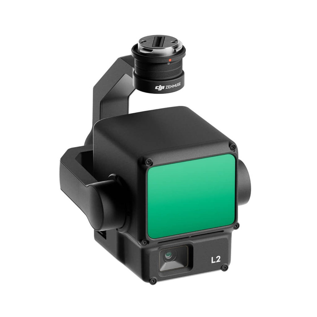
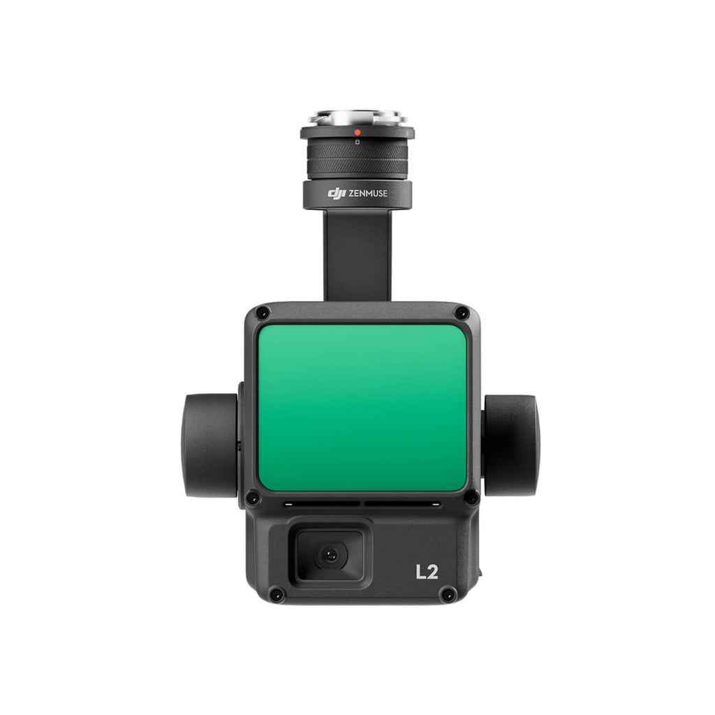
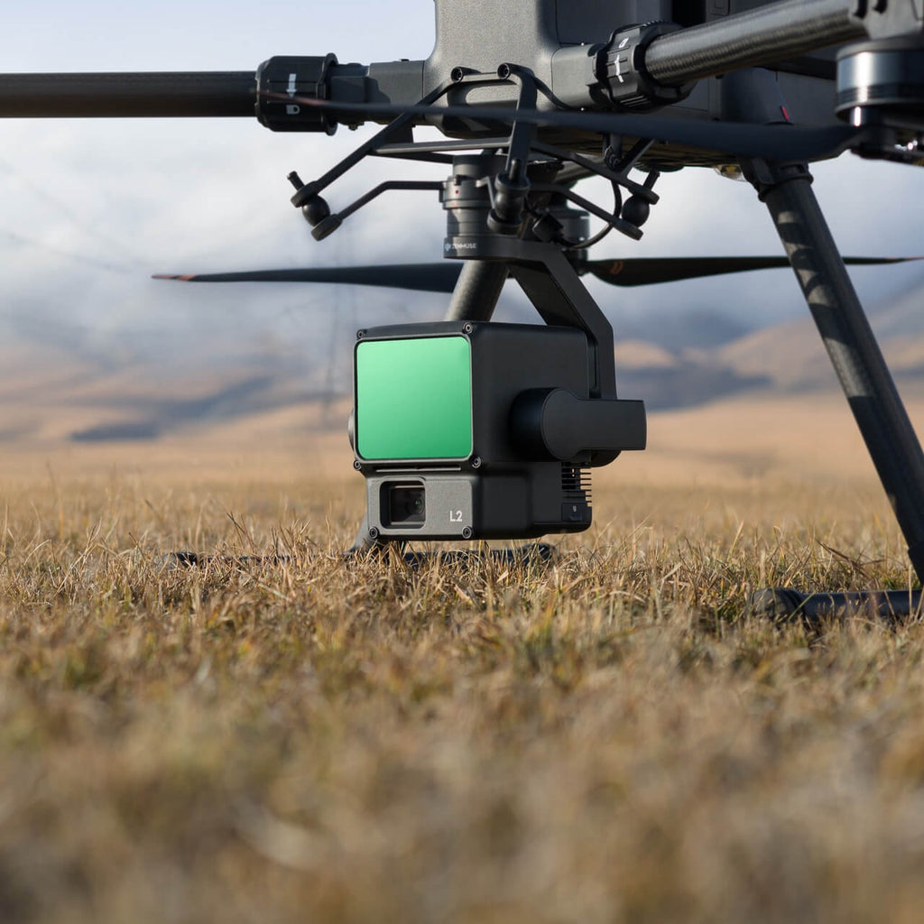
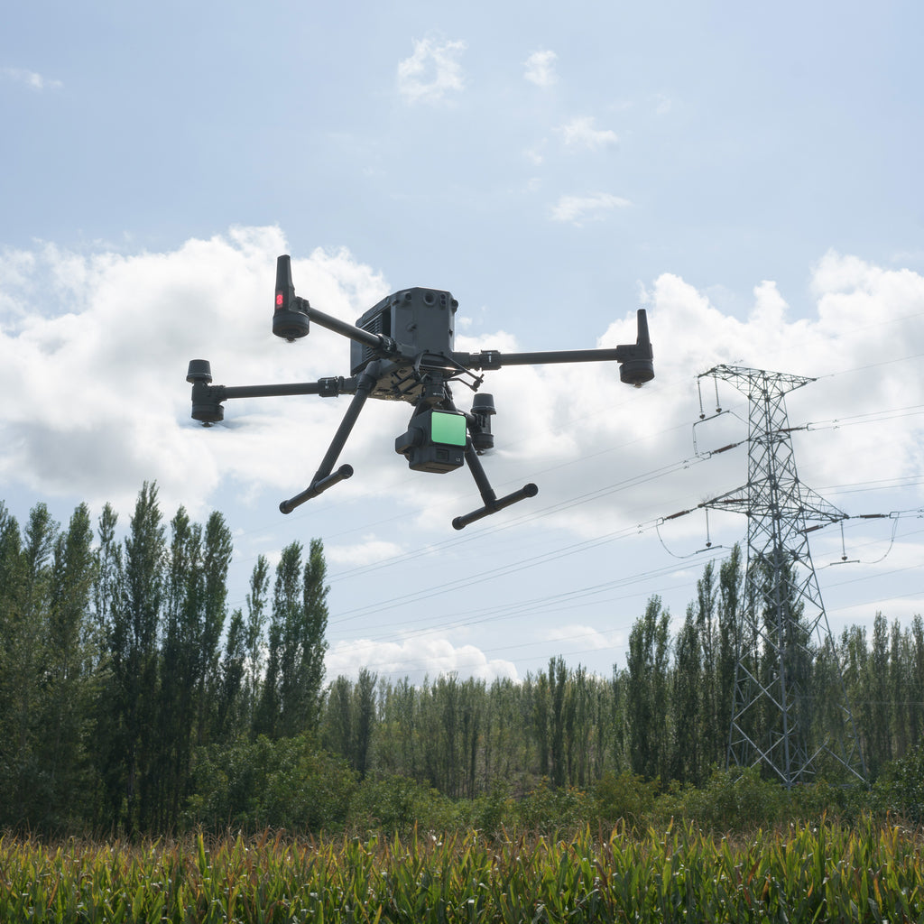
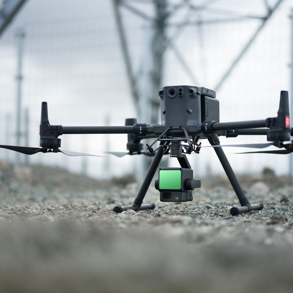
Introducing the cutting-edge DJI Zenmuse L2 LiDAR payload, designed to elevate your aerial surveying and mapping capabilities to unprecedented heights. Tailored for seamless integration with the DJI Matrice 350 and 300 series, this innovative LiDAR solution packs a powerful punch with its high precision and exceptional efficiency. The Zenmuse L2 is engineered to deliver superior penetration, providing you with the ability to capture critical data beneath dense canopies and complex structures. With a detection range spanning an impressive 250 meters to 450 meters and the capability to return up to 5 data points from a single pulse, this payload offers the precision and coverage you demand for your surveying projects.
Effortlessly transform your data acquisition process with the DJI Zenmuse L2, a turnkey solution that simplifies the LiDAR scanning workflow. Real-time Point Cloud LiveView ensures you capture the right data as it happens, optimizing your decision-making on the fly. The one-click processing feature, seamlessly integrated with DJI Terra, streamlines data management and analysis, allowing you to focus on your project's critical insights rather than spending hours on data processing. Elevate your surveying and mapping capabilities to new heights with the DJI Zenmuse L2 LiDAR payload – precision, efficiency, and ease of use have never been so accessible.
An Integrated LiDAR Solution
Supported by its powerful hardware, L2 can allow for a precise scan of complex subjects within an extended range and faster point cloud acquisition. During operations, users can preview, playback, and process point cloud models on-site, with Task Quality Reports generated by DJI Terra, offering a simple, one-stop solution to improve overall efficiency. This enables users to achieve high-precision point cloud results with one-stop post-processing.
High-Level Precision
By combining GNSS and a high-accuracy self-developed IMU, this solution achieves 4cm vertical accuracy and 5cm horizontal accuracy.

Exceptional Efficiency
It’s ready for work as soon as it’s powered on and can collect both geospatial and RGB data from a 2.5km2 area in a single flight.

Intuitive Operation
In conjunction with Matrice 350 RTK and DJI Terra, L2 offers a turnkey solution that is simple to use, lowering the operational threshold.
Frame-Based LiDAR
30% Detection Range Increase
L2 can detect from 250 meters at 10% reflectivity and 100 klx, and up to 450 meters at 50% reflectivity and 0 klx. The typical operational altitude now extends up to 120 meters, notably enhancing operational safety and efficiency.
Smaller Laser Spots, Denser Point Clouds
With a reduced spot size of 4×12 cm @100m, only a fifth of that of L1, L2 not only detects smaller objects with more details, but can also penetrate denser vegetation, generating more accurate digital elevation models (DEM).

Supports 5 Returns
In densely vegetated areas, L2 can capture more ground points beneath the foliage.
Effective Point Cloud Rate: 240,000 pts/s
In both single and multiple return modes, L2 can reach a max point cloud emission rate of 240,000 points per second, allowing the acquisition of more point cloud data in a given time frame
Two Scanning Modes
L2 supports two scanning modes, offering flexibility for users based on their task demands. In repetitive scanning mode, L2's LiDAR can achieve more uniform and accurate point clouds while meeting high-precision mapping requirements. In non-repetitive scanning mode, it offers deeper penetration for more structural information, making it suitable for power line inspection, forestry surveying, and other scenar
Frame-based Design
The frame-based design results in an effective point cloud data rate of up to 100%. Together with a three-axis gimbal, it brings more possibilities to surveying scenarios.
High-Accuracy IMU System
Improved Accuracy
The high-accuracy self-developed IMU system, combined with the drone’s RTK positioning system for data fusion during post-processing, gives L2 access to highly accurate absolute position, speed, and attitude information. In addition, the IMU system’s enhanced environmental adaptability improves the operational reliability and precision of L2.
Yaw Accuracy
Real-time: 0.2°, post-processing: 0.05°
Pitch/Roll Accuracy
Real-time 0.05°, post-processing 0.025°
No IMU Warm-up
The performance of the IMU system has been significantly enhanced, and it is ready for use the moment it's powered on. And, the accompanying drone is ready to begin tasks immediately once the RTK is in FIX status, delivering an optimized in-the-field experience.
RGB Mapping Camera
4/3 CMOS, Mechanical Shutter
Pixel size has been enlarged to 3.3 μm, and effective pixels now reach 20 MP, resulting in a significant improvement in overall imaging, as well as more enriched true-color point cloud details. The minimum photo interval has been reduced to 0.7 seconds. The mapping camera has a shutter count of up to 200,000 times, further reducing operational costs. When point cloud collection is not needed, the RGB camera can still take photos and videos, or collect images for visible light mapping.
Introducing the cutting-edge DJI Zenmuse L2 LiDAR payload, designed to elevate your aerial surveying and mapping capabilities to unprecedented heights. Tailored for seamless integration with the DJI Matrice 350 and 300 series, this innovative LiDAR solution packs a powerful punch with its high precision and exceptional efficiency. The Zenmuse L2 is engineered to deliver superior penetration, providing you with the ability to capture critical data beneath dense canopies and complex structures. With a detection range spanning an impressive 250 meters to 450 meters and the capability to return up to 5 data points from a single pulse, this payload offers the precision and coverage you demand for your surveying projects.
Effortlessly transform your data acquisition process with the DJI Zenmuse L2, a turnkey solution that simplifies the LiDAR scanning workflow. Real-time Point Cloud LiveView ensures you capture the right data as it happens, optimizing your decision-making on the fly. The one-click processing feature, seamlessly integrated with DJI Terra, streamlines data management and analysis, allowing you to focus on your project's critical insights rather than spending hours on data processing. Elevate your surveying and mapping capabilities to new heights with the DJI Zenmuse L2 LiDAR payload – precision, efficiency, and ease of use have never been so accessible.
An Integrated LiDAR Solution
Supported by its powerful hardware, L2 can allow for a precise scan of complex subjects within an extended range and faster point cloud acquisition. During operations, users can preview, playback, and process point cloud models on-site, with Task Quality Reports generated by DJI Terra, offering a simple, one-stop solution to improve overall efficiency. This enables users to achieve high-precision point cloud results with one-stop post-processing.
High-Level Precision
By combining GNSS and a high-accuracy self-developed IMU, this solution achieves 4cm vertical accuracy and 5cm horizontal accuracy.
Exceptional Efficiency
It’s ready for work as soon as it’s powered on and can collect both geospatial and RGB data from a 2.5km2 area in a single flight.
Intuitive Operation
In conjunction with Matrice 350 RTK and DJI Terra, L2 offers a turnkey solution that is simple to use, lowering the operational threshold.
Frame-Based LiDAR

30% Detection Range Increase
L2 can detect from 250 meters at 10% reflectivity and 100 klx, and up to 450 meters at 50% reflectivity and 0 klx. The typical operational altitude now extends up to 120 meters, notably enhancing operational safety and efficiency.

Smaller Laser Spots, Denser Point Clouds
With a reduced spot size of 4×12 cm @100m, only a fifth of that of L1, L2 not only detects smaller objects with more details, but can also penetrate denser vegetation, generating more accurate digital elevation models (DEM).
Supports 5 Returns
In densely vegetated areas, L2 can capture more ground points beneath the foliage.

Effective Point Cloud Rate: 240,000 pts/s
In both single and multiple return modes, L2 can reach a max point cloud emission rate of 240,000 points per second, allowing the acquisition of more point cloud data in a given time frame

Two Scanning Modes
L2 supports two scanning modes, offering flexibility for users based on their task demands. In repetitive scanning mode, L2's LiDAR can achieve more uniform and accurate point clouds while meeting high-precision mapping requirements. In non-repetitive scanning mode, it offers deeper penetration for more structural information, making it suitable for power line inspection, forestry surveying, and other scenar
Frame-based Design
The frame-based design results in an effective point cloud data rate of up to 100%. Together with a three-axis gimbal, it brings more possibilities to surveying scenarios.
High-Accuracy IMU System

Improved Accuracy
The high-accuracy self-developed IMU system, combined with the drone’s RTK positioning system for data fusion during post-processing, gives L2 access to highly accurate absolute position, speed, and attitude information. In addition, the IMU system’s enhanced environmental adaptability improves the operational reliability and precision of L2.
Yaw Accuracy
Real-time: 0.2°, post-processing: 0.05°
Pitch/Roll Accuracy
Real-time 0.05°, post-processing 0.025°
No IMU Warm-up
The performance of the IMU system has been significantly enhanced, and it is ready for use the moment it's powered on. And, the accompanying drone is ready to begin tasks immediately once the RTK is in FIX status, delivering an optimized in-the-field experience.
RGB Mapping Camera
4/3 CMOS, Mechanical Shutter
Pixel size has been enlarged to 3.3 μm, and effective pixels now reach 20 MP, resulting in a significant improvement in overall imaging, as well as more enriched true-color point cloud details. The minimum photo interval has been reduced to 0.7 seconds. The mapping camera has a shutter count of up to 200,000 times, further reducing operational costs. When point cloud collection is not needed, the RGB camera can still take photos and videos, or collect images for visible light mapping.
DJI Zenmuse L2 LiDAR Sensor Specfications
General
Dimensions
|
155×128×176 mm (L×W×H)
|
Weight
|
905±5 g
|
| Power |
28 W (typical)
58 W (max.) |
IP Rating
|
IP54
|
Supported Aircraft
|
Matrice 300 RTK (requires DJI RC Plus)
Matrice 350 RTK
|
Storage Temperature
|
-20° to 60° C (-4° to 140° F)
|
System Performance
Detection Range
|
450m @50% reflectivity, 0 klx
250m @10% reflectivity, 100 klx
Typical data. Measured using a flat subject with a size larger than the laser beam diameter, perpendicular angle of incidence, and an atmospheric visibility of 23 km. In low-light environments, the laser beams can achieve the optimal detection range. If a laser beam hits more than one subject, the total laser transmitter power is split, and the achievable range is reduced. The maximum detection range is 500 m.
|
Point Cloud Rate
|
Single return: max. 240,000 pts/s
Multiple returns: max. 1,200,000 pts/s |
System Accuracy
|
Horizontal: 5 cm @ 150 m
Vertical: 4 cm @ 150 m
Measured under the following conditions in a DJI laboratory environment: Zenmuse L2 mounted on a Matrice 350 RTK and powered up. Using DJI Pilot 2’s Area Route to plan the flight route (with Calibrate IMU enabled). Using repetitive scanning with the RTK in the FIX status. The relative altitude was set to 150 m, flight speed to 15 m/s, gimbal pitch to -90°, and each straight segment of the flight route was less than 1500 m. The field contained objects with obvious angular features, and used exposed hard ground check points that conformed to the diffuse reflection model. DJI Terra was used for post-processing with Optimize Point Cloud Accuracy enabled. Under the same conditions with Optimize Point Cloud Accuracy not enabled, the vertical accuracy is 4 cm and the horizontal accuracy is 8 cm.
|
Real-Time Point Cloud Coloring Coding
|
Reflectivity, Height, Distance, RGB
|
LiDAR
Ranging Accuracy (RMS 1σ)
|
2 cm @ 150 m
Measured in an environment of 25° C (77° F) with a subject of 80% reflectivity at a distance of 150 m. The actual environment may differ from the testing environment. The figure listed is for reference only. |
Maximum Returns Supported
|
5
|
Scanning Modes
|
Non-repetitive scanning pattern, Repetitive scanning pattern
|
| FOV |
Repetitive scanning pattern: Horizontal 70°, Vertical 3°
Non-repetitive scanning pattern: Horizontal 70°, Vertical 75° |
Minimum Detection Range
|
3 m
|
Laser Beam Divergence
|
Horizontal 0.2 mrad, Vertical 0.6 mrad
Measured at full width at half maximum (FWHM) conditions. 0.6 mrad signifies that for every 100m increase in distance, the diameter of the laser beam expands by 6 cm. |
Laser Wavelength
|
905 nm
|
Laser Spot Size
|
Horizontal 4 cm, vertical 12 cm @ 100 m (FWHM)
|
Laser Pulse Emission Frequency
|
240 kHz
|
Laser Safety
|
Class 1 (IEC 60825-1:2014)
|
Accessible Emission Limit (AEL)
|
233.59 nJ
|
Reference Aperture
|
Effective Aperture: 23.85 mm (equivalent to circular)
|
Max Laser Pulse Emission Power Within 5 Nanoseconds
|
46.718 W
|
Inertial Navigation System
IMU Update Frequency
|
200 Hz
|
Accelerometer Range
|
±6 g
|
Angular Velocity Meter Range
|
±300 dps
|
Yaw Accuracy (RMS 1σ)
|
Real-time: 0.2°, Post-processing: 0.05°
Measured under the following conditions in a DJI laboratory environment: Zenmuse L2 mounted on a Matrice 350 RTK and powered up. Using DJI Pilot 2’s Area Route to plan the flight route (with Calibrate IMU enabled). RTK in the FIX status. The relative altitude was set to 150 m, flight speed to 15 m/s, gimbal pitch to -90°, and each straight segment of the flight route was less than 1500 m.
|
Pitch/Roll Accuracy (RMS 1σ)
|
Real-time: 0.05°, Post-processing: 0.025°
Measured under the following conditions in a DJI laboratory environment: Zenmuse L2 mounted on a Matrice 350 RTK and powered up. Using DJI Pilot 2’s Area Route to plan the flight route (with Calibrate IMU enabled). RTK in the FIX status. The relative altitude was set to 150 m, flight speed to 15 m/s, gimbal pitch to -90°, and each straight segment of the flight route was less than 1500 m.
|
Horizontal Positioning Accuracy
|
RTK FIX: 1 cm + 1 ppm
|
Vertical Positioning Accuracy
|
RTK FIX: 1.5 cm + 1 ppm
|
RGB Mapping Camera
| Sensor |
4/3 CMOS, Effective Pixels: 20 MP
|
| Lens |
FOV: 84°
Format Equivalent: 24 mm
Aperture: f/2.8-f/11
Focus Points: 1 m to ∞ (with autofocus) |
Shutter Speed
|
Mechanical Shutter: 2-1/2000 s
Electronic Shutter: 2-1/8000 s |
Shutter Count
|
200000
|
Photo Size
|
5280×3956 (4:3)
|
Still Photography Modes
|
Single shot: 20 MP
Timed: 20 MP
JPEG Timed Interval: 0.7/1/2/3/5/7/10/15/20/30/60 s
RAW/JPEG + RAW Timed Interval: 2/3/5/7/10/15/20/30/60 s
|
Video Codec and Resolution
|
H.264
4K: 3840×2160@30fps
FHD: 1920×1080 @30fps |
ISO
|
Video: 100-6400
Photo: 100-6400 |
Video Bitrate
|
4K: 85Mbps
FHD: 30 Mbps |
Supported File System
|
exFAT |
Photo Format
|
JPEG/DNG (RAW)
|
Video Format
|
MP4 (MPEG-4 AVC/H.264) |
Gimbal
Stabilization System
|
3-axis (tilt, roll, pan)
|
Angular Vibration Range
|
0.01° |
Mounting
|
Detachable DJI SKYPORT
|
Mechanical Range
|
Tilt: -143° to +43°
Pan: ±105°
* Structural limit, not controllable range.
|
Controllable Range
|
Tilt: -120° to +30°
Pan: ±90°
|
Operation Mode
|
Follow/Free/Re-center
|
Data Storage
Raw Data Storage
|
Photo/IMU/Point cloud/GNSS/Calibration files
|
Point Cloud Data Storage
|
Real-time modeling data storage
|
Supported microSD Cards
|
microSD: Sequential writing speed 50 MB/s or above and UHS-I Speed Grade 3 rating or above; Max capacity: 256 GB. Use the recommended microSD cards. |
Recommended microSD Cards
|
Lexar 1066x 64GB U3 A2 V30 microSDXC
Lexar 1066x 128GB U3 A2 V30 microSDXC
Kingston Canvas Go! Plus 128GB U3 A2 V30 microSDXC
Lexar 1066x 256GB U3 A2 V30 microSDXC |
Post-Processing
Supported Software
|
DJI Terra
|
Data Format
|
DJI Terra supports exporting point cloud models in the following formats:
PNTS/LAS/PLY/PCD/S3MB |
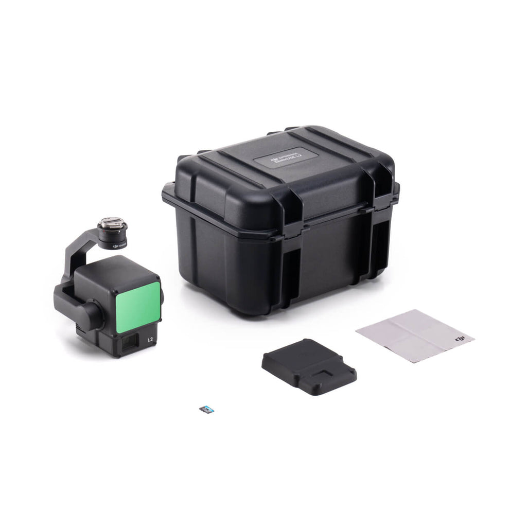
(1) Zenmuse L2
(1) microSD Card (128GB)
(1) Lens Cap
(1) Storage Case
(1) Lens Cleaning Cloth
DJI Enterprise Zenmuse L2 for Matrice 300 & 350
DJI Zemmuse L2 Test Flight
L2 Compatibility
Matrice 350 RTK
Matrice 300 RTK
Only supports DJI RC Plus as the remote controller. Before using, please upgrade the firmware of the aircraft and remote controller to the latest version. To ensure mapping accuracy, make sure the L2 is mounted on a single downward gimbal connector with the cable connected to the right USB-C port (when facing the aircraft).
DJI's Care Enterprise plan comes standard with all enterprise/commercial drone systems and provides additional support and coverage in case of accidents or damages, to use Care Enterprise, the payload must be recovered to be sent into DJI for replacement. For full DJI Care Enterprise terms of service and FAQ, please visit DJI.
Care Enterprise for the Zenmuse L2 is available in two (2) options:
Basic (1-Year): Provides one (1) year of coverage against damage caused by user error. The plan offers up to two (2) replacements within the year of coverage. The replacement fee for each replacement is $899. Care Enterprise Basic on the L2 can be renewed after the first year for up to two (2) additional years and has a renewal fee of $1,130. In year two (2), users have two (2) replacement options with a replacement fee of $899 each, and in addition, standard warranty is extended by a second year. Care Enterprise Basic can also be renewed for a third and final year for an additional $1,130.
Plus (1-Year): Provides one (1) year of coverage against damage caused by user error. The Plus plan offers unlimited aircraft replacements within the coverage amount equivalent to the product's value for the one (1) year period of the coverage plan. Plus coverage can also be "pooled" or shared amongst a fleet if all platforms are purchased with Plus and bound together in the same 30-day period. Care Enterprise Plus on the L2 can be renewed after the first year for up to two (2) additional years and has a renewal fee of $2,260 which provides an additional coverage amount of $11,300, and in addition, standard warranty is extended by a second year. Care Enterprise Plus can also be renewed for a third and final year for an additional $2,260.