
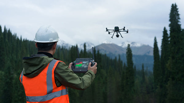
The realm of aerial surveying and mapping has witnessed a transformative upgrade with the launch of DJI's Zenmuse L2 LiDAR sensor, building upon the solid foundation established by its predecessor, the Zenmuse L1. With advancements geared towards enhanced accuracy, increased detection range, and improved integration, the L2 emerges as a paragon of innovation for professionals in topographical mapping, forestry, urban planning, and precision agriculture. As we dive into the specifics, it becomes pretty evident that the new L2 sensor is not just an iteration but a leap forward in LiDAR technology.
Understanding LiDAR and Its Complementary Technologies
What is LiDAR?
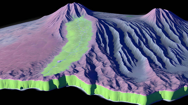
LiDAR, standing for Light Detection and Ranging, is akin to a bat's echolocation but with light. This technology uses a pulsed laser light to measure distances to the Earth, generating precise, three-dimensional information about the shape and surface characteristics of the terrain.
Precise 3D Mapping
At its core, LiDAR is about precision and detail. It emits up to millions of laser pulses per second, each pulse bouncing back to the sensor after hitting an object. By measuring the time it takes for each pulse to return, LiDAR calculates the exact distance to objects, resulting in a complex 'point cloud' that forms a highly accurate three-dimensional map of the surveyed area.
Enhanced Decision-Making
For surveyors and mapping professionals, LiDAR is a game-changer. This technology provides several advantages over traditional surveying methods:
- Speed and Efficiency LiDAR can cover large areas much more quickly than ground-based surveying methods, capturing large datasets in a fraction of the time.
- Accessibility: It can survey difficult-to-reach or hazardous areas without putting surveyors at risk, such as steep terrains, dense forests, or disaster zones.
- Comprehensive Data: LiDAR captures a wealth of data in a single pass, often revealing details that might be missed by the human eye or other methods.
Versatility: It is capable of penetrating vegetation and capturing the ground surface beneath, which is particularly useful in forestry and land management.
LIDAR and RGB
Enhanced Detail and Texture Mapping
LiDAR excels in creating accurate 3D representations of the surveyed environment by measuring the distance between the sensor and the target with laser precision. When LiDAR data is combined with high-resolution RGB imagery, it provides a textured, colorized point cloud that offers a more comprehensive understanding of the environment. This visual context is essential for applications where the detail and color of the terrain are necessary for analysis, such as in land management, environmental conservation, and urban planning.
Accurate Geospatial Data
The fusion of data from LiDAR and RGB cameras allows for the creation of georeferenced imagery. This means that each pixel in the image can be associated with a precise location in physical space, enabling detailed analyses like change detection over time, asset management, and disaster assessment where accurate positioning is crucial.
Streamlined Workflows
For surveying professionals, time is of the essence. The ability to capture LiDAR data and high-resolution images simultaneously streamlines the data collection process, allowing for faster completion of surveying tasks. This efficiency translates into cost savings and enables more frequent data updates, leading to more accurate and timely decision-making.
Versatile Application
Integration of these technologies allows for the flexibility of applying the sensor suite across a diverse range of environments and conditions. Whether it's for detailed urban mapping where the structural complexity requires high-resolution imaging, or for agricultural lands where color differentiation is key for crop health assessments, the combination of LiDAR and RGB captures both the quantitative and qualitative aspects of the area being surveyed.
Improved Data Reliability
The overlap of data from both sources provides a means of cross-verification, enhancing the reliability of the data. For instance, shadows or reflections that may affect RGB images can be accounted for by the depth information from LiDAR data, ensuring that the final dataset is both accurate and dependable.
LIDAR with IMU
The Inertial Measurement Unit (IMU) is an essential component in modern LiDAR systems, particularly when mounted on drones. This sophisticated device complements LiDAR's spatial data with precise orientation and movement information, which is crucial for creating accurate and usable 3D models.
Synchronized Positioning and Orientation Data
An IMU typically contains a combination of accelerometers and gyroscopes, which together measure linear acceleration and rotational changes, respectively. The integration of an IMU with LiDAR ensures that the spatial data collected is accurately georeferenced, accounting for the pitch, roll, and yaw of the drone during flight. This is especially important when the drone is in motion, as it allows for the correction of any movement that could otherwise distort the LiDAR data.
Enhanced Data Accuracy
The benefits of integrating an IMU with LiDAR technology include:
- Real-time Corrections: As the drone navigates the terrain, the IMU provides real-time data that can be used to adjust the point cloud on-the-fly, ensuring high fidelity in the representation of the surveyed area.
- Post-processing Precision: The orientation data from the IMU is crucial during post-processing to align and stitch together multiple passes of LiDAR data, particularly in large or complex surveying projects.
- Stability in Varied Conditions: Regardless of external factors such as wind or sudden movements, the IMU helps maintain the stability and accuracy of the data capture process.
Critical for Complex Environments
The integration of an IMU is particularly critical when surveying environments with uneven terrain, varying elevations, or dense vegetation. By providing constant updates on the sensor's orientation, the IMU allows LiDAR to accurately map the ground—even in conditions where the drone's position might change unpredictably.
A Foundation for Advanced Applications
For advanced applications such as autonomous navigation, precision farming, or infrastructure inspection, the combination of LiDAR and IMU is non-negotiable. The IMU's data is vital for drones to adjust their flight paths autonomously, for agricultural drones to monitor crop heights accurately, and for structural analysis that requires the precise location and orientation of features.
Industry Use Cases for L1 and L2 Sensors
Both the L1 and L2 sensors have carved their niches across various applications. The L1 has been pivotal in areas like topographic mapping, forestry management, and infrastructure inspection. Meanwhile, the L2 pushes boundaries into urban planning and precision agriculture, where heightened accuracy is paramount.
A Comparative Look at the Zenmuse L1 and L2 LiDAR Sensors

When it comes to aerial surveying and mapping, the details make all the difference. DJI's Zenmuse L1 sensor has been a reliable tool for professionals, thanks to its advanced Livox LiDAR, high-quality imaging, and precise inertial measurement capabilities. However, the new Zenmuse L2 sensor elevates the benchmark with enhancements that cater to the most demanding surveying and mapping needs.
Zenmuse L1 – The Trailblazer
The Zenmuse L1 is revered for its robust integration of Livox LiDAR technology with a 1-inch 20 MP RGB sensor and an accurate IMU. It boasts:
- An IP54 weather rating, ensuring reliability in various conditions.
- A detection range of up to 450m at 80% reflectivity, suitable for expansive areas.
- A notable point cloud rate of 489,999 points per second on multiple returns, capturing dense, detailed data.
- LiDAR system accuracy (RMS 1σ) of 10 cm horizontally and 5 cm vertically at 50m, providing reliable measurements.
- Effectiveness in topographic mapping, forestry, and critical infrastructure inspection.
- A minimum shooting interval of 2 seconds on the RGB camera.
The L1's IMU enhances these capabilities, offering real-time and post-processing yaw accuracy of 0.3° and 0.15°, respectively, and pitch/roll accuracy at 0.05° and 0.025°.
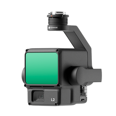
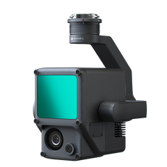
Zenmuse L2 – The New Frontier
The Zenmuse L2 is not just an incremental update but a significant leap forward, specifically designed to address the intricate requirements of urban planning and precision agriculture. The L2 sensor amplifies the capabilities of its predecessor by offering:
- An extended detection range of up to 500m at 50% reflectivity, pushing the boundaries further than the L1.
- An impressive point cloud rate boost up to 1,200,000 points per second on multiple returns, which is over double the L1's rate, allowing for richer, more detailed data capture.
- Maintained LiDAR system accuracy (RMS 1σ) at increased distances, ensuring measurements remain precise even at extended ranges.
- An upgraded 4/3 CMOS sensor that supports DNG RAW images and boasts a 0.7-second shooting interval, enabling faster, more flexible data capture during flight.
The L2 sensor's IMU is fine-tuned for higher accuracy, with yaw accuracy improved to 0.2° in real-time and 0.05° post-processing. Pitch and roll accuracy advancements reflect a more sophisticated and exact measurement system. This is further complemented by:
- A ground point density 3x that of the L1, capturing the nuances of the surveyed terrain with greater fidelity.
- A point cloud thickness 1/3 of the L1, indicating a more refined data representation.
- A smaller, more potent laser, enhancing the sensor's efficiency and performance.
The horizontal and vertical accuracy metrics of the L2 dramatically outperform the L1, with a horizontal accuracy of 5cm at 159m and a vertical accuracy of 4cm at 150m, compared to the L1's 10cm and 5cm at 59m, respectively. Moreover, DJI's Terra software has been optimized for the L2, streamlining the post-processing of data collected by this advanced sensor.
Technical Specifications
|
Sensor Version |
Zenmuse L2 LiDAR Sensor |
Zenmuse L1 LiDAR Sensor |
|
Dimensions |
155 x 128 x 176 mm |
152 x 110 x 169 mm |
|
Weight |
905±5 g |
930±10 g |
|
Power |
28W (typical) 58W (max) |
30W (typical) 60W (max) |
|
IP Rating |
IP54 |
IP54 |
|
Supported Aircraft |
M300 RTK (requires DJI RC Plus); M350 RTK |
M300 RTK; M350 RTK |
|
System Efficiency |
The operating area of a single mission can reach 2.5km-squared. Relative altitude: 150m; Flight speed: 15m/s. |
The operating area of a single mission can reach 2km-squared. Relative altitude: 100m; Flight speed 13m/s. |
|
Detection Range |
450m @ 50% reflectivity, 0klx; 250m @ 10% reflectivity, 100klx |
450m @ 80% reflectivity, 0 klx; 190m @ 10% reflectivity, 100 klx |
|
Point Rate |
Single return: max. 240,000 pts/s; Multiple returns: max. 1,200,000 pts/s |
Single return: max. 240,000 pts/s; Multiple return: max. 480,000 pts/s |
|
System Accuracy (DJI stated specs) |
Horizontal: 5cm @ 150m; |
Horizontal: 10cm @ 50m; Vertical: 5cm @ 50m. Both at 50m flight altitude, flight speed to 10 m/s. |
|
LiDAR Module: Ranging Accuracy |
2cm @ 150m |
3cm @ 100m |
|
Inertial Navigation System Accuracy |
Yaw Accuracy: Real-time 0.2°, post-processing, 0.05°; Pitch/Roll Accuracy: Real-time 0.05°, post-processing, 0.025° |
Yaw Accuracy: Real-time 0.3°, post-processing, 0.15°; Pitch/Roll Accuracy: Real-time 0.05°, post-processing, 0.025° |
|
Real-time Point Cloud Coloring Modes |
Reflectivity, Height, Distance, RGB |
Reflectivity, Height, Distance, RGB |
|
LiDAR: Maximum Returns Supported |
5 |
3 |
|
LIDAR: Maximum Sampling Frequency |
240kHz for all modes, including Penta |
240 kHz (single/dual echo mode); 160 kHz (triple-echo mode) |
|
LiDAR: Scan Modes (including FOV) |
Repetitive scanning pattern: 70° x 3°; Non-repetitive scanning pattern: 70° x 75° |
Repetitive scanning pattern: 70.4° x 4.5°; Non-repetitive scanning pattern: 70.4° x 77.2 |
|
RGB Mapping Camera: Sensor Size & Effective Pixels |
4/3 inch; 20MP; 0.7 seconds shooting interval |
1 inch; 20MP; 2 seconds (minimum) shooting interval |
|
RGB Mapping Camera: Shutter Speed |
Mechanical Shutter: 2-1/2000 s; Electronic Shutter: 2-1/8000 s |
Mechanical Shutter Speed: 1/2000 - 8 s; Electronic Shutter Speed: 1/8000 - 8 s |
|
RGB Mapping Camera: Video Resolution |
4K @ 30fps |
4K @ 30fps |
|
Recommended Data Capture Speed |
15m/s |
8m/s to 13m/s |
|
Pre-flight High-accuracy IMU Warm-up Required |
No |
Yes: 5-10 minutes |
|
Point cloud Real-time Preview |
Support, point cloud rendering optimisation |
Support |
Price and Availability
Advexure understands that investment in such cutting-edge technology is a significant decision. The Zenmuse L1 retails at $8,543, while the L2 is available for pre-order now starting at $12,430. These tools are not just purchases but investments in the accuracy and efficiency of your surveying and mapping projects.
Mapping the Future with Advexure
The DJI Zenmuse L2 LiDAR sensor is not just an upgrade but a new benchmark in aerial surveying. It stands on the shoulders of the L1, offering mapping and surveying professionals an instrument of unmatched precision and reliability. For those looking to integrate the L2 into their workflows, reach out to our team of drone SME’s today.


