Instead of scrambling up a 30-ft cone of crushed basalt with a GNSS rover, imagine tapping “Start” on a tablet while you sip coffee. Ten minutes later an RTK-enabled drone has circled the pile, the cloud has stitched the data, and your dashboard displays today’s tonnage—accurate to within ± 2.6 % of a tape-and-total-station survey.
Drone-based LiDAR and high-overlap photogrammetry workflows are stripping the danger, drudgery, and delay out of stockpile measurement. By swapping clipboards for point-clouds, mines reclaim hours of survey time and keep boots off unstable slopes, sharply reducing fall-hazard exposure. Compared with traditional walk-and-shoot methods, teams report surveys up to 10× faster, transforming end-of-quarter write-offs into daily inventory intelligence.
In the sections that follow, we’ll unpack how drones, sensors, and volumetric software plug together—from flight planning to ERP export—so you can automate inventory with confidence and compliance.
Why Precise Stockpile Data Matters
Whether you sell crushed stone by the ton or track ROM ore to satisfy NI 43-101 audits, inventory accuracy sits at the center of mine profitability and compliance. A single quarry that mis-counts by 10,000 tons can see year-end write-offs of US $60-70k—and that discrepancy multiplies across multi-site operations.
But the impact isn’t just financial. Regulators and external auditors increasingly demand transparent, high-resolution volume evidence for environmental reporting and quarterly statements. Drone-derived point clouds deliver “to-the-inch” volumes that auditors can verify, streamlining reconciliation cycles and supporting emissions-mass-balance requirements.
Equally critical is worker safety. Traditional rover or total-station crews must climb unconsolidated slopes subject to slips and collapse. Removing people from the pile with autonomous overflights cuts exposure and helps mines meet zero-harm targets.
Finally, timely stockpile intelligence unlocks operational agility: production teams can align crusher throughput with real demand, logistics can right-size haul scheduling, and finance can forecast cash flow with confidence. Precise, frequent measurements transform stockpiles from accounting headaches into live KPIs that drive smarter planning across the pit-to-port chain.
End-to-End Drone Workflow: From Flight Plan to ERP Upload
Below is a practical, step-by-step walk-through you can hand to any survey or production team. Follow (or adapt) each stage and you’ll have repeatable volume numbers on the dashboard—often in under two hours from take-off.
Pre-Survey Preparation — Match Platform to Pile
-
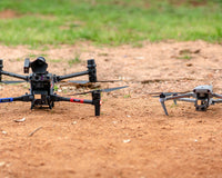
Site Reconnaissance: Note pile boundaries, haul-truck traffic, overhead conveyors, and safe take-off/landing zones.
-
Platform Selection:
-
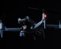
Multirotor RTK (e.g., DJI M350 RTK) for confined benches and steep faces.
-
Fixed-wing VTOL for >200 ac (80 ha) waste dumps—one battery covers the site.
-
Sensor Choice:
-
Photogrammetry cameras capture RGB at ≤2 cm/px GSD; ideal for clean, sun-lit aggregates.
-
LiDAR penetrates sparse vegetation and resolves steep, shaded slopes with ~240 k pts/s density.
-
Control Network:
-
Deploy 3–5 smart GCPs around the yard; they self-level and upload PPK logs.
-
Use RTK base or VRS for live positioning; fall back to PPK if cellular drops.
Mission Planning
|
Parameter |
Photogrammetry |
LiDAR |
Notes |
|
Front / side overlap |
80 % / 70 % |
70 % / 60 % |
Widely accepted best practice for accurate stockpiles |
|
Flight altitude |
1.5 × highest pile |
1.2 × highest pile |
Ensures clear view of apex while keeping point density high |
|
Speed |
≤4 m/s |
≤8 m/s |
Faster LiDAR passes still hit ≥200 pts/m² |
|
Oblique ring |
Optional 25° pass |
Not required |
Captures near-vertical faces for RGB workflows |
Automated Flight Execution
-
Run pre-flight checklist (battery temp, compass, obstacle sensing).
-
Launch from windward side to reduce prop-wash dust.
-
Maintain VLOS or use remote Ops center if site has a docked platform.
-
Land, swap battery, and repeat for additional benches if required. Typical 20-ac stockyard = 12–15 min with a multirotor.
Data Offload & Geo-Referencing
-
Photogrammetry: copy JPGs + .MRK (RTK metadata).
-
LiDAR: offload .LAS plus INS trajectory.
-
Apply PPK corrections (Propeller, Emlid Studio, or DJI Terra’s built-in) to lock absolute accuracy to <3 cm XY / Z.
Processing Pipeline
Photogrammetry route (DJI Terra / Pix4D / DroneDeploy):
-
Image alignment & sparse cloud.
-
Bundle adjustment, then dense point cloud.
-
Mesh & DSM/orthomosaic generation.
-
Automatic stockpile segmentation and “best-fit base plane” volume tool. Total compute for a 500-photo survey on Terra ≈ 25 min (v3.7: 400 % faster than v3.5).
LiDAR route (Terra / CloudCompare / LP360):
-
Strip alignment & boresight optimization.
-
Ground/non-ground classification → DTM.
-
Volume extracted from DTM + user-drawn toe polygon; no need for base-plane guesswork when vegetation is present.
QA/QC – Confidence Before You Report
-
Checkpoint residuals: target ≤5 cm RMSE; flag piles >10 cm Z error.
-
Visual cloud review: look for soft edges (blur) signalling insufficient overlap or motion blur.
-
Cross-method check: LiDAR vs photogrammetry volume should differ by <3 %.
Integration & Automation
-
Export CSV (volume, tonnage), DXF (toe polygon), or LAS to Trimble Business Center, Carlson Natural Regrade, or SAP ERP.
-
Propeller & DroneDeploy dashboards surface daily trend lines and automatic delta alerts.
-
Docked drones schedule dawn flights; Flinks (FlytBase ⇆ Pix4D) auto-push to cloud processing with no human touch.
Common Pitfalls & Quick Fixes
|
Pitfall |
Impact |
Fix |
|
Too few GCPs on elongated piles |
Warped base & inflated volume |
Add at least one GCP every 100 m perimeter |
|
Mid-day harsh shadows |
Tie-point drop-outs |
Fly early morning or overcast days |
|
Dust on LiDAR lens |
Noisy points |
Wipe optics, enable downward-looking pilot cam to inspect in-flight |
Hardware Choices for Mine & Quarry Sites
Choosing the right airframe + sensor combination is the foundation of a reliable stockpile program. Below is a practical guide to matching common site conditions with proven drone platforms and payloads.
|
Typical Scenario |
Recommended Airframe |
Why It Fits |
Go-To Sensor Payloads |
Specs / Proof Points |
|
High-volume pits & multi-pile yards that need LiDAR penetration |
DJI Matrice 400 RTK heavy-lift multirotor |
• 59-min endurance keeps batteries to a minimum• 6 kg max payload supports dual-sensor stacks• O4 Enterprise link + mmWave radar for BVLOS safety |
• Phoenix Ranger-LR / FLEX → 1.5–3 cm RMSEz @ 120 m• DJI Zenmuse L2 → 4 cm vertical / 5 cm horizontal acc. without GCPs |
M400 launch (June 2025) ups the bar for flagship mapping drones ; Ranger-LR Lite spec sheet shows sub-3 cm accuracy ; L2 range to 450 m & turnkey Terra workflow |
|
Large open pits / overburden dumps (> 200 ac) |
WingtraOne Gen II VTOL fixed-wing |
• 59-min flight covers up to 760 ac per sortie• 2 × 2 m pad take-off—no catapult• Proven 1 cm / 3 cm absolute accuracy with PPK |
61 MP full-frame RGB (Sony RX1R II or RGB61) for ultra-dense photogrammetry meshes |
Wingtra spec: 59 min endurance & 1 cm horizontal accuracy without GCPs (PPK) |
|
Small-to-mid aggregate yards & quarry faces (< 100 ac) |
DJI Matrice 4D (M4D) |
• Compact IP55 airframe; 47-min flight keeps workflows nimble• 5-direction oblique & 3-direction orthophoto capture for steep faces• Full Dock 3 integration for scheduled vols |
Integrated mapping camera (20 MP 4/3 CMOS) + laser range finder; RTK ready |
M4D features: IP55, 47 min endurance, dock-ready, designed for high-precision mapping |
|
GPS-denied reclaim tunnels / surge piles |
DJI M400 + Emesent Hovermap (SLAM LiDAR pod) |
• Autonomy in dark, dusty voids• SLAM point cloud builds in real time; no satellite lock needed |
Hovermap ST/FX LiDAR (360°) |
Hovermap validated on iron-ore surge piles, capturing vertical walls unreachable by photogrammetry |
Selection Tips
-
LiDAR vs. RGB: Dense vegetation or shaded coal piles → LiDAR (Phoenix Ranger or Zenmuse L2). Clean crushed-stone stock → photogrammetry on WingtraOne or Matrice 4D.
-
Payload capacity matters: Pair M400’s 6 kg lift with dual P1+L2 for hybrid RGB+LiDAR runs; smaller M4D is photogrammetry-only but lower cost.
-
Environmental hardening: All listed airframes carry ≥ IP54 ratings and self-heating batteries to handle dusty benches and −10 °C dawn launches.
-
Workflow compatibility: Each platform exports RTK/PPK data ready for DJI Terra, Pix4D, Propeller, and Carlson modules, ensuring seamless volume extraction and ERP push.
With the right hardware matched to site scale and surface conditions, the downstream steps—overlap geometry, cloud processing, and finance reporting—fall neatly into place, turning stockpile surveys into an efficient, repeatable routine.
Sensor Showdown – LiDAR vs Photogrammetry: Which Tool When?
Mining teams typically land on one of two mapping weapons: an active-laser LiDAR scanner or a high-resolution RGB camera for photogrammetry. Both can deliver stockpile volumes within the coveted ±2–3 % band, but they get there in very different ways. Below is a practical comparison you can use to pick the right tool—or decide when to fly both on the same site.
|
Factor |
LiDAR Workflows |
Photogrammetry Workflows |
|
Measurement Principle |
Emits 100-240 k laser pulses /s (Zenmuse L2; Phoenix Ranger) and records return time to build a 3-D point cloud. |
Captures overlapping RGB frames; software triangulates matching pixels into a dense point cloud. |
|
Accuracy Benchmarks |
• Zenmuse L2: 4 cm Vert / 5 cm Horiz @ 150 m AGL • Phoenix Ranger-LR: 2–3 cm RMSEz with PPK |
• WingtraOne Gen II + PPK: 1 cm Horiz / 3 cm Vert over >50 ha • Mavic 3 E + AeroPoints smart GCPs: ±3 cm XYZ typical on clean gravel piles |
|
Strengths |
• Penetrates sparse vegetation & sees true ground through dust/shade • Works in low light / night flights • Captures vertical faces without oblique imagery |
• Sub-centimeter texture & color for visual QA • Lower payload cost & lighter airframes • Horizontal accuracy often superior on bare rock when paired with GCPs |
|
Limitations |
• Higher sensor cost and heavier (needs Matrice 400-class lift) • Raw .LAS files require point-classification skill |
• Needs consistent lighting; midday shadows cause “holes” • Vegetation or dark coal piles inflate error unless GCP density is increased |
|
Typical File Size / Processing |
2–5 GB for a 15-min L2 mission; automated boresight in DJI Terra finishes in ≈ 20 min |
5–10 GB image set; alignment + dense cloud in Pix4D/Propeller ≈ 40 min on a modern GPU |
|
Ideal Use-Cases |
• Overburden dumps with scrub / grass • Shaded coal or ore stockpiles • Vertical reclaim tunnels (with SLAM) |
• Clean aggregate yards • Daily check-in flights where speed & cost trump sub-cm elevation detail |
Hybrid Strategy—Best of Both Worlds
Many mines now fly RGB and LiDAR back-to-back: LiDAR delivers an accurate bare-earth model while high-res photogrammetry textures the mesh for easy inspection and marketing visuals. Cloud engines like Propeller Platform and DJI Terra accept both datasets, letting you toggle layers without duplicate ground control.
Key takeaways:
-
If piles are clean and sunlight is plentiful → photogrammetry hits ±2–3 % at the lowest cost.
-
If slopes are vegetated, shadowed, or safety-critical → LiDAR’s active laser ensures every tonne is counted.
-
Blending the two lets operations pick accuracy, cost, and visual richness on a site-by-site basis rather than locking into a single sensor.
Ground Control, RTK/PPK & Checkpoints — Locking Airborne Data to the Mine Grid
Stockpile workflows live or die on geo-reference quality. A drone may shoot hundreds of millions of points in the air, but unless those points are “pinned” to known coordinates on the ground, volumes drift from reality. Below is a practical field guide to anchoring your data — whether you fly RTK in real time, process PPK after the fact, or lean on smart GCPs like AeroPoints.
RTK vs PPK in a Mining Context
|
Correction Method |
How It Works |
Best For |
Watch-outs |
|
RTK (Real-Time Kinematic) |
Drone receives live corrections from a base/CORS; positions written to each photo in flight |
Sites with reliable cell/radio links that need same-day turnarounds |
Drops to meter-level accuracy if telemetry breaks mid-sortie |
|
PPK (Post-Processed Kinematic) |
Raw GNSS logged onboard; corrections applied during processing using base/CORS data |
Remote pits with patchy signal or where absolute accuracy (< 3 cm) is critical |
Adds a 5-min post-flight step, but is more resilient to outages |
Rule of thumb: RTK for speed, PPK for certainty. In both cases, a handful of well-placed GCPs or checkpoints is still the gold standard for validation.
Smart GCP Placement – “Pin the Tarp, Not Just the Corners”
Propeller’s research shows that clustering control in one corner warps an entire model; optimal geometry rings the perimeter and center, including the highest and lowest elevations of the yard.
Quick layout cheatsheet
-
< 20 ac yard → 5 points (4 corners + 1 center)
-
20–100 ac → 8 points (perimeter every 250 m + 2 internal)
-
100 ac or elongated piles → 10 points (Propeller’s AeroPoints kit)
Place boards in clear sky, away from haul-truck paths; mark two additional squares as checkpoints for QA only (never used in processing).
Accuracy Targets & QA/QC
-
Process your model (photogrammetry or LiDAR) with RTK/PPK corrections.
-
Import checkpoints; software reports residuals.
-
Pass/Fail: aim for ≤ 5 cm RMSE Z on clean rock, ≤ 8 cm on vegetated dumps. DJI Zenmuse L2 routinely hits 4 cm vertical without any GCPs on bare ground, but validation is still required for audit trails.
Tip: If checkpoints exceed tolerance, inspect for missing overlap, poor GCP spread, or errant base logs before reflying.
When “Control-Lite” Works
-
LiDAR on M400 + IMU calibration flights can deliver audit-grade volumes using only two checkpoints to verify scale.
-
Docked photogrammetry drones on daily cycles often rely on RTK alone; a monthly “full control” flight with GCPs resets any accumulated drift.
Bottom line: Combine solid control geometry with the right correction method (RTK for real-time speed, PPK for bulletproof accuracy) and your stockpile numbers will land inside the 2–3 % tolerance window every time—no more year-end reconciliations that don’t reconcile.
Processing & Analytics Platforms — Turning Point Clouds into Inventory KPIs
Below is a practical side-by-side look at the software engines most commonly used by mines and aggregate yards. All of them ingest either LiDAR (.LAS) or photogrammetry images and spit out cut/fill volumes, but each has its own strengths, quirks, and export habits.
DJI Terra — “One-Click” for Mixed RGB + L2 LiDAR
Ideal when you already fly Matrice-series drones and want an offline workflow.
-
Automated presets: Choose Aerial Photogrammetry or LiDAR Mapping; Terra auto-detects Zenmuse L2 files and aligns strips during ingest.
-
Stockpile volume tool: Draw a quick toe polygon → Terra returns Cut, Fill, Net, and sets the base plane to Lowest Point or Custom Reference.
-
Processing speed: v3.7 benchmarks show a 500-image model in ≈ 25 min on a 12-core workstation (4× faster than v3.5).
-
Outputs: LAS/LAZ, OBJ, DXF, CSV; drag-and-drop into Carlson, TBC, or SAP modules.
Propeller Platform — Cloud Dashboard Built Around Smart GCPs
Best for crews already using AeroPoints or needing shareable, browser-based analytics.
-
Upload → PPK-correction → processing happens server-side; no local GPU required.
-
Composites: Merge up to 25 partial flights into a single dataset for multi-bench yards.
-
Accuracy track record: Internal case studies report sub-2 % variance against total-station checks on clean gravel piles (with smart GCPs).
-
Live tools: Compare “today vs last month,” set density (T / m³) to auto-convert volumes into tonnage, and publish a share-link to finance or pit foremen.
Pix4Dmapper / Pix4Dcloud — Photogrammetry Workhorse for Big Mining Majors
Chosen by nearly half of the world’s top 40 mining companies for stockpile workflows.
-
Volume wizard: Guided toe-line extraction; reports ±2–5 % accuracy when GCPs are used.
-
API hooks: Direct hand-off to SAP and other ERP stacks for reconciliation.
-
Labs tools: Semi-automatic pile delineation (beta) speeds 100-pile yards.
DroneDeploy Stockpile App — Fast Cloud Photogrammetry with RTK Edge
Great for compact operations flying Mavic 3 E or Matrice 4D photogrammetry.
-
Inch-level accuracy: White-paper tests show consistent sub-3 cm XYZ error on M3E RTK + 5 GCPs.
-
Mobile QA: On-site preview flags missing overlap before you leave the pit.
-
Automated reports: PDF & CSV exports broken down by pile, ready for finance or auditors.
LP360 (GeoCue) — Heavy-Duty LiDAR Analytics
When you need advanced classification and volumetrics.
-
High-density handling: Optimized to chew through 50+ GB LAS blocks without down-sampling.
-
Stockpile volume & pit calculations run directly on classified ground; results export as tabbed text or shapefile.
-
Custom workflows: Macro builder lets you script QA, strip-alignment, and reporting for repeat missions.
Choosing the Right Processing Platform
|
If you… |
Lean toward… |
Because… |
|
Fly DJI airframes and want offline processing |
DJI Terra |
Native L2 integration and perpetual licence model |
|
Need browser-based sharing and AeroPoints automation |
Propeller |
PPK corrections + live volume dashboards |
|
Run multi-company sites with established photogrammetry SOPs |
Pix4D |
Mature toolset, ERP hooks, wide industry adoption |
|
Want a quick-and-easy cloud flow for small yards |
DroneDeploy |
Sub-hour turnaround and mobile QA |
|
Require detailed LiDAR ground classification |
LP360 |
Advanced filters, strip-alignment, and pit benchmarks |
Key take-away: Pick a processing platform that matches your sensor type, IT policies (on-prem vs cloud), and reporting cadence. With the right engine in place, piles turn into live KPIs that flow straight into mine-planning and finance—no spreadsheet gymnastics required.
Quantifiable Benefits—What the Numbers Say
-
Time Saved:
-
85% faster inventory audit: PwC’s coal-pile survey dropped from two full shifts to 30 minutes when they switched to a Phantom-4-based workflow.
-
From one day to ≈ 2 h: Balfour Beatty’s rail-ballast yard cut manual tape-and-pole surveys down to a 15-minute flight plus two-hour cloud processing cycle.
-
Labour & Cost Cuts:
-
60% reduction in man-hours at an Event 38 quarry deployment—crew time fell from 40 to 16 hours per month once drones took over stockpiles.
-
A WingtraOne program at Idaho Forest Group logged an 80% drop in field time and a rapid ROI payback in less than six months.
-
Accuracy You Can Reconcile:
-
Multiple independent tests report ±2–3% variance versus total-station benchmarks when RTK/PPK photogrammetry is paired with 5–8 GCPs; LiDAR rigs like the Zenmuse L2 routinely meet a 4cm vertical spec without GCPs on bare ground.
-
Safety Wins:
-
Indoor-bunker surveys with collision-tolerant Elios 3 drones eliminated all on-foot exposure to loose aggregate, aligning with zero-harm mandates.
Bottom line: Across diverse sites, autonomous drone workflows consistently turn multi-day, high-risk field jobs into sub-hour, keyboard-only tasks—delivering audit-grade numbers while slashing labour and incident risk.
What’s Next — BVLOS, Detect-and-Avoid, and Edge AI
Regulators and vendors are rapidly clearing the final hurdles to true “hands-off” inventory loops where a drone launches, maps, processes, and lands with no on-site crew—even beyond visual line of sight (BVLOS).
Regulation is catching up
-
The FAA is drafting Part 108, a rule set to replace the one-off waiver process and standardize BVLOS across U.S. industries.
-
DJI and FlytBase now publish waiver-ready “safety cases” for Dock 3 deployments, cutting the paperwork load for mines that want remote ops.
Hardware born for BVLOS
-
Dock 3’s IP56 enclosure and 32-minute quick-charge cycle let the Matrice 4D fly multiple autonomous sorties per shift without human battery swaps.
Edge AI & 5G pipelines
-
FlytBase’s latest release pushes LiDAR/RGB sets straight from the dock to Propeller or Pix4D; edge GPUs run quick-look QC before file transfer so bad flights are auto-flagged within minutes.
-
Private-LTE/5 G networks being rolled out at Tier-1 mines support real-time telemetry plus high-bandwidth uploads, trimming the “sensor-to-dashboard” cycle to well under one hour.
Why it matters for stockpiles
Daily—or even post-blast—BVLOS flights mean supervisors open their ERP each morning to see overnight volume deltas without dispatching a single tech onto unstable slopes. As Part 108 and detect-and-avoid suites mature, fully autonomous inventory management is shifting from pilot projects to standard operating procedure for forward-looking mine sites.
Need help integrating drone hardware or software into your mining or aggregate workflows? Reach out to Advexure’s Enterprise Sales team.
References & Further Reading
-
Ghosh, B. “The Impact of Drones in Mining: How Autonomy and AI Are Transforming the Industry.” FlytBase Blog (2024). https://www.flytbase.com/blog/drones-for-mining-industry
-
Miller, K. “Stockpile Measurement with DJI Enterprise Drones and DJI Terra.” DJI Enterprise Insights (2022). https://enterprise-insights.dji.com/blog/stockpile-measurement-with-dji-drones
-
Becker, S. “How to Use Drones in Mining and the Advantages of UAV Technology.” Elsight Blog (2024). https://www.elsight.com/blog/drones-in-mining/
-
Flyability. “6 Ways Mine Drones Are Being Used.” Flyability Blog (2023). https://www.flyability.com/blog/mine-drone
-
Propeller Aero. “Smart Stockpile Management: Automating Inventory with AeroPoints and the Propeller Platform.” Propeller Blog (2023). https://www.propelleraero.com/blog/smart-stockpile-management
-
Wingtra AG. “WingtraOne GEN II Accuracy Report.” Wingtra White Paper (2024). https://wingtra.com/wp-content/uploads/wingtraone-gen-ii-accuracy-report.pdf
-
Phoenix LiDAR Systems. “Ranger-LR Sensor Specification Sheet.” (2024). https://ranger-lr.phoenixlidar.com/specifications
-
Federal Aviation Administration (FAA). “BVLOS ARC Final Report.” (2023). https://www.faa.gov/regulations_policies/bvlos_arc_report
-
MFE Inspection Solutions. “MFE Receives Nationwide BVLOS Waiver for Docked Drone Operations.” Press Release (2024). https://www.mfe-is.com/news/nationwide-bvlos-waiver
-
PricewaterhouseCoopers (PwC). “MineLens: Drone Surveying Drives Efficiencies in Coal Stockpile Management.” (2018). https://www.pwc.com/gx/en/energy-utilities-mining/publications/minelens-drone-surveying-coal-stockpiles.html
-
Propeller Aero. “The Real ROI of Drone Surveys: Case Study at a Midwestern Limestone Quarry.” (2022). https://www.propelleraero.com/blog/roi-drone-surveys-limestone