Moving dirt twice is one of the quickest ways to light a match to a project budget. Industry analyses put the global price tag of bad construction data—mis-measured volumes, mis-aligned grades, and the rework that follows—at US $1.8 trillion in 2020, with inaccurate site-work driving roughly 14% of avoidable rework on civil projects.
Recent field studies show that when aerial photogrammetry or drone-mounted LiDAR is properly referenced to terrestrial laser-scan control, the merged point clouds can agree to within 1.7 cm RMS error—tight enough for pay-quantity certificates and machine-control models alike.
In this blog, we’ll explore that hybrid workflow step-by-step. You’ll see how civil engineers, construction managers, and surveyors can:
- Plan complementary flight lines and scanner positions.
- Register drone- and ground-based datasets into a single, centimeter-grade reality capture.
- Turn that data into cut-and-fill heat maps, stockpile volumes, and progress billings that stick.
From the ground up—and from the sky down—we’ll show you how combined LiDAR technology closes the precision gap that costs projects days and dollars.
Reality-Capture Toolbox: Strengths & Gaps
Earth-work teams have three primary sensor options—each tuned to a different slice of the project “visibility pyramid.” Knowing where each one excels (and where it doesn’t) is step one in any successful hybrid workflow.
| Technology | Coverage & Speed | Typical Accuracy* | Point-Cloud Density* | Core Gaps |
| Drone Photogrammetry | ≈ 100 ha hr⁻¹ on an autonomous grid | 0.5–3 cm (RTK / GCP-calibrated) | 100–300 pts m⁻² | Struggles on near-vertical cut faces, reflective standing water, dense canopy; wind & lighting affect image quality |
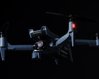
| Drone-Mounted LiDAR | ≈ 40 ha hr⁻¹ on single or cross-grid strips | 2–5 cm (post-processed) | 50–200 pts m⁻²; penetrates light vegetation | Lower point density than tripod LiDAR; sensor cost; limited endurance on large corridors |
| Terrestrial (Tripod) LiDAR | 250–500 scans day⁻¹ (≈ 1–2 ha) | 1–3 mm @ 10 m (e.g., Leica RTC360) | 5 k–10 k pts m⁻² typical ** | Requires line-of-sight; multiple setups on tall stockpiles or pit walls; traffic-control hassles |
* Field accuracy depends on RTK/PPK quality, control network design, and sensor calibration.
** High-end static scanners capture up to 2 M pts s⁻¹; practical ground density sits in the low-thousands.
Key Takeaways
- Drone Photogrammetry is the race-horse for broad, horizontal coverage—orthomosaics, surface models, and quick cut-and-fill snapshots. Its weak spot is accuracy on steep cut walls or shaded embankments.
- Drone LiDAR punches through light vegetation and low sun angles, mapping bare-earth terrain where imagery stalls. Point density is lower, but its speed over rough terrain makes it indispensable for interim volume checks.
- Tripod LiDAR delivers millimetre-grade fidelity on near-vertical excavation faces, trench walls, and stockpile slopes—surfaces that photogrammetry often under-samples. Its trade-off is time: more setups and careful registration.
Pre-Planning for Success
Smart hybrid surveys are won (or lost) before the first prop spins or tripod deploys. Lock down these three planning pillars and your downstream registration will be almost routine.
1. Control & Coordinate Strategy
- Start with a solid geodetic backbone. Fly RTK/PPK on the drone tied to a CORS network or local base; raw aerial accuracy drops below 3 cm without ballooning GCP counts.
- Ground Control Points are still king. Field studies show six-to-nine well-placed GCPs push horizontal RMSE to ≤ 2× GSD, while anything under three lets errors jump five-fold.
- Use dual-visible targets. Painted chequerboards readable from the air double as reflective prisms for the scanner, giving both datasets a common reference.
- Lock vertical control. Run a quick differential-level loop (or RTK stave shots) on at least two GCPs; it anchors the merged cloud’s Z-axis for tight volume math.
2. Mission Design—Drone Work
| Flight Type | Use-Case | Key Parameters |
| Horizontal Grid | Site-wide surface model, interim cut-fill map | 75 % front-lap / 70–75 % side-lap; altitude ≈ 3–4× focal length for < 3 cm GSD. |
| Steep-Wall / Slope Pass | Highwalls, quarry faces, retention-pond embankments | Offset 35–75 ft from slope; 80 % side-lap; min. 25 ft AGL due to obstacle sensors. |
| Orbit / Pile Scan | Tall surge piles, isolated spoil heaps | Spiral or stacked orbit; camera tilt 15–20 ° up; overlap ≥ 80 % in all directions to avoid voids. |
Pro tips
- Fly the slope-oriented pass after the horizontal grid so metadata inherits the finished site coordinate frame.
- If vegetation masks toe-of-slope detail, add a LiDAR strip at 45 ° off-nadir to expose bare earth.
3. Scanner Layout — Ground Work
- Follow the “three-position rule.” Every critical surface—cut face, trench wall, pile flank—should appear in at least three tripod setups, ensuring redundancy for plane-to-plane registration.
- Target geometry matters. Place at least three reflective spheres or checkerboards within each overlap volume, staggered in height and spread in an L-shape to give strong 3-D cues.
- Mind line-of-sight. Avoid berms, haul trucks, and stockpile crests that can occlude targets during a 360 ° sweep.
- Add a “tie-scan.” Set one scanner station on the perimeter that sees both ground targets and drone-visible GCPs—this becomes the hinge that locks terrestrial data to the aerial model.
Field Data Acquisition
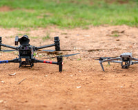
With control established and missions planned, capture can run like a relay between two crews—Drone Team and Ground Team—operating in parallel but staying radio-linked to prevent data gaps.
A. Drone Team — Drone Capture Workflow
- Pre-Flight Checks (≈ 10 min)
- Confirm RTK lock or PPK base is logging (≥ 5 s epoch).
- Verify firmware / IMU calibrations; run compass-interference scan.
- Load horizontal-grid, slope, and pile-orbit missions to the aircraft.
- Horizontal Grid Pass
- Overlap: 75 % front-lap / 70–75 % side-lap.
- Altitude: ≈ 3–4× focal length above highest terrain (e.g., 55 m AGL with a 24 mm equivalent lens ≈ 2.5 cm GSD).
- Gimbal: Nadir (–90 °); shutter ≥ 1/1000 s to freeze rotor vibration.
- Slope / Wall Pass
- Offset 10–25 m from steep cut faces or embankment slopes.
- 80 % side-lap; maintain ≥ 25 ft AGL to keep obstacle sensors happy.
- Fly during low-angle light to minimise glare on exposed soils.
- Orbit / Pile Scan
- Spiral or stacked orbits around tall surge piles or spoil heaps.
- Camera tilt 15–20 ° up; ≥ 80 % overlap all directions to kill voids.
- Field QA/QC
- Review quick-stitch previews; re-fly tiles with blur, dust, or sun-flare.
- Log battery, weather, and file counts for traceability.
B. Ground Team — Terrestrial LiDAR Workflow
- Station Setup & Targeting
- Place reflective spheres/chequerboards so every critical surface—cut face, trench wall, pile flank—appears in three scan positions for robust registration.
- Set one tie-scan on the site perimeter that views both scanner targets and drone-visible GCPs; this locks ground data to the aerial model.
- Scanner Configuration
- Resolution: ≈ 6 mm @ 10 m (≈ 10 M pts per scan)—balances detail and file size.
- HDR imagery on; colorized point clouds help visual QA and slope inspection.
- Tilt compensator auto-levels; verify bubble on steep ground.
- Rapid Field Registration
- Use tablet software (e.g., Cyclone FIELD 360) to pre-align setups; instant overlap feedback prevents missed data before leaving site.
- Tag each scan to control via RTK backsight or visible GCP targets.
- Environmental Checks
- Wind < 25 km h⁻¹ for scanner stability.
- Pause during haul-truck passes or heavy dust—airborne fines create ghost points.
- Keep batteries warm; Li-ion capacity drops ≈ 15 % below 10 °C.
Smart Merging 101
Once the drone passes and tripod scans are complete, the final accuracy hinges on how you align those two point clouds. Two field-proven referencing paths get you there.
1. Actual-Distance Referencing
Use when tripod data are limited or missing.
| Step | Action | Notes |
| 1.1 | Identify ≥ 3 well-distributed checkpoints visible in both clouds (e.g., hub nails, painted boulder corners). | Keep lines > 10 m apart to maximise geometric strength. |
| 1.2 | Measure true ground distances (tape or total station). | The longer the baseline, the tighter the scale lock. |
| 1.3 | In Autodesk ReCap → Registration → Constraints, key in those real-world lengths. | ReCap rescales the UAV model to match ground reality. |
| 1.4 | Run auto-register, then inspect residuals. Target ≤ 60 mm max. | Anything higher signals poor checkpoint spread. |
Pros: Works when laser data are sparse.
Cons: Manual field measurements add labour and are impractical on large footprints.
2. Laser-Scanner-Based Referencing (Hybrid)
Fastest and most repeatable for earthworks.
| Step | Action | Notes |
| 2.1 | Ensure tripod scans overlap the UAV cloud by ≥ 30 % on ground and slope surfaces. | Hit 60 mm max error with this rule. |
| 2.2 | Export tripod scans as RCS/RCP, import the UAV LAS/LAZ into the same ReCap project. | ReCap treats both as native clouds. |
| 2.3 | Use Plane-to-Plane Manual Registration: pick three non-parallel ground or slope planes common to both datasets. | ReCap’s Create Plane tool locks each selection; three planes eliminate XYZ drift. |
| 2.4 | Hit Merge Scans → ReCap solves scale, rotation, and translation simultaneously. | Typical run-time: < 5 min on a modern workstation. |
| 2.5 | Save a single, unified RCP for CAD/quantity take-off workflows. | Keeps colour and intensity from both sensors intact. |
Pros: No tape measurements; piggybacks on the millimetre precision of terrestrial LiDAR.
Cons: Requires at least one “tie-scan” that sees common control.
QA/QC Checklist (run immediately after merge)
| Check | Pass Criterion | Tool / View |
| Global Residuals | ≤ 60 mm maximum, ≤ 30 mm RMS | ReCap Registration Report |
| Heat-Map Overlap | No hot-spots > ±0.06 m on cut faces or pile flanks | ReCap Cloud-to-Cloud colour map |
| Local Spot Shots | Temp surfaces (haul road crowns, pad corners) within design tolerance | Snap points → compare to design surface in Civil 3D |
| Visual Sweep | No double edges, ghost slopes, or scale “steps” | Toggle clouds on/off while orbiting |
Unlocking Earthwork Value
The payoff for merging aerial and terrestrial LiDAR isn’t just a prettier point cloud—it’s tighter margins and faster decisions on the dirt-moving front line.
1. Cut/Fill Heat-Maps: Change-Orders in Hours, Not Weeks
Merged clouds let you run design-to-as-built comparisons the same day they’re captured. Tools such as DroneDeploy’s Cut/Fill engine convert the unified surface into a color-graded heat map, instantly flagging over-excavation or missed fill zones. Foremen can redirect scrapers before the next shift, compressing the re-grade/change-order loop from weeks to a single progress meeting.
2. Stockpile Volumes: Weekly Sweeps, Half the Survey Hours
Walking a quarry or plant yard with a rover once a month ties up crews and exposes them to unstable slopes. Weekly or bi-weekly drone passes—registered to high-density tripod scans—deliver centimetre-accurate volumes in a fraction of the time:
- 50% cost and labour savings reported by Martin Remote Sensing after switching to drone-based stockpile surveys.
- 60% reduction in man-hours at a Mid-West aggregate site when drones replaced ground shots for pile measurement.
3. Progress Billing & Claims: Timestamped Truth
Because each merged cloud is stamped with GNSS-precise time, date, and control, it becomes an immutable record of exactly how much earth was moved between pay periods. Owners, GCs, and subs can settle quantities with a single cross-section cut, while legal teams appreciate an auditable trail should disputes arise. Regular LiDAR flights have already proven their worth on civil job sites for as-built-versus-plan comparisons and claim defense.
A Quick Example Scenario — 40-Acre Distribution Hub
| Phase | Traditional Workflow | Hybrid-LiDAR Workflow | Time Saved |
| 1. Field Capture | Day 1–4 • Two-person topo crew walks the 40 ac site • RTK rover traverses grids and breaklines • Safety escort on active haul roads | Day 1–2 • Drone grid + slope mission (45 min flight, 2 batteries) • 18 tripod LiDAR setups (3 per cut face) • All control & tie-scan completed same shift | ≈ 2 days |
| 2. Data Registration & Cleanup | Day 5–6 • Manual stitching of GNSS shots in CAD • Surface smoothing & breakline editing | Day 3 (Morning) • Laser-scanner referencing in Autodesk ReCap (< 30 mm RMS) • One-click merge → single RCP surface | ≈ 2–3 days |
| 3. Volume & Compliance Reporting | Day 7 • Cross-sections cut by hand • Quantity checks drafted for PM review | Day 3 (Afternoon) • Cut-/fill heat-map & stockpile volumes computed in 2h • Auto-generated PDF sent to project team | ≈ 1 day |
Headline Results
- Schedule: First pay-quantity package delivered 5 days earlier than the baseline topo workflow.
- Accuracy: Merge residuals ± 23 mm—well inside the ≤ 60 mm specification.
- Cost: 3 person-days (pilot + 2 surveyors) vs. 6 person-days conventional—~50 % labour reduction.
- Risk Mitigation: Heat-map flagged a 4,800 yd³ over-cut on a retention basin before liners were ordered, avoiding an US $18 k re-grade.
Drone + Tripod = Centimeter-Grade Certainty
Fusing drone data with terrestrial LiDAR turns earthwork measurement from an approximate art into a repeatable science. The drone grid delivers full-site coverage in minutes; static scans tighten up steep cut faces and stockpile slopes; a disciplined control network and three-plane registration bind the two clouds into a single surface that regularly tests below ± 3 cm residual error. With that level of confidence you can:
- Spot over-excavation the same day it happens, slashing change-order churn.
- Generate weekly stockpile volumes in half the survey hours, without sending crews onto unstable material.
- Defend every pay application with timestamped, audit-ready point clouds.
Ready to integrate aerial and terrestrial LiDAR into your own cut-and-fill workflows? Advexure’s Enterprise Sales team can walk you through the hardware and software that make hybrid reality capture possible.
References & Further Reading
- Autodesk & FMI. Harnessing the Data Advantage in Construction. Autodesk Construction Cloud Guide, 2021. construction.autodesk.com/…
- Kwon, Soonwook; Park, Jae-Woo; Moon, Daeyoon; Jung, Suwan; Park, Heesung. “Smart Merging Method for Hybrid Point Cloud Data Using UAV and LiDAR in Earthwork Construction.” Procedia Engineering 196 (2017): 21–28. sciencedirect.com/…
- McQuillen, David. Drones in a Terrestrial LiDAR Workflow (webinar). ATG USA, 2020. YouTube. youtube.com/…
- DroneDeploy Help Center. “Uploading a Design File for Cut/Fill Analysis.” 2024. help.dronedeploy.com/…