This week marks National Emergency Medical Services (EMS) Week, a time to recognize the lifesaving work of first responders and emergency professionals. In today’s emergency management landscape, unmanned aircraft systems (UAS), or drones, have emerged as a game-changing tool to help those professionals save lives. Drones have become integral to disaster response, search and rescue, and incident management. Agencies across the country, from local fire departments to federal disaster teams, are launching or expanding drone programs to enhance situational awareness and responder safety.
The strategic value of drones in emergency services is clear: they can rapidly provide aerial eyes on a situation that would otherwise be dangerous or impossible for personnel to assess. As we honor EMS Week and the mission of saving lives, it’s an ideal time to explore how to build an effective drone program for emergency management.
In this blog, we offer a practical guide for emergency management agencies, public safety departments, and incident commanders looking to establish or scale up a drone response program. We will cover the strategic benefits of UAS in emergencies, key equipment considerations (from drone platforms to payloads), and how to integrate drones into emergency response workflows like the Incident Command System.
The Strategic Value of UAS in Emergency Management
Drones bring significant tactical and strategic advantages to emergency management agencies. A drone provides instant aerial perspective. This overhead view is crucial in fast-evolving incidents – whether it’s a wildfire, a flood, or a multi-vehicle accident – because it allows incident commanders to see the big picture in real time. Rather than relying on incomplete ground reports, decision-makers gain live video and thermal imagery of an incident scene, improving situational awareness and informing smarter strategies.
Some of the proven use cases where drones add value in emergencies include:
Search and Rescue
Quickly locating missing or injured persons in challenging terrain or disaster rubble. Drones equipped with infrared cameras can spot heat signatures of survivors at night or through dense foliage, speeding search missions. (In one real example, a thermal drone helped rescuers find a missing 6-year-old boy in Minnesota at 1:30 AM by detecting the child’s heat signature, after hundreds of volunteers on foot had searched for hours.)
Firefighting Support
Flying over structure fires or wildfires to map fire spread and identify hotspots, all without putting firefighters in danger. A drone’s eye in the sky can guide crews on the ground to where the fire is most intense or where embers are spreading . High-resolution and thermal imagery from above also helps in planning evacuation zones and staging areas safely away from the flames.
Disaster Damage Assessment
After hurricanes, earthquakes, tornadoes, and floods, drones can be launched immediately to survey damage across wide areas. They capture high-resolution photos and videos used to map affected zones, assess structural damage, and prioritize relief efforts. This real-time damage assessment accelerates the recovery phase by helping agencies allocate resources where they’re needed most.
Hazardous Materials and CBRNE Incidents
In chemical, biological, or radiological emergencies, drones can carry specialized sensors to remotely detect hazardous substances, allowing teams to gauge threats from a safe standoff distance . By accessing hard-to-reach or contaminated areas, a drone keeps hazmat responders out of harm’s way while providing the data needed to contain the incident.
Situational Overwatch and Tactical Operations
During complex incidents like mass casualty scenes or law enforcement standoffs, drones can silently hover above to provide overwatch. This real-time intelligence – streaming live video to commanders – improves coordination of ground units.
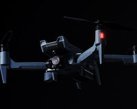
Core Equipment Considerations
Building a drone response program starts with choosing the right equipment. Not all drones are created equal, especially when it comes to the demands of emergency services. Here are some core equipment considerations to ensure your drones can withstand operational realities:
-
Durability and Weather Resistance: Emergency scenarios don’t wait for fair weather, so your drones must be tough. Public safety drones should be built to handle harsh environments – from rain and high winds to smoke and dust. Look for airframes with weather-resistant ratings (such as IP43, IP45 or higher) that can tolerate water and grit. Rugged construction is important both for outdoor use and for the bumps and scrapes of frequent deployments.
-
Extended Flight Time: Every minute counts in an emergency. Longer flight time translates to greater area coverage and fewer interruptions for battery swaps. Endurance should be a key spec in your drone selection. Modern public safety UAS commonly offer 30–55 minutes of flight time on a single battery. Aim for platforms that advertise extended flight times (30+ minutes) so you can sustain aerial overwatch during critical operations.
-
Reliable Connectivity and Range: In disaster response, drones often need to fly beyond the immediate line of sight of the pilot or relay live video over long distances. A reliable control link and video transmission system are therefore essential. Prioritize drones that use robust, secure communication links (like digital encrypted radio or LTE-based systems) to ensure you maintain control and data downlink even in complex terrain or urban environments.
-
GPS and Navigation Precision: In chaotic disaster scenes, GPS reliability can be a challenge (think of dense urban downtowns or forest canopies). Yet precise navigation is important – whether you’re trying to hover steadily over a point of interest or fly a mapping mission. Ensure your drones have high-quality GNSS receivers (GPS plus alternatives like GLONASS, Galileo) and ideally support RTK (Real-Time Kinematic) positioning or other augmentation for improved accuracy.
-
Platform Size and Portability: Think about the size and form-factor of the drones you deploy. A mix of platforms can be advantageous: for example, a small portable drone (under 5 lbs) that fits in a backpack for quick deployment by a single operator, and a larger workhorse drone for heavy-lift or longer endurance tasks. Smaller drones (like foldable quadcopters) are great for rapid assessment in tight spots or indoor use, whereas larger drones can carry more capable sensors and withstand tougher weather. Evaluate your typical mission profile: in urban search and rescue you may need a small agile drone to fly inside collapsed structures, while for wide-area disaster surveys a bigger drone or even a fixed-wing UAS might be better suited.
-
COO Compliance (NDAA and “Blue UAS”): Government agencies and grant-funded programs often have to follow equipment compliance rules. A major consideration in recent years is the U.S. National Defense Authorization Act (NDAA) provisions that prohibit using federal funds to obtain drones from certain foreign manufacturers (notably Chinese companies) due to perceived security concerns. Many state and local agencies are likewise choosing or required to use “NDAA-compliant” drones – essentially platforms with domestically or allied-manufactured components that meet supply chain security criteria.
The Department of Defense’s Blue UAS initiative goes a step further by vetting and approving specific drone models as secure and safe for government use . When selecting equipment for your drone program, it’s wise to factor in these compliance aspects.
By carefully weighing these core equipment factors you can choose drones and accessories that will stand up to the realities of emergency response. Remember that your drone is an operational tool; it must be ready to perform in life-and-death situations. Investing in reliable, public safety-grade equipment will pay off the first time you deploy it.
Drone Platform & Payload Recommendations
With the general requirements in mind, what types of drone platforms and payloads make sense for emergency management? In this section, we’ll provide some recommendations for capabilities to look for, based on common scenarios:
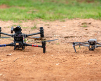
Multi-rotors (Quadcopters/Hexacopters)
The workhorse of public safety drone programs is typically a multi-rotor platform. These drones can take off and land vertically (no runway needed), hover in place, and maneuver in tight areas – all essential traits for emergency scenes. Look for an enterprise-graded option with at least 30 minutes of flight time, weather-resistant airframe, and support for modular payloads. A mid-sized quadcopter can handle most missions from mapping to overwatch, while a larger hexacopter might offer more stability in high winds and redundancies (like extra motors) for added safety.
Some agencies use tethered drones since they draw power from the ground and don’t rely on batteries. Tethered systems trade mobility for persistence, so you might deploy them at a fixed command post while also having free-flying drones for roaming tasks.
Fixed-Wing UAS
Fixed-wing UAS (airplane-style drones) are less common in tactical response but can be very useful for wide-area surveys and disasters covering large geography. They typically have much longer flight times (several hours) and greater range, which is beneficial for monitoring extensive flood plains, large wildfire perimeters, or searching vast wilderness. If your agency’s responsibilities include regional damage assessment or mapping, a fixed-wing drone with mapping camera could be a valuable addition. Keep in mind they need space to launch and land.
Optical Camera Payloads
A high-quality optical/RGB camera is a staple payload for any drone program. This usually means at least a 4K resolution video camera with zoom capability. For emergency work, a zoom lens (optical zoom) is extremely valuable.
Some payloads offer powerful dual or multi sensor setups: for instance, a gimbal that has both a zoom 4K video camera and a radiometric thermal camera side by side. This dual payload is ideal for public safety because it covers day/night and detail at range. Ensure any camera you deploy has stabilization for steady imagery, and consider low-light performance as well (larger sensors, high ISO capability) for dusk/dawn operations.
Thermal/Infrared Cameras
Thermal imaging is indispensable for finding people, detecting fires, and even seeing through smoke. Many drone models marketed for public safety come with thermal options.
When selecting a thermal camera, consider the resolution (640x512 or 1280x1024; higher is better for clarity) and the temperature sensitivity. Some cameras also provide temperature measurement, which can be useful for hazmat (reading tank temperatures from afar) or firefighting (measuring hotspot temps). A dual thermal+visible gimbal is often the most efficient choice so you can toggle between views.
Specialty Payloads
One advantage of a robust drone platform is the ability to swap payloads depending on the mission. Beyond the standard visual and thermal cameras, consider acquiring or budgeting for some specialty payloads:
-
Loudspeaker/PA System: Useful for making announcements from the air – e.g., guiding a lost hiker or alerting a crowd to evacuate. Drones with integrated loudspeakers have been used to reassure trapped victims and give instructions when other communication is down .
-
High-Powered Spotlight: A steerable searchlight on a drone can illuminate areas at night for ground teams or help in searches. It’s like having a movable floodlight in the sky, which can be crucial in nighttime disaster scenes or to signal to a lost person.
-
Delivery Mechanism: Some drones can carry and drop small payloads – for example, delivering a flotation device to a drowning victim, or an AED (defibrillator) to the site of a cardiac arrest. In fact, drones have already been credited with helping save cardiac arrest patients by delivering defibrillators faster than ambulances in trials . If your community has areas that are hard to reach quickly by vehicle (remote trails, high-rise buildings, etc.), a drone with a delivery winch or drop-box could be a literal lifesaver.
-
Gas/Specialty Sensors: As mentioned, drones can be outfitted with chemical sensors (for chlorine, ammonia, etc.), radiation detectors, or other environmental sensors to support hazardous materials response . If your agency handles a lot of industrial incidents or homeland security missions, integrating these sensors allows the drone to double as a remote monitor.
-
Mapping Cameras or LiDAR sensors: For agencies focused on disaster assessment and reconstruction, a high-megapixel mapping camera or even a lightweight LiDAR unit can be a great addition. These payloads allow drones to create detailed 3D maps of wreckage, generate orthoimagery for GIS, and survey terrain changes (like landslide volumes or flood extents). They tend to be used in the post-disaster phase more than the initial lifesaving phase, but having that capability in-house can significantly speed up recovery efforts.
Redundancy and Spares
A quick note on equipment philosophy: emergency drone programs should plan for redundancy. This means having at least one backup drone (if not more) and critical spare parts (propellers, batteries, etc.).
In the high-stakes world of emergency response, you can’t afford to be grounded because one drone had a malfunction or is stuck in maintenance. Many agencies start with two or three identical drones, so that if one is out of service, others can fill in.
Likewise, invest in plenty of batteries and perhaps additional charging hubs – you’ll need the endurance for sustained operations. Maintenance gear like extra propeller blades, motor spares, and tools for field repair are also part of your equipment considerations. Incorporate a routine for battery rotation and health checks, since battery failures can end a mission prematurely.
Integrating Drones into Emergency Management Workflows
Drones should not operate in a silo or as a novelty; they need to be a standard tool within the Incident Command System and your SOPs, so that everyone knows when and how to deploy them during an incident.
Incorporate Drones into the Incident Command System (ICS)
Most emergency responses use the ICS structure to manage resources and personnel. Your drone team (even if it’s a single pilot at first) should be incorporated into that structure from the outset.
In practice, this means establishing a clear chain of command and communication for UAS operations at an incident. For example, many fire departments and emergency agencies assign a UAS Unit Leader or an “Air Operations” function within the ICS organization. The person in this role (sometimes called an Air Boss in large incidents) coordinates all drone flights, ensures deconfliction with manned aircraft, and keeps the Incident Commander informed of aerial observations .
In smaller incidents, a dedicated Air Boss might not be necessary, but assigning a single point of contact for drone operations (e.g. the UAS pilot or a supervisor) helps maintain unity of command. The rest of the incident management team should understand that the drone unit is there to support operations, much like any other sector or division in ICS.
Train Your Team in ICS and NIMS
It’s not just the commanders who need to know how drones fit in – the drone pilots and crew themselves must be fluent in ICS principles. A drone operator showing up to a disaster should know how to report to Command, how to communicate on the radio using clear text, and how to prioritize missions according to the incident objectives. Familiarity with the National Incident Management System (NIMS) is key.
Make ICS and NIMS training (such as FEMA’s ICS-100, 200, 700 courses) a prerequisite for your drone team. This common framework ensures that when a drone is deployed, it operates as an integrated resource, not a rogue element. It also builds trust with other responders – firefighters and police officers will be more comfortable with drones overhead when they know the operators are following the same incident command protocols.
Develop Clear Deployment Protocols
Determine when and how drones will be requested and used in your emergency operations. For example, you might write into your emergency operations plan that “upon report of a lost person in [County], the on-call UAS team should be notified for potential deployment” or “a drone will be dispatched to any 2nd alarm fire for size-up.”
By having trigger points or criteria, you normalize the use of drones as part of the standard response package. During an incident, the process for launching a drone should be clearly defined: Who approves the flight? On what radio channel will the pilot communicate? Is there a need to establish a no-fly zone for other aircraft? Consider integrating drone activation into your run cards or dispatch protocols, similar to how you’d dispatch special rescue units. Having a standard workflow for requesting and deploying drones ensures they are used consistently when they can add value.
Real-Time Coordination and Data Sharing
Once a drone is in the air at an incident, you need a plan for who will receive its information and how. The goal is to feed the drone’s live intelligence to the people who need it without delay. Many agencies establish a system where the drone pilot is in direct communication with the Incident Commander or Operations Section.
For instance, the pilot might be monitoring the fireground radio channel and can chime in with critical observations. Additionally, use technology to your advantage: set up the drone’s controller to live-stream video to command posts, emergency operations centers, or even to mobile devices carried by team leaders.
Modern drone software and apps allow streaming to secure web links or integration with tools like EOCs and GIS dashboards. By doing this, you enable what Homeland Security calls “real-time situational awareness” – multiple personnel can watch the live feed and make informed decisions collaboratively.
Agencies have found that this real-time coordination significantly enhances decision-making and resource deployment, as drones “provide live video feeds and data streams to command centers, facilitating immediate decision-making and efficient allocation of resources” .
Airspace Deconfliction and Safety
If your drone is sharing the sky with other aircraft (news helicopters, police helicopters, or water-dropping planes in a wildfire), it’s imperative to have airspace coordination.
Within ICS, this is handled by the Air Operations branch or the Air Boss, but even on small scenes the drone pilot must stay alert to incoming medical helicopters or low-flying planes. Establish procedures such as: always announce your drone operations on the relevant frequency, use a strobe or identifiable lighting on the drone, and if a manned aircraft is inbound, be prepared to immediately descend or land the UAS.
Some jurisdictions set up Temporary Flight Restrictions (TFRs) for major incidents, which helps keep unaffiliated drones (e.g. hobbyists or media) out of the area – make sure your team knows how to comply with TFRs and coordinate with any Air Traffic Control if near controlled airspace. Detection of “rogue” drones is another emerging need; larger agencies might employ counter-UAS measures or at least have a plan if an unknown drone is flying in your incident airspace.
On a day-to-day basis, maintaining visual line of sight, respecting altitude limits, and having a dedicated visual observer can go a long way to ensuring safe drone integration in a busy emergency scene.
Integration with Existing Tech and Systems
Incorporate drone data into the tools your agency already uses. For example, many Emergency Operations Centers (EOCs) use GIS mapping systems or programs like WebEOC to track incidents – make sure your drone imagery can be quickly added to those systems
If your 911 dispatch or CAD system supports it, note in the call comments when a drone is being deployed so all responding units know. Some drones allow direct feed into platforms integrated with 911 centers; others rely on the pilot to share a URL for live video.
Whatever the case, drone operations should be part of the communication plan. In training exercises, practice having the drone team feed intel to planning meetings or briefings. For instance, during a large wildfire, the UAS team might provide an updated aerial map before each operational briefing, giving crews the latest look at fire spread.
Finally, make drones a routine part of after-action reviews and continuous improvement. After each deployment, evaluate how effectively the drone was used within the workflow. Did the Incident Commander get the info they needed? Was there confusion about who had airspace control? Use those lessons to refine your procedures.
Success in Integration
Drones are rapidly becoming indispensable partners in emergency management. From providing a bird’s-eye view of disasters, to delivering critical medical supplies, to keeping responders out of harm’s way, a well-run drone program extends the capabilities of any emergency agency.
Building a drone program requires more than just buying a drone or two – it takes strategic planning around equipment, training, and workflows. The insights above highlight that success lies in integration: integrating the right durable equipment, integrating drones into the incident command framework, and integrating sound policies and training for sustained operations.
Advexure is here to help as a resource and partner in this journey. With deep experience in public safety UAS solutions, our team can assist in everything from selecting NDAA-compliant drone platforms to developing training programs and standard operating procedures tailored to your mission. We understand the unique challenges first responder agencies face and can provide guidance to build or expand your drone program the right way – with safety, compliance, and effectiveness at the forefront
Resources & Further Reading
- Emergency Response by JOUAV: https://www.jouav.com/emergency-response
- Drone for Disaster Management – FlytBase: https://flytbase.com/drones-for-disaster-management/
- Disaster Prevention and Response – DJI Enterprise: https://enterprise.dji.com/disaster-prevention-and-response
- The Crucial Role of Drones in Emergency Response – FEDS Group: https://www.feds.group/the-crucial-role-of-drones-in-emergency-response-and-natural-disaster-relief
-
UAV Use in Disaster Management – The Pennsylvania State University: https://www.researchgate.net/publication/341652914_UAV_Use_in_Disaster_Management
-
FAA Part 107 Remote Pilot Certification: https://www.faa.gov/uas/commercial_operators/become_a_drone_pilot
- FAA Certificate of Authorization (COA) Overview: https://www.faa.gov/uas/public_safety_gov/public_safety_toolkit
- Department of Defense – Blue UAS Framework: https://www.diu.mil/blue-uas
- National Defense Authorization Act (NDAA) Drone Restrictions: https://www.congress.gov/bill/116th-congress/senate-bill/1790
- NFPA 2400 – Standard for Public Safety UAS: https://www.nfpa.org/codes-and-standards/all-codes-and-standards/list-of-codes-and-standards/detail?code=2400