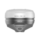
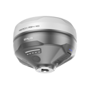
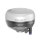
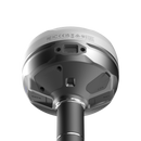
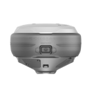
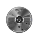
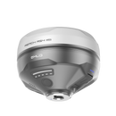
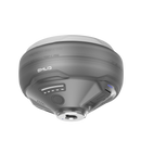
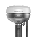
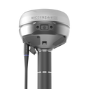
Emlid Reach RS4 Pro pairs all-band RTK GNSS with dual Full HD cameras for AR stakeout and image-based measurements. Achieve centimeter accuracy with L1/L2/L5/L6, 672 channels, and fast tilt compensation. IP68 magnesium body, 16-hour battery, base/rover via NTRIP, UHF, or LoRa.
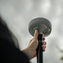
Emlid Reach RS4 Pro is an all-band RTK GNSS receiver built on RS4 and upgraded with dual Full HD cameras for AR-guided stakeout and image-based measurement. Achieve centimeter accuracy with L1/L2/L5/L6, 672 channels, and fixes in under 5 seconds, plus next-gen IMU tilt (RTK + 2 mm + 0.3 mm/°). Overlay designs on the real world, capture video, and extract coordinates from images to reach inaccessible or hazardous points. Magnesium alloy, IP68, −40 to +149 °F (−40 to +65 °C), and up to 16 hours of battery keep crews productive on complex sites.
Reach RS4 Pro: Discover The New Way To Survey With Dual Cameras
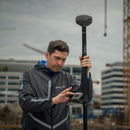
Two integrated Full HD cameras push RS4 Pro beyond traditional RTK. Overlay designs on the live scene for AR-guided stakeout, then auto-switch to the bottom camera’s bullseye view as you close in. Crews get faster alignment, better situational awareness, and safer workflows when points are near traffic, machinery, or other hazards.
Stake Out Faster With AR Guidance
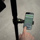
Skip abstract map chasing. RS4 Pro projects CAD geometry into the real world, guiding you visually to each target and confirming alignment at the pole tip. Ideal for dense construction sites and roadworks where clarity and speed matter.
- Dynamic navigation that adapts as you move
- Auto bullseye view for final alignment
- Cut & fill indicator at the point
- Quick point switch for rapid stake sequences
Measure From Images

When a point is out of reach, the RS4 Pro lets you capture a short video sweep and compute coordinates directly from the frames—no total station, no risky access. Generate a visual audit trail for every measurement while keeping crews out of harm’s way.
- Across water
- Behind fences
- Over traffic
- Above pits
- Past hedges
- Around machinery
It’s faster, safer, and simpler: keep working from where you stand and still deliver centimeter-grade results.
Unmatched Precision, Even Under Canopy
The Reach RS4 Pro tracks every major constellation and band—including L1/L2/L5/L6—on a 672-channel engine. Lower-frequency L5/L6 signals and a redesigned antenna improve multipath resistance, so you keep a stable fix beneath tree cover and in reflective urban sites while tracking 40+ satellites concurrently.
RTK precision: H: 7 mm + 1 ppm (≈ 0.28 in + 1 ppm), V: 14 mm + 1 ppm (≈ 0.55 in + 1 ppm). Fix time: typically under 5 seconds.
- All-band GNSS: L1/L2/L5/L6
- GPS, GLONASS, Galileo, BeiDou, QZSS, NavIC
- 672 channels with improved antenna design
- Centimeter-level results in canopy and dense urban environments
- Fast initialization for rapid first fix
Next-Gen Tilt Compensation
Work accurately without leveling. The Reach RS4 Pro maintains centimeter precision while the pole is tilted, with a typical specification of RTK + 2 mm + 0.3 mm/°. The compensation mechanism activates with a few quick moves and stays stable through the session, so you keep moving even in tight corridors and near obstructions.
Fast start, no recalibration. Initialization typically takes 5–7 seconds. Each unit is factory-calibrated, so there is no field calibration to manage.
Designed for difficult environments. The IMU is immune to magnetic interference, which helps maintain accuracy around vehicles, steel structures, and electronics. There is no practical angle limit for the algorithm within normal field use.
- Example performance: ~18 mm at 30° tilt (≈ 0.71 in).
- Typical spec: RTK + 2 mm + 0.3 mm/° tilt error.
- 5–7 s initialization; remains stable during long surveys.
- Factory-calibrated; no user calibration required.
- Magnetically immune IMU for urban and industrial sites.
Quick Release Mount

The RS4 Pro quick release mount is engineered for tilt workflows. A backlash-free thread and keyed interface lock the receiver to the survey pole, removing wobble that could bias the IMU during tilt. Attachment is fast and repeatable, and the rigid coupling keeps geometry stable through rotation, stakeout, and transport.
Base and Rover
NTRIP
Run RTK in RTCM3 via VRS/CORS networks, or set another GNSS as an NTRIP base using Emlid NTRIP Caster.
Dual-Band Radio
UHF 450 MHz
- Transmit and receive corrections.
- Up to 2 W output (licensing may be required by local regulations).
- Compatible with Reach and third-party receivers supporting TRIMTALK 450S.
LoRa 915 MHz
- Transmit and receive corrections.
- Up to 1 W output (optimized for license-free use in North America).
- Interoperable with Reach receivers for simple base–rover links.
Built to Perform in Extreme Conditions

Magnesium Alloy Body
The RS4 Pro uses a magnesium-alloy enclosure for high strength at low weight. This premium material is common in aerospace and high-end electronics and holds up to jobsite abuse without adding bulk.
16 Hours on One Charge
Work a full day without swapping gear. RS4 Pro runs up to 16 hours on a single charge and tops up via USB-C or a power bank for flexible recharging in the field.
Waterproof and Dustproof
Rated IP68 for sealed, weatherproof operation in rain, snow, and dusty construction environments. Keep surveying when conditions turn rough.
Wide Operating Temperature
Engineered for year-round use from −40 to +65 °C (−40 to +149 °F) without compromising performance or stability.
Software to Drive Your Entire Workflow
Emlid Flow pairs with the Flow 360 cloud to keep devices, projects, and code lists in sync on iOS and Android. Field updates appear in the office in near real time, so teams stay aligned and work from the same, current dataset.
Coordinate Your Team
Invite teammates, share projects, and control access. Track field progress from the office and exchange files without email or manual merges. A single, consistent interface reduces training time and keeps crews productive.
- Add users, assign permissions, and share active jobs.
- View project status and sync changes instantly between field and office.
- One workflow across the team with always up-to-date data.
Execute Projects On Site
Use Flow tools to set up the receiver, collect features, create linework, and stake designs with confidence. Results are organized for fast handoff to the office.
- Topographic surveys for terrain and elevation capture.
- Stakeout and layouts for points, lines, and markers.
- Line and road surveys for centerlines, offsets, and curves.
- Cut and fill calculations for earthworks and stockpiles.
- As-built verification against design plans.
Emlid Reach RS4 Pro is an all-band RTK GNSS receiver built on RS4 and upgraded with dual Full HD cameras for AR-guided stakeout and image-based measurement. Achieve centimeter accuracy with L1/L2/L5/L6, 672 channels, and fixes in under 5 seconds, plus next-gen IMU tilt (RTK + 2 mm + 0.3 mm/°). Overlay designs on the real world, capture video, and extract coordinates from images to reach inaccessible or hazardous points. Magnesium alloy, IP68, −40 to +149 °F (−40 to +65 °C), and up to 16 hours of battery keep crews productive on complex sites.
Reach RS4 Pro: Discover The New Way To Survey With Dual Cameras
Two integrated Full HD cameras push RS4 Pro beyond traditional RTK. Overlay designs on the live scene for AR-guided stakeout, then auto-switch to the bottom camera’s bullseye view as you close in. Crews get faster alignment, better situational awareness, and safer workflows when points are near traffic, machinery, or other hazards.
Stake Out Faster With AR Guidance
Skip abstract map chasing. RS4 Pro projects CAD geometry into the real world, guiding you visually to each target and confirming alignment at the pole tip. Ideal for dense construction sites and roadworks where clarity and speed matter.
- Dynamic navigation that adapts as you move
- Auto bullseye view for final alignment
- Cut & fill indicator at the point
- Quick point switch for rapid stake sequences
Measure From Images

When a point is out of reach, the RS4 Pro lets you capture a short video sweep and compute coordinates directly from the frames—no total station, no risky access. Generate a visual audit trail for every measurement while keeping crews out of harm’s way.
- Across water
- Behind fences
- Over traffic
- Above pits
- Past hedges
- Around machinery
It’s faster, safer, and simpler: keep working from where you stand and still deliver centimeter-grade results.
Unmatched Precision, Even Under Canopy
The Reach RS4 Pro tracks every major constellation and band—including L1/L2/L5/L6—on a 672-channel engine. Lower-frequency L5/L6 signals and a redesigned antenna improve multipath resistance, so you keep a stable fix beneath tree cover and in reflective urban sites while tracking 40+ satellites concurrently.
RTK precision: H: 7 mm + 1 ppm (≈ 0.28 in + 1 ppm), V: 14 mm + 1 ppm (≈ 0.55 in + 1 ppm). Fix time: typically under 5 seconds.
- All-band GNSS: L1/L2/L5/L6
- GPS, GLONASS, Galileo, BeiDou, QZSS, NavIC
- 672 channels with improved antenna design
- Centimeter-level results in canopy and dense urban environments
- Fast initialization for rapid first fix
Next-Gen Tilt Compensation
Work accurately without leveling. The Reach RS4 Pro maintains centimeter precision while the pole is tilted, with a typical specification of RTK + 2 mm + 0.3 mm/°. The compensation mechanism activates with a few quick moves and stays stable through the session, so you keep moving even in tight corridors and near obstructions.
Fast start, no recalibration. Initialization typically takes 5–7 seconds. Each unit is factory-calibrated, so there is no field calibration to manage.
Designed for difficult environments. The IMU is immune to magnetic interference, which helps maintain accuracy around vehicles, steel structures, and electronics. There is no practical angle limit for the algorithm within normal field use.
- Example performance: ~18 mm at 30° tilt (≈ 0.71 in).
- Typical spec: RTK + 2 mm + 0.3 mm/° tilt error.
- 5–7 s initialization; remains stable during long surveys.
- Factory-calibrated; no user calibration required.
- Magnetically immune IMU for urban and industrial sites.
Quick Release Mount

The RS4 Pro quick release mount is engineered for tilt workflows. A backlash-free thread and keyed interface lock the receiver to the survey pole, removing wobble that could bias the IMU during tilt. Attachment is fast and repeatable, and the rigid coupling keeps geometry stable through rotation, stakeout, and transport.
Base and Rover
NTRIP
Run RTK in RTCM3 via VRS/CORS networks, or set another GNSS as an NTRIP base using Emlid NTRIP Caster.
Dual-Band Radio
UHF 450 MHz
- Transmit and receive corrections.
- Up to 2 W output (licensing may be required by local regulations).
- Compatible with Reach and third-party receivers supporting TRIMTALK 450S.
LoRa 915 MHz
- Transmit and receive corrections.
- Up to 1 W output (optimized for license-free use in North America).
- Interoperable with Reach receivers for simple base–rover links.
Built to Perform in Extreme Conditions

Magnesium Alloy Body
The RS4 Pro uses a magnesium-alloy enclosure for high strength at low weight. This premium material is common in aerospace and high-end electronics and holds up to jobsite abuse without adding bulk.
16 Hours on One Charge
Work a full day without swapping gear. RS4 Pro runs up to 16 hours on a single charge and tops up via USB-C or a power bank for flexible recharging in the field.
Waterproof and Dustproof
Rated IP68 for sealed, weatherproof operation in rain, snow, and dusty construction environments. Keep surveying when conditions turn rough.
Wide Operating Temperature
Engineered for year-round use from −40 to +65 °C (−40 to +149 °F) without compromising performance or stability.
Software to Drive Your Entire Workflow
Emlid Flow pairs with the Flow 360 cloud to keep devices, projects, and code lists in sync on iOS and Android. Field updates appear in the office in near real time, so teams stay aligned and work from the same, current dataset.
Coordinate Your Team
Invite teammates, share projects, and control access. Track field progress from the office and exchange files without email or manual merges. A single, consistent interface reduces training time and keeps crews productive.
- Add users, assign permissions, and share active jobs.
- View project status and sync changes instantly between field and office.
- One workflow across the team with always up-to-date data.
Execute Projects On Site
Use Flow tools to set up the receiver, collect features, create linework, and stake designs with confidence. Results are organized for fast handoff to the office.
- Topographic surveys for terrain and elevation capture.
- Stakeout and layouts for points, lines, and markers.
- Line and road surveys for centerlines, offsets, and curves.
- Cut and fill calculations for earthworks and stockpiles.
- As-built verification against design plans.
Emlid Reach RS4 Pro Specifications
Positioning
| Precision — Static | H: 4 mm + 0.5 ppm V: 8 mm + 1 ppm |
| Precision — PPK | H: 5 mm + 0.5 ppm V: 10 mm + 1 ppm |
| Precision — RTK | H: 7 mm + 1 ppm V: 14 mm + 1 ppm |
| Convergence time | ~5 s typically |
| Tilt compensation | RTK + 2 mm + 0.3 mm/° |
| Update rate | Up to 10 Hz |
GNSS
| Signals tracked | GPS: L1C/A, L2C, L5 GLONASS: L1OF, L2OF Galileo: E1-B/C, E5a, E6 BeiDou: B1I, B1C, B2a, B3I QZSS: L1C/A, L1C/B11, L2C, L5 NavIC: L1-SPS Data, L5-SPS |
| Number of channels | 672 |
Connectivity
| Cellular (LTE modem) | Regions: Global FDD-LTE: 1, 2, 3, 4, 5, 7, 8, 12, 13, 18, 19, 20, 26, 28 TD-LTE: 38, 39, 40, 41 UMTS: 1, 2, 5, 8 GSM (Quad-band): 850 / 900 / 1800 / 1900 MHz SIM: Nano-SIM |
| Emlid/LoRa radio | 868 / 915 MHz, 0.1 W, up to 8 km (≈ 5.0 mi) |
| UHF radio | 410–470 MHz; Protocol: TRIMTALK 450S; Modulation: GMSK |
| Wi-Fi | 802.11 a/b/g/n |
| Bluetooth | Bluetooth 5.1 (BR/EDR + LE) |
| Ports | RS-232, USB Type-C |
Data
| Corrections | NTRIP, RTCM3 |
| Position output | NMEA, LLH/XYZ |
| Data logging | RINEX, NMEA, LLH/XYZ, UBX |
| Internal storage | 16 GB |
Imaging
| Image sensors | 1/2.6 in CMOS, global shutter, Full HD |
| Field of view — Front | H: 64.6°, V: 42.8° |
| Field of view — Bottom | H: 63°, V: 42° |
| Video frame rate | 25 fps |
Mechanical
| Dimensions | 128.6 × 128.6 × 99.3 mm (5.06 × 5.06 × 3.91 in) |
| Weight | 920 g (2.03 lb) |
| Operating temperatures | −40 to +65 °C (−40 to 149 °F) |
| Ingress protection | IP68 |
Electrical
| Autonomy | Up to 16 hrs as RTK rover with tilt; up to 22 hrs logging |
| Battery | Li-Ion 5000 mAh, 7.2 V, 36 Wh |
| Charging | USB Type-C (PD): 5 V—3 A, 9 V—3 A, 12 V—3 A, 15 V—3 A |
* Use the correct antenna (LoRa or UHF) for your setup.
** TRIMTALK is a trademark of Trimble Inc.
(1) Reach RS4 Pro
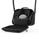
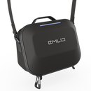
(1) Carrying Case
(1) USB Type-C Cable
(1) LoRa Antenna 860–930 MHz
(1) UHF Antenna 410–470 MHz
What industries and jobs is Reach RS4 Pro best for?
The RS4 Pro is built for land surveyors, construction engineers, critical-infrastructure teams, GIS specialists, and drone operators who need highly accurate position data. With all-band, multi-constellation GNSS, integrated IMU, and dual cameras, it also suits satellite navigation projects, precision agriculture, mapping, inspection, and measuring hard-to-reach points while improving safety.
Does Reach RS4 Pro come with a software?
Yes. RS4 Pro integrates with Emlid Flow (mobile) and Flow 360 (cloud) for device setup, base/rover and correction configuration, project management, and data collection. Cloud sync keeps office and field aligned, and you can record RINEX for PPK workflows when needed.
Can RS4 Pro work as a base station or integrate with other devices?
Absolutely. RS4 Pro can act as an RTK-GNSS base, streaming corrections, or as a rover outputting position to external hardware. Bluetooth and physical connectors enable smooth integration with controllers, autopilots, tractors, GPRs, and industrial systems. As an all-band, multi-constellation receiver, it embeds cleanly into existing workflows and navigation infrastructures.
How does RS4 Pro ensure durability, safety, and long-term reliability?
Its rugged, IP68-rated enclosure protects the antenna, IMU, and electronics for dependable operation in harsh environments. Interference-mitigation and strong signal reception support stable data even near power infrastructure or in dense urban areas. The long-life battery supports up to two working days before recharge (usage dependent), and manufacturer support underpins smooth deployment and ongoing reliability.
What level of accuracy does Reach RS4 Pro provide?
RS4 Pro delivers centimeter-level results with advanced sensor integration, robust antenna design, and optimized all-band processing. Expect fast RTK fixes and consistent precision using network corrections, with the option to log RINEX for high-accuracy PPK processing when RTK is unavailable.
Emlid Reach RS4 Pro Receiver—Stake Out In AR And Measure From Photos
Frequently Bought Together
Payment & Security
Your payment information is processed securely. We do not store credit card details nor have access to your credit card information.


