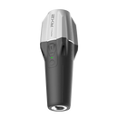
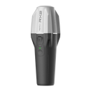
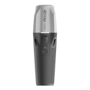
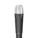
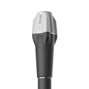
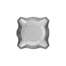
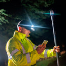
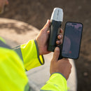
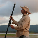
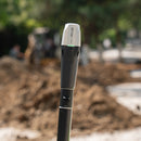
Emlid Reach RX2 is a pocket-sized RTK rover with IMU tilt compensation, 672-channel all-band GNSS, and NTRIP support. Delivers centimeter accuracy in tight spaces, runs up to 16 hours, IP68 rugged, MFi for iOS and Android, and integrates with ArcGIS and Emlid Flow.
Emlid Reach RX2 is a compact, network-rover GNSS receiver that brings IMU tilt compensation, an all-band, 672-channel engine, and centimeter-level RTK to everyday fieldwork. It’s built for teams that need high-precision coordinates without wrestling with complex setup, integrates cleanly with Emlid Flow as well as popular GIS apps, and is rugged enough for year-round use.
IMU Tilt Compensation, Done Right

Measure Accurately without Leveling
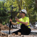
Capture points with a tilted pole while maintaining RTK precision. Typical specification: RTK + 2 mm + 0.3 mm/° of tilt error. That means fast, reliable shots near walls, slopes, or tight spaces where bubble leveling slows you down.
Immune to Magnetic Interference
The RX2’s IMU does not rely on a magnetometer, so measurements stay stable around vehicles, steel structures, and electronics.
No User Calibration
Each RX2 is factory-calibrated. On site, initialization takes only 7 to 10 seconds with a quick rotate, then you’re ready to survey.
Secure Quick-Release Mount
A purpose-built thread and adapter lock the receiver to the survey pole to prevent backlash during tilt, preserving accuracy.
All-Band, Multi-Constellation GNSS

672 Channels for reliable Fixes
Tracks GPS, GLONASS, Galileo, BeiDou, QZSS, and NavIC, including modern signals such as GPS L5 and BeiDou-3. The new GNSS antenna improves reception for challenging environments, including light canopy and urban clutter.
RTK via NTRIP
Connect to any CORS or correction service using RTCM3 over NTRIP to get centimeter-level results with minimal setup.
Planned SSR Options
Future firmware will enable L-band/SSR services such as Galileo HAS for decimeter-class positioning (about 2 to 8 inches), useful when RTK corrections are unavailable.
Note: RX2 is a rover only. It cannot act as a base and does not log raw data for PPK.
Pocket-Sized, Field-Ready

Lightweight and Compact
Approx. 280 g (0.62 lb) with a slim profile that fits in a jacket pocket or glove compartment.
Ruggedized for Real Work
IP68 protection, water resistant to 1.5 m (4.9 ft) for up to 30 minutes. Operating range −20 to +65 °C (−4 to 149 °F).
All-Day Battery
Up to 16 hours on a single charge; top up via USB-C in under 3 hours. High-capacity Li-ion 7000 mAh (25.2 Wh) chemistry handles heat and cold well.
Works the Way Your Team Works
 Emlid Flow Keeps Field and Office in Sync
The Emlid Flow mobile app pairs instantly over Bluetooth for collector setup, linework, coding, stakeout, and QA checks. Projects and code lists sync with the Emlid Flow 360 cloud so teams always work from the latest data.
iOS and Android Friendly
MFi-certified for seamless use on iPhone and iPad, and fully compatible with Android devices. Use RX2 directly with apps your team already knows.
Plays Nicely with GIS
Integrates with ArcGIS Field Maps, Survey123, QuickCapture, QField, Mergin Maps, and more to lift sub-meter workflows into the centimeter class without retooling your stack.
Where Reach RX2 Delivers Value
GIS and Esri Ecosystem
Boost positional accuracy for asset inventories, environmental mapping, and inspections while staying inside ArcGIS Field Maps, Survey123, or QuickCapture. MFi support ensures smooth performance on iOS-based fleets.
Utilities
Capture points in trenches and hard-to-reach corridors with tilt, then verify clearances, offsets, and as-builts. Pair RX2 with terrestrial scanning apps to estimate volumes and track progress.
Construction
Equip non-survey staff to stake fences, check elevations, lay out site features, and collect control or checkpoints. Simple operation reduces training time and error rates across growing teams.
Landscaping
Produce quick topography, layout designs, and validate grades with centimeter precision. Emlid Flow’s CAD-aware tools streamline field capture to office deliverables.
Terrestrial Scanning
Use RX2 with PIX4Dcatch and similar apps to geo-reference 3D captures of buildings, facades, and constrained spaces for utility mapping, volume calculations, and as-built documentation.
Emlid Reach RX2 is a compact, network-rover GNSS receiver that brings IMU tilt compensation, an all-band, 672-channel engine, and centimeter-level RTK to everyday fieldwork. It’s built for teams that need high-precision coordinates without wrestling with complex setup, integrates cleanly with Emlid Flow as well as popular GIS apps, and is rugged enough for year-round use.
IMU Tilt Compensation, Done Right

Measure Accurately without Leveling
Capture points with a tilted pole while maintaining RTK precision. Typical specification: RTK + 2 mm + 0.3 mm/° of tilt error. That means fast, reliable shots near walls, slopes, or tight spaces where bubble leveling slows you down.
Immune to Magnetic Interference
The RX2’s IMU does not rely on a magnetometer, so measurements stay stable around vehicles, steel structures, and electronics.
No User Calibration
Each RX2 is factory-calibrated. On site, initialization takes only 7 to 10 seconds with a quick rotate, then you’re ready to survey.
Secure Quick-Release Mount
A purpose-built thread and adapter lock the receiver to the survey pole to prevent backlash during tilt, preserving accuracy.
All-Band, Multi-Constellation GNSS

672 Channels for reliable Fixes
Tracks GPS, GLONASS, Galileo, BeiDou, QZSS, and NavIC, including modern signals such as GPS L5 and BeiDou-3. The new GNSS antenna improves reception for challenging environments, including light canopy and urban clutter.
RTK via NTRIP
Connect to any CORS or correction service using RTCM3 over NTRIP to get centimeter-level results with minimal setup.
Planned SSR Options
Future firmware will enable L-band/SSR services such as Galileo HAS for decimeter-class positioning (about 2 to 8 inches), useful when RTK corrections are unavailable.
Note: RX2 is a rover only. It cannot act as a base and does not log raw data for PPK.
Pocket-Sized, Field-Ready

Lightweight and Compact
Approx. 280 g (0.62 lb) with a slim profile that fits in a jacket pocket or glove compartment.
Ruggedized for Real Work
IP68 protection, water resistant to 1.5 m (4.9 ft) for up to 30 minutes. Operating range −20 to +65 °C (−4 to 149 °F).
All-Day Battery
Up to 16 hours on a single charge; top up via USB-C in under 3 hours. High-capacity Li-ion 7000 mAh (25.2 Wh) chemistry handles heat and cold well.
Works the Way Your Team Works
 Emlid Flow Keeps Field and Office in Sync
The Emlid Flow mobile app pairs instantly over Bluetooth for collector setup, linework, coding, stakeout, and QA checks. Projects and code lists sync with the Emlid Flow 360 cloud so teams always work from the latest data.
iOS and Android Friendly
MFi-certified for seamless use on iPhone and iPad, and fully compatible with Android devices. Use RX2 directly with apps your team already knows.
Plays Nicely with GIS
Integrates with ArcGIS Field Maps, Survey123, QuickCapture, QField, Mergin Maps, and more to lift sub-meter workflows into the centimeter class without retooling your stack.
Where Reach RX2 Delivers Value
GIS and Esri Ecosystem
Boost positional accuracy for asset inventories, environmental mapping, and inspections while staying inside ArcGIS Field Maps, Survey123, or QuickCapture. MFi support ensures smooth performance on iOS-based fleets.
Utilities
Capture points in trenches and hard-to-reach corridors with tilt, then verify clearances, offsets, and as-builts. Pair RX2 with terrestrial scanning apps to estimate volumes and track progress.
Construction
Equip non-survey staff to stake fences, check elevations, lay out site features, and collect control or checkpoints. Simple operation reduces training time and error rates across growing teams.
Landscaping
Produce quick topography, layout designs, and validate grades with centimeter precision. Emlid Flow’s CAD-aware tools streamline field capture to office deliverables.
Terrestrial Scanning
Use RX2 with PIX4Dcatch and similar apps to geo-reference 3D captures of buildings, facades, and constrained spaces for utility mapping, volume calculations, and as-built documentation.
Reach RX2 (Standard)
(1) Reach RX2
(1) USB-C cable
Pix4D & Emlid Scanning Kit
(1) Reach RX2
(1) USB-C cable
(1) Pix4Dcatch 1-year license
(1) Emlid Scanning Kit:
• Emlid handle
• Leash
• Allen key 3 mm
• Carrying case
Emlid Reach RX2 Specifications
Mechanical
| Dimensions | 172 × 51 × 51 mm (6.77 × 2.00 × 2.00 in) |
| Mount | 5/8"-11 UNC and quick-release |
| Weight | 280 g (0.62 lb) |
| Operating Temperature | −20 to +65 °C (−4 to 149 °F) |
| Ingress Protection | IP68 (water resistant to 1.5 m / 4.9 ft for up to 30 min) |
Electrical
| Autonomy | Up to 16 hrs |
| Battery | Li-ion 7000 mAh, 3.6 V, 25.2 Wh |
| Charging | USB Type-C, 5 V 2 A |
| Certification | FCC, CE, IC, MFi |
Positioning
| RTK | H: 7 mm + 1 ppm V: 14 mm + 1 ppm |
| Tilt accuracy | RTK + 2 mm + 0.3 mm/° |
| Convergence time | ~5 s typically |
| Update rate | 5 Hz |
Connectivity
| Communication interface | Bluetooth 4.2 (BR/EDR + LE) |
| Ports | USB Type-C |
Data
| Input data format | RTCM3 |
| Input data protocol | NTRIP |
| Position data format | NMEA |
GNSS
| Signals tracked | GPS: L1C/A, L2C, L5 GLONASS: L1OF, L2OF Galileo: E1-B/C, E5a, E6 BeiDou: B1I, B1C, B2a, B3I QZSS: L1C/A, L1C/B11, L2C, L5 NavIC: L1-SPS Data, L5-SPS |
| Number of channels | 672 |
Frequently Bought Together
Customer Reviews
Payment & Security
Your payment information is processed securely. We do not store credit card details nor have access to your credit card information.


