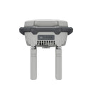
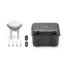
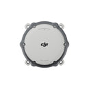
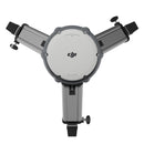
The All-New DJI D-RTK 3 Multifunctional GNSS Station is a powerful solution for surveying, mapping, and construction professionals. With advanced modes like Base Station, Relay Station, and Rover Station, it delivers centimeter-level positioning, extended operational range, and seamless integration with DJI Terra. Shop now to elevate your drone workflows with precision and efficiency.
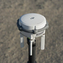
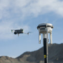
The D-RTK 3 Multifunctional GNSS Station features high-performance antennas and receiver modules that track and process data from all major global satellite navigation systems. It supports multiple data transmission links, enabling it to operate as a base station that provides centimeter-level positioning for multiple drones simultaneously or to extend drone operational ranges in relay mode.
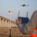
Additionally, the rover station mode, integrated with the DJI Enterprise app and DJI Terra, delivers a complete solution for high-precision aerial surveying, ensuring secure and accurate operations.
Multiple Modes, Versatile Control
Base Station Mode:
Supports Simultaneous Operation of Multiple Models

The D-RTK 3 supports the new O4 Enterprise video transmission system, featuring four external directional antennas that deliver stable 15 km video transmission in base station broadcast mode.
This ensures reliable signals in all directions. With the D-RTK 3 Multifunctional Station, operators can easily set up a single unit without additional configuration, allowing multiple drones to connect to the base station and receive centimeter-level positioning.
Relay Station Mode:
Break Through Limitations
Activate Relay Station Mode on the D-RTK 3 and install it in elevated locations within areas that have significant signal obstructions, such as urban environments or valleys. This setup enhances video transmission distances and extends the Matrice 4 series’ operational range up to 25 kilometers.
The D-RTK 3 features obstruction sensing for the Matrice 4 Series, providing real-time analysis of obstructions and signal quality between the relay station, remote controller, and drone. This allows operators to adjust the drone’s position using prompts from the remote controller, ensuring optimal communication quality.
Rover Station Mode:
Flexible and Efficient
In addition to functioning as a base station, the D-RTK 3 can operate as a rover station to collect control point coordinates. This enhances the accuracy and precision of UAV aerial surveys.
Effortless High-Precision Positioning
Enhanced Performance for Superior Accuracy
The D-RTK 3 is equipped with an air dielectric antenna featuring a specialized filtering design that effectively tracks low-elevation satellites. Its antenna phase-center accuracy remains within millimeters, providing exceptional resistance to multipath interference and ensuring high-precision positioning even in complex environments.
With its integrated receiver module, the D-RTK 3 accesses satellite data from five major global satellite systems across nineteen frequency points. Compared to traditional network RTK solutions, the D-RTK 3 delivers more accurate and stable positioning results, even when facing ionospheric disturbances.

Standalone Precise Point Positioning (PPP)
The D-RTK 3 utilizes DJI’s proprietary PPP (Precise Point Positioning) technology, enabling satellite-based auto convergence*. This delivers free decimeter-level positioning accuracy even in challenging network conditions.
*Currently supports BeiDou PPP-B2b only.
Network High-Precision Calibration
The D-RTK 3 receives RTCM data to automatically obtain coordinates and correct positions via the network. When used outdoors, it delivers centimeter-level precision positioning without the need to pre-measure the setup point location.
A DJI Integrated Mapping Solution
New DJI Enterprise App
Supports Ground Control Point (GCP) Setup and Tilt Compensation
Download the new DJI Enterprise app on your Android device to measure ground control point coordinates without the need for third-party tools. When paired with DJI drones that support RTK, the DJI solution enables a complete and efficient high-precision surveying workflow.
The D-RTK 3 features a built-in high-precision inertial measurement unit, allowing you to measure control points by simply holding the pole at an angle—no tripod or perfectly vertical base station required. This significantly boosts operational efficiency in complex measurement environments.
Supports Projection Coordinate Conversion
The new DJI Enterprise app includes a comprehensive projection coordinate database, enabling the direct output of planar coordinates. This feature streamlines your workflow by allowing seamless conversion and integration of coordinate data without the need for additional software.
Compatible with DJI Terra for Efficient Data Processing
One-Click Import: Time-Saving and Effortless
Export rover measurement results as control point files directly through the DJI Enterprise app and import them into DJI Terra without any format adjustments. DJI Terra’s powerful algorithms ensure high-precision results are generated easily, streamlining your data processing workflow.
Supports Local PPK
D-RTK 3 records raw satellite observations, enabling local PPK (Post-Processed Kinematic) calculations. When imported into DJI Terra version 4.4 or later alongside data from the Matrice 4E, local PPK can be performed with a single click, enhancing accuracy and efficiency in your surveying projects.
The D-RTK 3 Multifunctional GNSS Station features high-performance antennas and receiver modules that track and process data from all major global satellite navigation systems. It supports multiple data transmission links, enabling it to operate as a base station that provides centimeter-level positioning for multiple drones simultaneously or to extend drone operational ranges in relay mode.
Additionally, the rover station mode, integrated with the DJI Enterprise app and DJI Terra, delivers a complete solution for high-precision aerial surveying, ensuring secure and accurate operations.
Multiple Modes, Versatile Control
Base Station Mode:
Supports Simultaneous Operation of Multiple Models

The D-RTK 3 supports the new O4 Enterprise video transmission system, featuring four external directional antennas that deliver stable 15 km video transmission in base station broadcast mode.
This ensures reliable signals in all directions. With the D-RTK 3 Multifunctional Station, operators can easily set up a single unit without additional configuration, allowing multiple drones to connect to the base station and receive centimeter-level positioning.
Relay Station Mode:
Break Through Limitations
Activate Relay Station Mode on the D-RTK 3 and install it in elevated locations within areas that have significant signal obstructions, such as urban environments or valleys. This setup enhances video transmission distances and extends the Matrice 4 series’ operational range up to 25 kilometers.
The D-RTK 3 features obstruction sensing for the Matrice 4 Series, providing real-time analysis of obstructions and signal quality between the relay station, remote controller, and drone. This allows operators to adjust the drone’s position using prompts from the remote controller, ensuring optimal communication quality.
Rover Station Mode:
Flexible and Efficient
In addition to functioning as a base station, the D-RTK 3 can operate as a rover station to collect control point coordinates. This enhances the accuracy and precision of UAV aerial surveys.
Effortless High-Precision Positioning
Enhanced Performance for Superior Accuracy
The D-RTK 3 is equipped with an air dielectric antenna featuring a specialized filtering design that effectively tracks low-elevation satellites. Its antenna phase-center accuracy remains within millimeters, providing exceptional resistance to multipath interference and ensuring high-precision positioning even in complex environments.
With its integrated receiver module, the D-RTK 3 accesses satellite data from five major global satellite systems across nineteen frequency points. Compared to traditional network RTK solutions, the D-RTK 3 delivers more accurate and stable positioning results, even when facing ionospheric disturbances.

Standalone Precise Point Positioning (PPP)
The D-RTK 3 utilizes DJI’s proprietary PPP (Precise Point Positioning) technology, enabling satellite-based auto convergence*. This delivers free decimeter-level positioning accuracy even in challenging network conditions.
*Currently supports BeiDou PPP-B2b only.
Network High-Precision Calibration
The D-RTK 3 receives RTCM data to automatically obtain coordinates and correct positions via the network. When used outdoors, it delivers centimeter-level precision positioning without the need to pre-measure the setup point location.
A DJI Integrated Mapping Solution
New DJI Enterprise App
Supports Ground Control Point (GCP) Setup and Tilt Compensation
Download the new DJI Enterprise app on your Android device to measure ground control point coordinates without the need for third-party tools. When paired with DJI drones that support RTK, the DJI solution enables a complete and efficient high-precision surveying workflow.
The D-RTK 3 features a built-in high-precision inertial measurement unit, allowing you to measure control points by simply holding the pole at an angle—no tripod or perfectly vertical base station required. This significantly boosts operational efficiency in complex measurement environments.
Supports Projection Coordinate Conversion
The new DJI Enterprise app includes a comprehensive projection coordinate database, enabling the direct output of planar coordinates. This feature streamlines your workflow by allowing seamless conversion and integration of coordinate data without the need for additional software.
Compatible with DJI Terra for Efficient Data Processing
One-Click Import: Time-Saving and Effortless
Export rover measurement results as control point files directly through the DJI Enterprise app and import them into DJI Terra without any format adjustments. DJI Terra’s powerful algorithms ensure high-precision results are generated easily, streamlining your data processing workflow.
Supports Local PPK
D-RTK 3 records raw satellite observations, enabling local PPK (Post-Processed Kinematic) calculations. When imported into DJI Terra version 4.4 or later alongside data from the Matrice 4E, local PPK can be performed with a single click, enhancing accuracy and efficiency in your surveying projects.
GNSS Receiver
| GNSS | GPS: L1 C/A, L2C, L2E GLONASS: L1 C/A, L2 C/A Galileo: E1, E5b BeiDou: B1, B2 |
| RTK Positioning Accuracy | Horizontal: 1 cm + 1 ppm Vertical: 2 cm + 1 ppm |
| Static Positioning Accuracy | Horizontal: 3 mm + 0.1 ppm Vertical: 3.5 mm + 0.4 ppm |
| Maximum Operating Elevation | 6000 m |
| Time to First Fix (TTFF) | Cold Start: <50 s Warm Start: <30 s |
| Signal Reacquisition | <1 s |
Video Transmission
| Transmission System | OcuSync Enterprise |
| Operating Frequency | 2.4 GHz / 5.8 GHz |
| Maximum Transmission Distance | Up to 15 km (unobstructed, FCC-compliant) |
| Latency | 120 ms |
Electrical Properties
| Battery Type | Li-ion |
| Battery Capacity | 4920 mAh |
| Operating Voltage | 12 V |
| Max Power Consumption | 10 W |
| Operating Time | 12 hours |
| Charging Time | Approx. 3 hours |
Physical Characteristics
| Weight | Approx. 1.25 kg |
| Dimensions | 150×150×130 mm |
| Mounting Method | Quick-release mount |
| Ingress Protection Rating | IP65 |
(1) D-RTK 3 Multifunctional Station
(4) Spare OcuSync Directional Antennas
(1) USB-A to USB-C Cable
TRIPOD NOT INCLUDED
Base Station Mode:
Enterprise:
DJI Matrice 4 series
DJI Matrice 3D/3TD*
Matrice 300/350 RTK*
Matrice 30 Series*
DJI Mavic 3 Enterprise Series*
Agriculture:
T60*
T50/T25*
T40/T20P*
DJI FlyCart 30*
Professional Filmmaking:
DJI Inspire 3*
* Currently, only manual D-RTK 3 position calibration is supported. Please refer to official updates for future feature enhancements.
Relay Station Mode:
Supports Matrice 4E/Matrice 4T
Rover Station Mode:
Supports Bluetooth 5.1, compatible with Android 10 and above*
* See the tested compatibility phone list on the download page for details.
What modes does the DJI D-RTK 3 Multifunctional Station support, and what are their functions?
The station supports three modes:
Broadcast Mode (Green Light): Delivers accurate centimeter-level positioning data to enhance the operational precision of multiple DJI aircraft simultaneously.
Relay Station Mode* (Blue Light): Acts as a communication relay after connecting to compatible DJI aircraft and remote controllers, mitigating signal obstruction during operations.
Rover Station Mode (Yellow Light): Functions as a handheld mapping device for surveying and measuring control points.
*Note: Relay Station Mode is unavailable in regions without 5GHz frequency support. Please verify local regulations for details.
How do I activate the D-RTK 3 Multifunctional Station? What methods are available?
You can activate Relay Station Mode and Broadcast Mode through the DJI Pilot 2 app. If your remote controller firmware is outdated, activation is possible using DJI Assistant 2 (Enterprise Series).
What coordinate systems are compatible with the D-RTK 3 Multifunctional Station?
- Relay Station Mode and Broadcast Mode: By default, these modes use the WGS84 coordinate system.
- Rover Station Mode: Provides latitude, longitude, and altitude, with coordinates defined by the RTK source. The DJI Enterprise app allows for coordinate conversion into standard projection formats.
What are the dimensions of the D-RTK 3 Multifunctional Station Self-locking Survey Pole and Dual-lock Tripod?
- Survey Pole: Diameter of 32 millimeters and adjustable length from 1.25 to 2 meters.
- Dual-lock Tripod: Height of 92 millimeters.
Can the D-RTK 3 Multifunctional Station’s raw satellite data be used with DJI Terra for PPK processing?
Yes, raw satellite observation data is supported in DJI Terra version 4.4.0 and later.
What distinguishes the D-RTK 3 Multifunctional Station from the D-RTK 3 AG?
- D-RTK 3 Multifunctional Station: Supports Relay Station Mode, Broadcast Mode, and Rover Station Mode; compatible with multiple DJI devices.
- D-RTK 3 AG: Limited to Broadcast Mode and compatible with fewer DJI devices.
What thread specifications does the Survey Pole interface use?
The interface features a 5/8”11 UNC thread hole.
How many devices can connect to the D-RTK 3 Multifunctional Station simultaneously?
- Broadcast Mode: Multiple DJI aircraft.
- Relay Station Mode: One remote controller and its paired aircraft.
- Rover Station Mode: One mobile device via Bluetooth.
What is the position information sampling frequency of the D-RTK 3 Multifunctional Station?
The sampling frequency is 1 Hz in both Broadcast and Relay Station modes.
What is the function of the reserved port on the D-RTK 3 Multifunctional Station?
Currently, the reserved port is inactive and non-detachable. Tampering may void the warranty.
What are the supported frequency bands for BeiDou B2b and Galileo E6, and their use cases?
These international frequency bands provide high-precision PPP positioning without network dependency. The D-RTK 3 supports BeiDou, Galileo, and GPS bands to enhance accuracy. Software support for parsing Galileo E6 will be added in future updates.
How can I check the battery level of the D-RTK 3 Multifunctional Station?
Battery status can be monitored in various ways:
- Check the device’s battery indicator lights.
- View battery and satellite details in the RTK settings of DJI Pilot 2 (Broadcast Mode).
- Access the DJI Enterprise app for status updates (Relay Station Mode).
- Use the flight interface status bar and RTK settings in Relay Station Mode.
How do I install and remove the D-RTK 3 Multifunctional Station OcuSync Orientation Antennas? What tools and torque are required?
Use a 13mm open-ended wrench for installation and removal. Tighten the antennas to a torque of 15 kgf to ensure proper installation.
How do I switch between working modes on the D-RTK 3 Multifunctional Station?
You can switch modes using any of the following methods:
1. Press the power button three times.
2. Use a USB-C cable to connect the station to the remote controller and switch modes through the DJI Pilot app.
3. Switch modes via DJI Assistant 2 (Enterprise Series).
How does the D-RTK 3 Multifunctional Station connect to an aircraft in Broadcast Mode? Do I need to reconnect manually for future uses?
To connect:
1. Access the RTK settings on your aircraft.
2. Select "D-RTK Base Station" as the RTK source.
3. Choose the desired D-RTK device from the scanned list to complete the connection.
For future operations, the aircraft and remote controller will automatically connect once powered on. If the connection does not establish automatically, manually trigger it in the RTK settings.
How can I set coordinate points in Broadcast Mode?
Coordinate points can be set through the Coordinate Calibration section in the RTK settings. Choose calibration options such as Network RTK, PPP calibration, or manual calibration to define the base station's coordinates.
What should I do if I forget the administrator password for the D-RTK 3 Multifunctional Station in Broadcast Mode?
Press and hold the power button for 10 seconds to reset the password to the default value, "123456".
Can the D-RTK 3 Multifunctional Station be moved while serving as a Base Station?
No, the station continuously monitors its position for displacement. If movement is detected, the app will issue a warning, and any active flight missions will terminate, requiring the drone to return and land manually. Normal operation resumes once the position is updated.
What precautions should be taken when setting up the D-RTK 3 Multifunctional Station as a Base Station?
Install the station in an open, unobstructed area to ensure effective antenna coverage of measurement and takeoff zones. If using a survey pole for elevation, ensure stability to prevent toppling or contact with electrical hazards.
How can I export satellite raw observation files generated by the D-RTK 3 Multifunctional Station?
Satellite observation files are generated each time the device powers on or off in Relay or Broadcast modes. To export:
1. Connect the station to a computer.
2. Access the removable disk that appears.
3. Copy the DAT files corresponding to the task timing.
These files can be processed in DJI Terra.
How do I connect the D-RTK 3 Multifunctional Station in Rover Station Mode to a network RTK signal?
In the DJI Enterprise app, enter the NTRIP configuration details provided by your RTK service provider to establish a network RTK connection.
How can I export control point data in Rover Station Mode?
Export control points using the following steps:
1. Open the DJI Enterprise app.
2. Select "Mission Library."
3. Choose the "Export" option to download control points in JSON format for DJI Terra and results in CSV format for other uses.
How do I use the Tilt Compensation feature in Rover Station Mode?
To enable Tilt Compensation:
1. Tap the Tilt Compensation icon in the DJI Enterprise app.
2. Follow the on-screen instructions to complete shaking and inertial navigation calibration.
3. Tilt Compensation will now be active for use in challenging environments.
How is the base station height calculated in Rover Station Mode?
The DJI Enterprise app includes built-in parameters for height calculation. Enter the pole height directly within the app. For third-party surveying poles, measure the height from the pole’s tip to the nut joint (excluding the section screwed into the nut).
How does Tilt Compensation work in Rover Station Mode, and what scenarios does it support?
Tilt Compensation utilizes built-in IMU sensors to determine the device's tilt angle. Trigonometric calculations identify the actual position of the pole's tip. This feature is useful for marking points in hard-to-reach areas like corners, roadsides, or near utility poles.
Does removing the OcuSync Orientation Antennas impact Rover Station operations?
The station can operate without the antennas installed; however, prolonged removal may compromise the waterproofing of the antenna interfaces. Only remove them when absolutely necessary.
What data format is generated in Rover Station Mode, and how can it be used with DJI Terra?
Control and checkpoint data exported from the DJI Enterprise app are in JSON format. DJI Terra’s ground control point management feature allows you to import this data with a single click.
How does the D-RTK 3 Multifunctional Station connect to an aircraft in Relay Station Mode?
Follow these steps to establish a connection in Relay Station Mode:
1. Power on the remote controller and aircraft, ensuring they are paired.
2. On the home screen of the DJI Pilot 2 app, tap the Relay Pairing button and select "Connect Relay Device."
3. Press and hold the power button on the D-RTK 3 Multifunctional Station for 5 seconds to enter linking mode (mode indicator will flash).
4. Once linked, the mode indicator will show a solid blue light, confirming the connection.
What should I consider when using the D-RTK 3 Multifunctional Station in Relay Station Mode?
For optimal image transmission performance in Relay Station Mode:
- Place the station at an elevated location, such as a rooftop, to bypass obstacles and ensure clear signal paths.
- If utilizing the Relay RTK function, secure the station in a fixed position with an unobstructed top view for consistent operation.
In which countries or regions is the D-RTK 3 Multifunctional Station Relay Station Mode unavailable?
Relay Station Mode is not supported in countries or regions without 5GHz frequency support, such as Japan, Russia, and Kazakhstan. Only Base Station and Rover Station Modes are available in these areas. Previously paired drones and relay stations brought into unsupported regions will fail to connect, and pairing attempts will also be unsuccessful.
How can a remote controller be reconnected to a new drone while in Relay Station Mode?
To reconnect a new aircraft in Relay Station Mode:
1. Pair the new aircraft while the relay station is powered on.
2. If the relay station is powered on after pairing the new aircraft, restart either the aircraft or the remote controller to re-establish the connection among all devices.
How do I pair the D-RTK 3 Multifunctional Station?
Frequency pairing is required only in Relay Station Mode. To pair:
1. Select the relay station pairing option on the remote controller.
2. Press and hold the power button on the D-RTK 3 Multifunctional Station for 5 seconds to enter pairing mode.
What is the connection logic for the D-RTK 3 Multifunctional Station in Relay Station Mode?
In Relay Station Mode, the station connects to both the remote controller and the aircraft simultaneously. The remote controller maintains a signal connection with the aircraft, allowing the system to dynamically adjust the signal connection method during flight based on environmental conditions. The flight interface on the remote controller displays an integrated signal view.
What are the practical applications of the D-RTK 3 Multifunctional Station in Relay Station Mode?
Relay Station Mode is ideal for scenarios where communication between the aircraft and remote controller is hindered by obstacles in the takeoff area. By placing the Relay Station at an elevated position, such as a high point in the operation area, users can extend the control signal range and overcome obstructions. This setup is particularly useful in harsh on-site conditions, enabling pilots to operate from shaded locations, indoors, or inside vehicles.
Frequently Bought Together
Customer Reviews
Payment & Security
Your payment information is processed securely. We do not store credit card details nor have access to your credit card information.


