Drone-as-First-Responder (DFR) programs are exploding across public-safety and adoption has nearly tripled since 2022 as departments seek faster eyes-on-scene–especially amid budget cuts and the growing need to allocate limited resources more efficiently. The market has no shortage of companies–both large and small–offering turnkey DFR solutions that promise reliability, ease-of-use, and low barriers to entry. Some are VC-funded, others independently built. Offerings vary widely: some require significant upfront investment, multi-year commitments, or carry exorbitant subscription pricing–while others offer low hardware costs and minimal ongoing fees, delivering more technology for every taxpayer dollar, and making DFR more accessible to resource-constrained agencies.
Thousands of public safety agencies already rely on DJI aircraft in their UAS programs, with teams familiar with the ecosystem’s ease of use, safety, and reliability. As DFR adoption grows, the Advexure team is being asked the same question: “Can we run DFR on DJI Dock 3 with BVLOS capabilities?” The answer is Yes—if a few key considerations are addressed. For agencies already invested in DJI, adding DFR capabilities is a natural next step.
With so many options and technical considerations, choosing your DFR platform stack can feel overwhelming. Having guided dozens of departments through this process over the last five to six years, we’ve created this practical guide to help agencies cut through the noise and keep things simple—even as the technology becomes more complex.
Terms like “DFR 1.0” and “DFR 2.0” are commonly used in the industry, but they’ve also introduced some confusion. DFR 1.0 typically refers to manually operated drone launches from stations or rooftops, where pilots and rooftop VOs initiate and control each mission. DFR 2.0, on the other hand, refers to fully automated, dock-based operations—often enabled by BVLOS waivers. These waivers are typically achieved through the use of Detect-and-Alert (DAA) equipment, allowing drones to be dispatched autonomously in response to 911 calls or active incidents.
In this guide we’ll break the process into four straightforward steps: (1) the Core Hardware every DFR program using DJI Dock 3 needs, (2) optional add‑ons, (3) the remote‑ops software choices that tie it all together, and (4) a clear idea of the BVLOS pathway–so you can fly legally and compliantly.
Step 1: Core Hardware
What You need to launch a Dock 3-centric DFR program

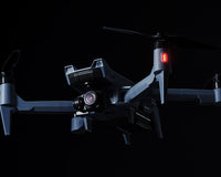
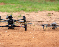
DJI Dock 3 – Autonomous, weather-hardened drone docking station
-
IP56 weather rated, runs –22°F to 122°F and handles wind speeds up to 27 mph
-
10 second take-off, 27-min recharge; built for 24/7 remote ops
-
Fixed-site or vehicle-mounted deployment for mobile DFR coverage
DJI Matrice 4TD / 4D (sold separately) – Dock-ready, IP-rated aircraft
-
IP55 airframe with anti-ice props; stable in rain, dust, and 27 mph winds
-
Up to 30-36 min flight time (realistic) for on-scene loiter, and “automatic swap” feature in DJI FlightHub 2 for multi-site DFR deployments
-
Triple-lens RGB + laser rangefinder; 4TD adds 640×512 radiometric thermal for night/heat detection
Installation & Infrastructure Considerations
-
Power: 110V AC circuit, licensed electrician recommended for permanent installs
-
Network: Reliable internet (≥ 10 Mbps up/down), connects via RJ45 ethernet port; 4G/5G dongle as backup
-
Site: Level pad or rooftop, secure, weather-proof, and within mission-coverage radius, site can be confined if using D–RTK 3 fixed deployment relay station
-
Deployment style: Choose fixed (building/rooftop power/network) or mobile (vehicle/trailer + generator/inverter) for flexible response
Step 2: Optional Add-Ons
Optional, but helpful add-ons for expanded capabilities.

For early-stage DFR planning, these optional (but highly useful) add-ons can significantly expand your capabilities without overcommitting your budget upfront.
- AVSS Parachute Recovery System (PRS) – Safety & compliance add-on for operations over people and most BVLOS waivers (subject to your CONOPS). ASTM F3322-22 certified; enables Operations-Over-People & supports BVLOS waiver paths. < 0.5s automatic deployment; integrated flight-termination system. Purpose-built mount for M4D/4TD; adds 180g without blocking sensors.
-
Vehicle-Mounted Gimbal Mount – Secure mounting bracket for deploying Dock 3 on a vehicle. It locks the drone and camera in place during transit, preventing bumps or vibrations from causing damage and enabling rapid mobile DFR operations across multiple sites.
-
Extra Batteries & Charging Hub – Spare intelligent flight batteries for your drone and a multi-battery charging station. Swapping in fresh batteries during missions while others recharge keeps your drone flying with minimal downtime.
-
DJI RC Plus 2 Enterprise – A rugged 7-inch touchscreen controller (IP54-rated) with an ultra-bright display and O4/4G connectivity. Useful for pilots who need direct on-site control or as a backup to autonomous operations, especially in bright or harsh conditions.
-
AS1 Speaker – Loudspeaker attachment that broadcasts real-time or pre-recorded messages up to 114 dB (audible 300 m away). Ideal for making announcements or giving warnings to people on the ground during emergency response or law enforcement missions.
-
AL1 Spotlight – High-intensity drone spotlight with constant or strobe modes, effective at illuminating subjects up to 100 m away. Ideal for night operations and search & rescue scenarios – it even synchronizes with the camera gimbal to keep targets lit in the camera’s view.
-
D-RTK 3 Relay (Fixed Deployment) – A fixed-position, extended-range RTK ground station that enhances the drone’s control link and delivers centimeter-level GPS accuracy. It ensures a stronger, more reliable connection in obstacle-rich environments—critical for safer BVLOS operations and precise automated landings. It also allows the DJI Dock 3 to be placed in a confined launch area while the D-RTK 3 unit is mounted high atop a building or antenna mast for optimal signal coverage.
Step 3: Software
Choose a remote operations flight platform.

Once your DJI Dock 3 and drone hardware are set up, the next step is selecting remote flight ops software to manage and pilot your DFR missions. Advexure recommends and supports three platforms compatible with DJI Dock 3: DJI FlightHub 2, DroneSense, and VOTIX. Each of these solutions enables remote launch and landing, live video streaming, mission planning, and data management tailored to public safety needs.
Below is a brief overview of each platform and their key strengths:
DJI FlightHub 2
DJI’s own cloud-based platform for enterprise drone operations, FlightHub 2 provides real-time situational awareness, fleet management, and mission planning in one hub. It seamlessly integrates with the DJI Dock 3 and the DJI ecosystem, allowing you to monitor drone flights, view live video, and even create quick 2D/3D maps from anywhere via a web browser.
Key Strengths:
-
Native Ecosystem Integration & First Access to Features: FlightHub 2 is DJI’s native operations platform—designed specifically to support the Dock 3, Matrice 4D/4TD series, and other DJI enterprise aircraft models. Because of this tight integration, new features and platform enhancements are consistently rolled out to FlightHub 2 first—often months ahead of third-party platforms. FH2 users gain early access to the latest tools as soon as DJI releases them. This speed of innovation is one of the top reasons agencies choose FlightHub 2—it ensures they’re always operating with the most up-to-date capabilities.
-
Ease of Use & Integration: Native support for DJI Dock and drones means minimal setup and a smooth user experience. Control the Matrice 4 series docked drone and gimbal remotely with an intuitive “virtual cockpit” interface.
-
Feature Set: Offers live mapping, real-time telemetry, and one-click mission planning (“Fly To” points, automated orbits, etc.), giving teams comprehensive situational awareness. It even supports AI object detection and cloud-based analytics for incident monitoring.
-
Data Security: Hosted on US-based AWS infrastructure with enterprise-grade security (ISO 27001 certified). All data transfer and storage are encrypted. (An on-premises option is in trial for specialized use cases.)
-
Deployment: 100% cloud-based – accessible through a secure web interface (and mobile apps) without needing local IT infrastructure. This makes it easy for agencies to start quickly and scale up as needed.
DroneSense
DroneSense is a comprehensive drone management and collaboration platform built specifically for public safety agencies. Its DroneSense Remote module allows first responders to fly Dock 3 drones beyond visual line of sight and send real-time video to command centers, creating a live overhead view of incidents that saves time and reduces risk to personnel . DroneSense is known for its robust situational awareness tools (it can ingest video from drones, body cams, helicopters, etc., into one common operating picture). It runs on a secure cloud (U.S.-based) and is designed with law enforcement and fire/EMS workflows in mind.
Key Strengths:
-
Purpose-Built for DFR: Developed alongside public safety teams, so it integrates features like Call-for-Service integration, allowing dispatch or 911 calls to directly kick off drone missions. Agencies using DroneSense for DFR report dramatically improved response times and safety outcomes .
-
Comprehensive Situational Awareness: Multiple drones and cameras can be viewed at once. Commanders can share live drone feeds securely via Magic Video Link, letting other officers or neighboring agencies see what the drone sees in real time.
-
Ease of Use & Administration: The platform is designed for field use – pilots get an intuitive app for flight control, while commanders and admins have tools to manage users, flight logs, and assets with just a few clicks. It supports role-based access (Pilots, Remote Operators, Admin) to simplify large team operations .
-
Data Security & Compliance: DroneSense prioritizes data security for government use. It is hosted on a secure cloud infrastructure (with options for CJIS-compliant data handling via Azure Government cloud). All video and flight logs are encrypted, and detailed audit logs are available for accountability.
-
Integration & Flexibility: Supports a range of drone hardware (not just DJI) and integrates with other systems like GIS maps and dispatch software. It’s a cloud service, but also offers APIs for custom integrations.
VOTIX (Drone Orchestration Platform)
VOTIX is a universal, hardware-agnostic drone operating system designed for automation at scale. It supports DJI Dock 3 operations along with many other drones and Drone-in-a-Box stations, making it a flexible choice for agencies that may use mixed fleets. VOTIX’s cloud platform combines three integrated modules – Manage (asset and mission management), Fly (remote flight control for BVLOS missions), and Stream (live video streaming). Public safety teams can use VOTIX to automate drone launch schedules, get low-latency live video feeds, and even leverage AI for object detection or thermal analytics during a response.
Key Strengths:
-
Hardware Agnostic & Scalable: Works with virtually any drone or dock hardware, not just DJI, which is ideal if your agency operates various drone models . You can manage multiple Dock 3 units (and other stations) under one system. The modular design lets you start with just the features you need and expand later.
-
Advanced Remote Operations: Enables fully remote BVLOS flights. Operators can pilot the Dock 3’s drone via a web interface with very low latency, as if they were on-site. Automated mission routines can be set (patrol routes, scheduled area scans, etc.), and VOTIX handles the orchestration – including autonomous takeoff, landing, and charging cycles.
-
Live Streaming & Intelligence: VOTIX’s streaming is optimized for real-time situational awareness, with the ability to stream to multiple users or even route video into other systems. It also offers visual AI add-ons (e.g. automated object recognition, tracking) to augment what the drone camera captures.
-
Airspace & Compliance Integration: The platform has built-in tools for regulatory compliance, such as automatic LAANC airspace authorizations for flights in controlled airspace . It logs all flight data for compliance with FAA and departmental policies. Data is stored securely in the cloud with full encryption.
-
Cloud Deployment with Enterprise Security: As a cloud-based service, there’s no complex installation – you access VOTIX via browser. All communications are encrypted, and you retain control over who can access your drone operations.
Note: While other remote ops software platforms exist on the market, these three are the solutions Advexure recommends and supports for public safety DFR deployments. They have been tested in real-world first responder scenarios and offer the necessary reliability, security, and integration capabilities to get your DJI Dock 3 program off to a strong start.
Step 4: BVLOS Pathways
Choose the Option That Best Fits Your DFR Scope

Below is a very high-level guide to the three FAA waiver options most public-safety teams use. Each unlocks a wider operating envelope for your DFR program while stacking requirements.
Follow the provided links for the latest official guidance—rules evolve quickly.
Tier 1 — TBVLOS (Tactical BVLOS with rooftop Visual Observers)
Best for: one-off emergencies and calls for service
-
Limits: ≤ 400 ft AGL; remain “well clear” of manned traffic; no loitering over crowds.
-
Eyes on airspace: Pilot + rooftop VOs can scan a 2-mile bubble; maintain two-way radios.
-
Paperwork: Pre-filed Part 91 COA + FAA Form 7711-2 via CAPS.
-
Resource: First-Responder BVLOS Waiver Guide
Tier 2 — CoW (Certificate of Waiver)
Best for: daily DFR flights ≤ 200 ft AGL across your jurisdiction.
-
Limits: Class G airspace; ASTM parachute; RPIC carries ADS-B In.
-
Situational awareness: requires a Remote ID detection tool such as the DroneTag Rider or UAS Sentry to monitor local air traffic.
-
Simplified filing: Email a Public-Safety Organization (PSO) letter to FAA ATO—no CAPS/DroneZone forms.
-
Duration & admin: Four-year approval; brief monthly activity log.
Resources: 91.113 Waiver Checklist PDF | Sample PSO Letter PDF
Tier 3 — DAA BVLOS (Detect-and-Avoid, up to 400 ft)
Best for: city-wide, 24/7 BVLOS where altitude and range matter.
-
Limits: ≤ 400 ft AGL; satisfy all CoW items plus an approved DAA sensor.
-
DAA options: Ground radar like MatrixSpace 360 or optical systems such as Casia G automate detect and alert.
-
Paperwork: Submit the DAA Criteria Determination (CMD) form with performance data.
-
Resource: DAA CMD Guidance PDF
Key Regulations These Waivers Modify
-
Right-of-Way – 14 CFR § 91.113
-
Minimum Altitudes – § 91.119
-
VFR Weather Minimums – § 91.155
Quick takeaways:
TBVLOS = emergency-only, rooftop VOs.
CoW = routine ≤ 200 ft BVLOS with parachute + ADS-B In (add Remote ID tools for extra situational awareness).
DAA = full 200–400 ft BVLOS once you integrate certified detect-and-avoid sensors.
Note: Regulations, forms, and review timelines change. We strongly recommend agencies review the linked FAA guides, checklists, and sample documents before submitting any waiver to ensure you’re working with the most current requirements.
Ready for Launch?

Standing up a DFR program with DJI Dock 3 is more straightforward than many assume. While some vendors emphasize complexity to steer agencies toward their own ecosystems—often pushing large consulting fees or ongoing service retainers—DJI’s approach, especially when paired with native tools like FlightHub 2, offers a streamlined, proven path to DFR with fewer barriers, faster deployment, and lower total cost.
Need more guidance? Advexure has helped departments of every size navigate hardware choices, software integrations, and BVLOS—always with an eye on operational needs and budget. Whether you’re pricing a single dock or mapping a multi launch site deployment network, we’re here to help. Reach out today!
Resources & Further Reading
Core Hardware
-
DJI Dock 3: https://advexure.com/collections/dji-dock-3
-
Matrice 4D / 4TD Aircraft: https://advexure.com/products/dji-matrice-4d-series
-
AVSS Parachute Recovery System: https://advexure.com/products/avss-parachute-m4d
Optional Add-Ons
-
D-RTK 3 Relay (Fixed): https://advexure.com/products/d-rtk-3-relay-fixed-deployment-version
-
Vehicle-Mounted Gimbal Mount: https://advexure.com/products/d-rtk-3-relay-fixed-deployment-version
-
Matrice 4-Series Batteries: https://advexure.com/products/dji-matrice-4-series-battery
-
Matrice 4-Series Charging Hub: https://advexure.com/products/dji-matrice-4-series-battery-charging-hub-100w
DJI RC Plus 2 Enterprise: https://advexure.com/products/dji-rc-plus-2-enterprise-enhanced -
AS1 Speaker: https://advexure.com/products/dji-as1-speaker-for-matrice-4-series
-
AL1 Spotlight: https://advexure.com/products/dji-al1-spotlight-for-dji-matrice-4-series
Remote-Ops Software
-
DJI FlightHub 2: https://advexure.com/products/dji-flighthub-2
-
DroneSense: https://advexure.com/pages/dronesense
Detect-and-Avoid / Remote-ID Detection
-
MatrixSpace 360 Radar: https://advexure.com/products/matrixspace-360-radar
-
Iris Automation Casia G: https://advexure.com/products/iris-automation-casia-g
-
DroneTag Rider: https://advexure.com/products/dronetag-rider
-
UAS Sentry RF Sensor: https://advexure.com/products/uas-sentry
BVLOS & FAA References
-
First-Responder BVLOS 91.113 Waiver Guide: https://www.faa.gov/uas/public_safety_gov/public_safety_toolkit/FR-BVLOS-91.113-Waiver-Guide
-
Part 91.113 Waiver Checklist (PDF): https://www.dropbox.com/scl/fi/vio3cp18cibo4sa3kshp5/PAO-91.113-Waiver-Checklist-March-2025-FINAL-V1.pdf?dl=0
-
Sample PSO Letter (PDF): https://www.dropbox.com/scl/fi/ox06qc2gfckhpszsrzyor/Sample-PSO-Letter-March-2025-FINAL.pdf?dl=0
-
DAA Criteria Determination Form (PDF): https://www.dropbox.com/scl/fi/zsexpdf3qgqwo31kc1fhq/CDM-DAA-March-2025-Final.pdf?dl=0
-
14 CFR § 91.113 – Right-of-Way: https://www.ecfr.gov/current/title-14/chapter-I/subchapter-F/part-91/subpart-B/subject-group-ECFRe4c59b5f5506932/section-91.113
-
14 CFR § 91.119 – Minimum Altitudes: https://www.ecfr.gov/current/title-14/chapter-I/subchapter-F/part-91/subpart-B/subject-group-ECFRe4c59b5f5506932/section-91.119
-
14 CFR § 91.155 – VFR Weather Minimums: https://www.ecfr.gov/current/title-14/chapter-I/subchapter-F/part-91/subpart-B/subject-group-ECFRe4c59b5f5506932/section-91.155