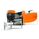
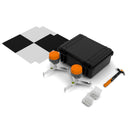
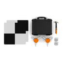
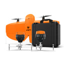
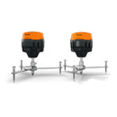
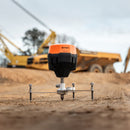
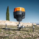
WingtraGROUND is a portable, all-in-one GNSS base and checkpoint kit for drone mapping. Guided setup and fixed-height tripods reduce errors and speed deployment by 4x. Data auto-syncs to WingtraCLOUD for 3 cm accuracy and a true end-to-end workflow. NDAA compliant.
WingtraGROUND is a portable, all-in-one ground setup kit for drone mapping that streamlines base-station and checkpoint workflows. Fully integrated with the Wingtra ecosystem, WingtraGROUND helps teams deliver survey-quality data faster with guided steps, automatic data sync, and NDAA-compliant hardware.
Focus on results, not the process
| Portable all-in-one kit | GNSS base & rover, compact fixed-height tripods, flexible targets, nails & hammer in one rugged case—one-person carry. |
| True end-to-end workflow | Plan, capture, log checkpoints, and auto-sync GNSS data to WingtraCLOUD—ready for processing immediately. |
| High precision | Consistent photogrammetry outputs with 3 cm (0.1 ft) accuracy*; checkpoints at ~1 cm (0.4 in) validate deliverables. |
| 4× faster setup | Fixed receiver height, pre-configured devices, and step-by-step guidance eliminate guesswork and rework. |
| NDAA compliant | Enterprise-ready kit that fits stringent program and project requirements. |
Simplified setup and workflow
All-in-one kit
Everything you need to start surveying—GNSS receivers, compact tripods, flexible targets, nails, and a hammer—organized in a single case so crews spend time mapping, not hunting for gear.
Step-by-step guidance
The companion tablet app walks you through base setup and checkpoint logging, confirming precise receiver locations and eliminating offset and pole-height mistakes.
Automatic data upload
After the flight, GNSS data syncs directly to WingtraCLOUD and is linked to your site’s coordinate system—no manual file handling or transformation.
Error-free by design
Automated checks and clear feedback enable non-experts to collect professional-grade results, while experienced surveyors save time and reduce risk across busy field days.
Discover WingtraGROUND’s improved workflow
1) Get to the survey site
Without WingtraGROUND: Bulky gear often requires multiple people and trips—more weight, more items to forget.
With WingtraGROUND: Portable kit, one-person job—GNSS receivers, fixed-height tripods, targets, nails & hammer in one rugged case alongside the drone.
2) Set up receivers
Without WingtraGROUND: Fragmented, manual configuration—switching between devices is tedious and error-prone.
With WingtraGROUND: Quick setup in one system—power the base, place it on a known point, and start accurate logging immediately.
3) Log checkpoints
Without WingtraGROUND: Manual entry of pole heights/offsets increases the chance of human error and inconsistent results.
With WingtraGROUND: Error-free process—place flexible targets and the rover; the app confirms correct placement. Checkpoints then verify 3 cm (0.1 ft)* map accuracy.
4) Sync data
Without WingtraGROUND: Manual downloads and coordinate transforms for each flight slow teams and introduce mistakes.
With WingtraGROUND: Automatic uploads, no errors—receiver data is organized per site and ready in WingtraCLOUD right after capture.
5) Process
Without WingtraGROUND: Small upstream errors surface late, forcing time-consuming troubleshooting and re-flights.
With WingtraGROUND: Reliable accuracy with less effort—fixed receiver height, guided steps, and tight WingtraCLOUD integration provide repeatable, survey-quality outputs flight after flight.
* Accuracy achievable using WingtraOne GEN II with a PPK module, the Wingtra RGB61 sensor, and a WingtraCLOUD PRO subscription, under optimal conditions on hard surfaces with a well-established known point on site. Checkpoints placed via the WingtraGROUND guided process validate final deliverables.
Base Logging
| Relative Positioning | Yes |
| Setup on Known Point | Yes |
| Absolute Positioning | PPP (Coming Soon) |
| Maximum Logging Duration | Up to 22 h |
Checkpoint Logging
| Logging Duration (Per Checkpoint) | 30 s |
| Max Distance to Base | Up to 10 km (6 mi) for best accuracy |
WingtraRECEIVER
| Positioning Accuracy (PPK) | Horizontal: 5 mm + 0.5 ppm • Vertical: 10 mm + 1 ppm |
| Signals Tracked | GPS/QZSS L1C/A, L2C • GLONASS L1OF, L2OF • BeiDou B1I, B2I • Galileo E1B/C, E5b |
| Number of Channels | 184 |
| Weight | 950 g (2.1 lb) |
| Size | 126 × 126 × 142 mm (4.96 × 4.96 × 5.59 in) |
| Waterproof Rating | IP67 (up to 1 m depth) |
| Temperature Range | -20 to +65 °C (-4 to +149 °F) |
| Batteries | Li-ion |
| Battery Lifetime | Over 2,000 charge/discharge cycles |
| Internal Storage | 16 GB |
WingtraCLOUD Integration
| Achievable Accuracy | 3 cm (0.1 ft)* |
| Communication | Bluetooth or Wi-Fi |
| Processing Options | PPK Single-Point Processing PPK Image Geotagging (Multi-Constellation) Map Processing (with Checkpoints or Ground Control Points) |
* Accuracy achievable using WingtraOne GEN II with a PPK module, Wingtra RGB61, and a WingtraCLOUD PRO subscription, under optimal conditions on hard surfaces with a well-established known point. Checkpoints placed via WingtraGROUND validate final deliverables.
(2) WingtraRECEIVER GNSS receivers
(2) Mini tripods (fixed height)
(6) Flexible targets (GCP/checkpoint)
(1) Hammer
(30) Survey nails (30 mm)
(30) Survey nails (50 mm)
(1) WingtraGROUND hard case
(2) Emlid USB charging cables
(2) LoRa antennas (for Emlid receivers)
(2) Emlid manuals
Note: WingtraGROUND requires an active WingtraCLOUD Pro subscription for processing.
Why should I choose WingtraGROUND over hiring survey service providers?
WingtraGROUND lets you collect survey data yourself, on demand. External providers are expensive and add turnaround time.
With its user-friendly, all-in-one system, you can achieve professional-grade accuracy without specialized training and realize ROI at a fraction of the cost—whenever you need data.
Is WingtraGROUND suitable for someone without surveying expertise?
Yes. WingtraGROUND is designed for ease of use. Step-by-step guidance, pre-configured tools, and automated workflows ensure you can collect accurate data confidently, even without prior experience.
I already own GNSS equipment. Why should I buy WingtraGROUND?
WingtraGROUND removes the hassle of configuring multiple tools and software.
Its seamless, integrated workflow saves time, reduces errors, and simplifies data collection—freeing up experts to deliver more projects.
What if I don’t want to use WingtraCLOUD?
WingtraCLOUD delivers maximum efficiency via automatic syncing. You can manually download data from the GNSS receiver using compatible apps, but this bypasses the seamless workflow and key benefits.
How accurate is the data collected with WingtraGROUND?
Combined with WingtraOne PPK, WingtraGROUND delivers photogrammetry outputs with 3 cm (0.1 ft) accuracy or better. Checkpoints placed during guided setup achieve ~1 cm (0.4 in) accuracy to verify and document results for clients.
What’s included in the WingtraGROUND kit?
Everything you need: GNSS receivers, tripods, flexible targets, nails, and a hammer—organized in a single, portable, rugged case for easy transport and fast setup.
How long does it take to set up WingtraGROUND?
Setup takes minutes. Pre-configured components and guided workflows reduce setup time to a fraction of traditional toolchains.
I’m worried the system might be too complex for me to use.
WingtraGROUND is built for simplicity. Guided steps and pre-configured tools help you start quickly and confidently. You’ll also have access to tutorials, distributor support, and expert help when needed.
I don’t want to invest in a tool I won’t use often.
WingtraGROUND suits occasional users. Its intuitive workflow requires minimal training, and the all-in-one design ensures you have everything ready when projects arise. Even a few surveys per year can deliver strong ROI.
Is this worth the cost?
Yes. WingtraGROUND provides professional-grade results at a fraction of traditional surveying setups or repeated service fees. Consider the time and labor saved to gather reliable survey data across projects—with minimal expertise required.
* Accuracy achievable using WingtraOne GEN II with a PPK module, the Wingtra RGB61 sensor, and a WingtraCLOUD PRO subscription, under optimal conditions on hard surfaces with a well-established known point on site. Checkpoints set up during the WingtraGROUND guided process validate the accuracy.
Customer Reviews
Payment & Security
Your payment information is processed securely. We do not store credit card details nor have access to your credit card information.


