As a manager at an open-pit operation, the pressures you might face are relentless. Delivering precise stockpile measurements is not just a routine task—it impacts inventory, financial reporting, and compliance with strict safety and environmental standards. Yet, traditional surveying methods are slow, labor-intensive, and often hazardous, causing costly delays and inefficiencies.
Drone technology offers a transformative alternative. Advanced sensors enable drones to collect accurate volumetric data quickly and safely, turning days of work into hours while reducing your team’s exposure to dangerous conditions.
Adopting drones, however, isn’t without its challenges. Concerns about upfront costs, workflow integration, and regulatory compliance are valid. But the benefits—improved safety, greater data accuracy, and streamlined operations—far outweigh the hurdles. And with advancements in technology, drones are more accessible and easier to implement than ever.
This blog explores how drones can revolutionize stockpile measurements, address common concerns, and guide you in choosing the right tools to integrate this powerful technology into your operations.
What Are Drone Volumetric Measurements?

Accurate volumetric measurements are essential for mining. Whether tracking production, managing stockpiles, or meeting regulatory requirements, knowing exactly how much material is on-site can significantly impact efficiency and decision-making.
A quick reminder—volumetric measurements refer to the process of calculating the volume of materials—such as gravel, ore, or sand—in a given stockpile.
Traditionally, this required teams of surveyors, specialized equipment, and hours of work, often leading to delays and potential inaccuracies. Drones offer a modern alternative.
Equipped with advanced sensors, they capture aerial data to produce highly accurate 3D models and orthomosaics. This streamlined approach delivers reliable measurements in far less time, allowing your team to focus on strategic decisions rather than time-consuming manual tasks.
Improving Measurement Accuracy and Reducing Surveying Time
Drone-based volumetric measurements offer some key advantages over traditional surveying methods. While there will always be a need for manual surveying and data collection, UAVs can help supplement your data collection. Here are the key benefits:
- Faster Data Collection: Traditional methods often require hours or even days of manual surveying to measure stockpiles and volumes. With drones, you can capture detailed data in a fraction of the time, enabling faster decision-making and increased productivity.
- Increased Accuracy: Manual measurements are prone to human error and inconsistencies. Drones, equipped with advanced sensors, provide highly accurate, repeatable measurements, ensuring that the data you rely on is precise and trustworthy.
- Cost-Effective: While the initial investment in drone technology can seem significant, the savings in labor, time, and operational costs quickly offset it. Drone surveys eliminate the need for expensive manual labor, reducing overhead costs while improving efficiency.
- Improved Safety: In traditional surveying, workers often have to navigate hazardous terrains or climb stockpiles. Drones remove the need for on-the-ground teams in dangerous areas, reducing risk while still providing high-quality data.
How Drone Volumetrics Work

Volumetric measurements using drones involve a systematic workflow that ensures precise and reliable data collection, processing, and analysis. This workflow can be broken down into three primary stages: Data Capture, Processing, and Volume Calculation. Each stage leverages advanced technologies and specialized software to provide mining operations with accurate volumetric data.
1. Data Capture
The first step in drone volumetrics is capturing aerial data using drones equipped with either optical cameras or LiDAR (Light Detection and Ranging) sensors.
- Optical/RGB Cameras: Drones outfitted with high-resolution optical cameras capture overlapping images of stockpiles and surrounding terrain. These images are essential for creating detailed 3D models through photogrammetry. For example, Pix4D and DroneDeploy are popular software choices that utilize these images to generate orthomosaics and 3D representations of stockpiles.
- LiDAR Sensors: Unlike optical cameras, LiDAR sensors emit laser pulses to measure distances between the drone and the ground or objects. This technology is particularly effective in environments with vegetation or obstructions, as LiDAR can penetrate these barriers to provide accurate elevation data. Companies like Flyability and Propeller Aero use LiDAR-equipped drones to create precise point clouds, which are critical for accurate volumetric measurements.
Helpful Tip: A point cloud is a collection of data points defined by a given coordinate system, representing the external surface of objects in 3D space. Point clouds are generated by LiDAR sensors and are used to create detailed 3D models of stockpiles.
2. Processing
Once the data is captured, it must be processed to transform raw information into usable formats. This stage involves using specialized software to convert aerial images or LiDAR data into 3D models or point clouds.
- Photogrammetry Software: Tools like Pix4D, DroneDeploy, and Agisoft Metashape process the overlapping images captured by optical cameras to generate accurate 3D models and orthomosaics. These models provide a comprehensive view of the stockpile’s surface, enabling precise measurements.
- LiDAR Processing Software: Software such as Propeller Aero and DroneDeploy handle the point cloud data generated by LiDAR sensors. These programs create detailed Digital Surface Models (DSMs) and Digital Terrain Models (DTMs), which are essential for accurate volumetric calculations. LiDAR processing software can also filter out noise and refine the data to enhance measurement accuracy.
Helpful Tip An orthomosaic is a geometrically corrected image that combines multiple aerial photographs into a single, uniform map. This process eliminates distortions caused by the camera angle or terrain, providing an accurate representation of the surveyed area.
Helpful Tip A DSM (Digital Surface Model) represents the elevation of the terrain and all objects on it, such as buildings and vegetation.
Helpful Tip A DTM (Digital Terrain Model) represents the bare ground surface without any objects, providing a clear view of the natural terrain.
LiDAR processing software can also filter out noise and refine the data to enhance measurement accuracy.
3. Volume Calculation
The final step is calculating the volume of the stockpiles using the processed data. This involves defining boundaries and utilizing software tools to compute the volume based on the 3D models or point clouds.
- Defining Boundaries: Using the processed 3D models, users delineate the base and perimeter of each stockpile. This can be done manually within the software or using automated tools that recognize the stockpile edges based on predefined criteria.
- Calculating Volume: Once boundaries are set, the software calculates the volume by measuring the space between the base and the highest points of the stockpile. Advanced algorithms consider elevation data and surface variations to ensure high accuracy. For instance, Propeller Aero allows users to compare current stockpile volumes with previous surveys or design specifications, providing actionable insights for inventory management and operational planning.
Use Case Example: Propeller Aero enabled a mining company to define the boundaries of their ore stockpiles within a 3D model, resulting in volume calculations with a 1% margin of error compared to traditional surveying methods.
This structured approach ensures that volumetric measurements are not only accurate but also efficient, allowing mining operations to make informed decisions swiftly and effectively.
What to Look for in a Drone for Stockpile Measurements
Selecting the right drone is crucial for effective stockpile measurements in mining operations. Here are the key features and considerations to ensure you choose a drone that meets your specific needs:
1. High-Resolution Cameras or LiDAR Sensors
- High-Resolution Cameras (Optical/RGB): Optical cameras capture detailed aerial images essential for creating accurate 3D models through photogrammetry. High-resolution imagery ensures that the resulting models are precise and reliable for volumetric calculations.
- LiDAR Sensors: LiDAR (Light Detection and Ranging) sensors emit laser pulses to measure distances, generating precise 3D point clouds even in environments with dense vegetation or obstructions. LiDAR is particularly effective for capturing accurate elevation data, making it invaluable for complex stockpile measurements.
2. RTK/PPK for Geospatial Accuracy
- Real-Time Kinematic (RTK) and Post-Processed Kinematic (PPK) GPS: RTK and PPK technologies enhance the geospatial accuracy of drone surveys by providing centimeter-level precision. This is essential for ensuring that volumetric measurements are both accurate and consistent, reducing the margin of error.
3. Durability and Reliability for Tough Environments
- Rugged Design: Mining environments can be harsh, with dust, debris, and variable weather conditions. Choosing a drone with a durable build and protective features, such as dust-resistant housings and robust frames, ensures reliable performance and longevity.
- Reliable Performance: Drones must operate consistently without frequent malfunctions. Models designed for industrial use typically offer enhanced stability, longer flight times, and resistance to environmental stressors, making them suitable for continuous operation in demanding settings.
4. Long Battery Life and Extended Flight Times
- Extended Flight Duration: Longer battery life allows drones to cover larger areas and complete more comprehensive surveys in a single flight. This efficiency reduces the number of flights needed, saving time and operational costs.
- Quick Recharge and Swappable Batteries: Features like swappable batteries and fast-charging capabilities ensure minimal downtime between flights, enabling continuous data collection and reducing delays in volumetric measurements.
5. Choosing the Right Payload for Specific Use Cases
- Sensor Compatibility: Ensure the drone is compatible with the sensors required for your specific volumetric measurement needs. Whether you need high-resolution optical cameras for photogrammetry or advanced LiDAR sensors for detailed elevation data, the drone should support the necessary payloads.
- Modular Payload Systems: Drones with modular payload systems offer flexibility, allowing you to switch between different sensors based on the requirements of each survey.
Best Drones for Mining Applications
Choosing the right drone is essential for effective stockpile measurements in mining operations. Below are some of the top drone models that excel in providing accurate and efficient volumetric data for mining applications:

1. DJI Matrice 4 Enterprise
The DJI Matrice 4 Enterprise sets a new benchmark in industrial drone performance with its advanced AI-driven operations. It can detect people, vehicles, and boats in real-time, enhancing situational awareness and operational safety. Equipped with superior 3x and 7x cameras, including a 112x hybrid zoom capable of capturing details from up to 250 meters, it delivers crystal-clear images with enhanced stabilization and low-light capabilities.
- AI-Powered Detection: Real-time identification of people, vehicles, and boats improves operational safety and efficiency.
- Advanced Imaging: Wide-angle camera with a 4/3 CMOS, 20MP sensor, and medium telephoto camera with a 1/1.3″ CMOS, 48MP sensor, alongside a telecamera boasting a 1/1.5″ CMOS, 48MP sensor for high-resolution data capture.
- Laser Range Finder (LRF): Provides precise measurements with a range accuracy of ± (0.2 + 0.0015 × D) meters.
- Enhanced Flight Performance: Rapid 15-second takeoff, speeds up to 21 m/s, a 25 km transmission range via 4G Enhanced Transmission, and an impressive 49-minute flight time.
- Precision Mapping: Factory-calibrated cameras, distortion correction 2.0, and multi-directional capture boost efficiency by up to 40%.
- Low-Light Excellence: Equipped with NIR auxiliary light and spotlight payloads, advanced low-light sensors, and electronic dehazing for clear visibility in challenging conditions.
- Smart Features: Includes FlyTo, POI, Smart Track, Cruise control, and real-time voice speaker functionalities for enhanced operational efficiency.
- Robust Design: Built to withstand harsh mining environments with improved obstacle avoidance and GNSS & Vision Fusion Positioning for safer return-to-home operations.

2. DJI Mavic 3 Enterprise
The DJI Mavic 3 Enterprise is a compact yet powerful drone designed for precision and versatility in mining surveys. Its streamlined and foldable structure allows for quick deployment and transportation between different mining sites, making it ideal for both beginner and veteran pilots.
- High-Resolution Imaging: Features a 20 MP wide-angle camera with a mechanical shutter for clear, distortion-free images, and a 12 MP tele zoom camera with 7-56x hybrid zoom to capture essential details from afar.
- RTK Module: Ensures centimeter-level accuracy for precise geospatial data collection, eliminating the need for ground control points in many cases.
- Portable Design: Its foldable structure facilitates quick setup and easy transportation, allowing for rapid deployment in various mining settings.
- Extended Flight Time: Offers up to 45 minutes of flight time, enabling comprehensive surveys covering up to 2 square kilometers in a single mission.
- Improved Low-Light Performance: Equipped with large 3.3μm pixels and intelligent low-light mode, significantly enhancing performance in dim conditions.
- Smart Tracking: Features Focus and Find capabilities with automatic zoom adjustments and subject reacquisition, ensuring continuous monitoring and data capture.
3. DJI Matrice 350 with Zenmuse P1 or Zenmuse L2

The DJI Matrice 350 RTK is an upgraded flagship drone platform that sets a new industry standard with its comprehensive safety features, robust payload capabilities, and enhanced flight performance. When paired with the Zenmuse P1 photogrammetry camera or the Zenmuse L2 LiDAR sensor, it offers unmatched flexibility and precision for mining volumetrics.
- Zenmuse P1: A 45 MP full-frame camera designed for photogrammetry and surveying missions, featuring an interchangeable lens system for enhanced efficiency and accuracy without the need for ground control points (GCPs).
- Zenmuse L2: A cutting-edge LiDAR payload that delivers precise elevation data and dense point clouds, capable of penetrating dense vegetation and complex structures with a detection range of up to 450 meters.
- Extended Flight Performance: 55-minute maximum flight time, 12.4 miles transmission range, and a dual battery system with hot swapping for uninterrupted operations.
- Advanced Sensing: 6-directional sensing and positioning with improved obstacle avoidance, ensuring safe navigation in challenging mining environments.
- Durable Design: Built with IP55 water and dust protection, operating in temperatures from -4°F to 122°F, making it reliable in harsh mining conditions.
- Intelligent Operations: Features FlyTo, POI, Smart Track, Cruise control, and real-time voice speaker functionalities to streamline operations and enhance data collection efficiency.
- Precision Mapping: Factory-calibrated cameras and distortion correction 2.0 ensure high-accuracy 3D models and orthomosaics, boosting mapping efficiency by up to 40%.
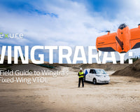
4. WingtraOne Gen II

The WingtraOne Gen II is a fixed-wing drone renowned for its ability to cover extensive areas efficiently, making it perfect for large mining sites. Its unique vertical take-off and landing (VTOL) capabilities combine the advantages of fixed-wing and multirotor drones, enabling easy deployment in confined spaces without compromising on coverage or accuracy.
- Vertical Take-Off and Landing (VTOL): Combines the benefits of fixed-wing and multirotor drones, allowing for easy deployment in confined spaces and eliminating the need for extensive runway setups.
- Long Flight Time: Offers up to 59 minutes of flight time, enabling expansive surveys in a single mission and covering large mining areas efficiently.
- High-Precision PPK GNSS: Ensures accurate geospatial data with minimal ground control points required, streamlining the surveying process.
- Advanced Imaging: Equipped with a 61 MP Sony Alpha A7R IV camera for maximum coverage and detail, allowing for the capture of high-resolution orthophotos and 3D models.
- Efficiency: Capable of surveying up to 310 hectares (766 acres) in a single flight, making it up to 11x faster than traditional multicopter drones and 2x faster than standard fixed-wing drones.
- Cost-Effective: Faster data collection and expanded coverage reduce the number of flights needed, lowering man-hour costs associated with data acquisition.
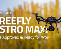
5. Freefly Astro (NDAA & BlueUAS Option)

The Freefly Astro is a robust drone platform compliant with NDAA and BlueUAS standards, making it suitable for mining operations that require adherence to specific regulatory requirements. Designed for flexibility and reliability, the Astro platform is equipped to handle high-pressure situations and diverse payloads, ensuring comprehensive data collection in demanding mining environments.
- Heavy Payload Capacity: Capable of carrying multiple sensors simultaneously, including high-resolution cameras and LiDAR systems, providing versatility for various surveying tasks.
- Enhanced Durability: Built to withstand harsh mining environments with a durable frame and reliable flight performance, ensuring consistent operation even in challenging conditions.
- Advanced Control Systems: Features sophisticated flight controllers for precise maneuvering and data capture, enhancing the accuracy and efficiency of volumetric measurements.
- High-Resolution Mapping: Equipped with a 61 MP Sony Alpha 7R IV camera mounted on a vibration-isolated Freefly gimbal, ensuring clear and detailed aerial imagery for accurate 3D modeling.
- Flexible Integration: Supports Quick-detach, allowing for easy switching between different payloads to suit specific surveying needs.
Selecting the Right Software for Drone Volumetrics
Selecting the right software is crucial for processing and analyzing volumetric data collected by drones in mining operations. The following software tools are among the top choices for mining professionals, each offering unique features, ease of use, integration capabilities, pricing options, and robust user support:
1. Pix4D
Pix4D is a leading photogrammetry software that converts aerial images captured by drones into precise 3D models and orthomosaics. It’s widely used in various industries, including mining, for its robust data processing capabilities.
- Advanced Photogrammetry: Generates highly accurate 3D models and orthomosaics from overlapping images.
- Cloud Processing: Offers both desktop and cloud-based processing options for flexibility and scalability.
- Customization: Provides extensive tools for customizing workflows to meet specific project requirements.
2. Propeller Aero
Propeller Aero specializes in drone data processing and cloud-based software for volumetric measurements, making it a popular choice in the mining sector for its accuracy and efficiency.
- Volumetric Calculations: Automates the process of calculating stockpile volumes with high precision.
- Real-Time Data Access: Provides instant access to processed data through its cloud platform, facilitating quick decision-making.
- Collaboration Tools: Enables multiple users to collaborate on projects, enhancing team productivity.
3. Agisoft Metashape
Agisoft Metashape is a powerful photogrammetry tool known for its high accuracy and detailed 3D reconstructions, making it suitable for complex mining projects.
- High-Resolution Outputs: Produces detailed 3D models and orthomosaics with superior precision.
- Advanced Editing Tools: Offers extensive post-processing options for refining models and data.
- Automation: Supports automated workflows to streamline the data processing pipeline.
4. DroneDeploy
DroneDeploy is a versatile, cloud-based drone software platform that excels in mapping and volumetric analysis, widely adopted in the mining industry for its ease of use and comprehensive features.
- Cloud Processing: Enables fast, cloud-based processing of aerial data, accessible from anywhere.
- Automated Workflows: Simplifies data collection and processing with automated flight planning and data analysis.
- Custom Reporting: Generates customizable reports and visualizations tailored to specific project needs.
5. DJI Terra
DJI Terra is DJI’s proprietary software designed to complement their drone hardware, offering powerful tools for mapping, modeling, and volumetric analysis tailored for industrial applications like mining.
- Seamless Integration: Optimized for DJI drones, ensuring smooth data transfer and processing.
- Comprehensive Mapping Tools: Supports 2D orthomosaic mapping, 3D reconstruction, and volumetric calculations within a single platform.
- Advanced Processing Algorithms: Utilizes sophisticated algorithms for accurate and efficient data processing, including distortion correction and multi-directional capture.
Drone volumetric measurements are transforming the mining industry by offering precise, efficient, and safe solutions for managing stockpiles. By harnessing advanced technologies such as optical cameras, LiDAR sensors, and specialized software, mining operations can achieve accurate inventory tracking, streamline operational planning, and ensure compliance with stringent regulatory standards.
At Advexure, we recognize the unique challenges faced by the mining sector and are dedicated to providing tailored drone solutions that meet your specific needs. With over 12 years of industry experience, we can offer expert guidance and support to help you seamlessly integrate drone technology into your operations.
Contact our Enterprise Sales team today to explore how our drone solutions can enhance your stockpile management and overall efficiency.


