Modern plant breeding and crop science hinge on plant phenotyping, the measuring of physical and biochemical traits of plants, to evaluate how different genetics and treatments affect growth and yield.
Traditionally, phenotyping crops in the field has been a slow, labor-intensive process, often requiring destructive sampling of plants for measurements. Today, drone-based remote sensing is transforming this process.
Small unmanned aerial vehicles (sUAVs or “drones”) equipped with advanced sensors can rapidly survey research plots and farms from above, gathering rich data on plant health, growth, and stress in a non-destructive, high-throughput manner.
This approach helps agricultural researchers break through the long-recognized “phenotyping bottleneck” in crop improvement by collecting more data, more frequently, than would ever be feasible with manual methods.
As a result, plant phenotyping drones are becoming indispensable tools in agriculture, enabling faster breeding of resilient, high-yield crops.
The Rise of Drone-Based Phenotyping in Agriculture

In recent years, drone remote sensing has seen explosive growth in agricultural research and precision farming. Unlike satellite imagery, drones fly low and capture ultra-high-resolution images on demand, unaffected by cloud cover.
Drones can quickly cover entire field trials, offering a panoramic view of thousands of plants during each flight. This high-throughput capability allows researchers to repeatedly monitor traits like plant height, canopy cover, and vegetation indices over a growing season.
Notably, studies show that UAV-based measurements often achieve accuracy comparable to traditional methods for many traits and, in some cases (like yield prediction), even outperform ground measurements.
More importantly, drones collect data noninvasively—measuring traits via reflected light or 3D scans—so plants remain intact for further research. By deploying drones carrying specialized sensors, agronomists can detect subtle signs of stress (e.g., drought or nutrient deficiencies) early, helping guide interventions or identify tolerant genotypes.
In short, UAVs are enabling a new era of data-driven crop science, where breeders and farmers can make decisions based on timely insights from the sky.
Multispectral vs. Hyperspectral Imaging

Central to drone phenotyping is the use of multispectral and hyperspectral imaging. These imaging systems measure reflectance from plant canopies in multiple wavelengths, which is key because healthy plants reflect light differently than stressed or diseased plants.
Multispectral cameras typically capture around 5–10 discrete spectral bands (for example, blue, green, red, red-edge, and near-infrared). A popular multispectral drone sensor is the MicaSense Altum-PT, which simultaneously records five narrow bands plus a high-resolution panchromatic image and a thermal image. Multispectral imagery allows calculation of vegetation indices like NDVI, which correlate with chlorophyll content, biomass, and water status, giving researchers a quick read on plant health and vigor.
Hyperspectral sensors, by contrast, capture hundreds of contiguous spectral bands, providing a detailed reflectance spectrum for each pixel. This wealth of data can reveal subtle biochemical differences (for example, leaf pigment composition or nutrient levels), making hyperspectral imaging extremely powerful for phenotyping.
In fact, hyperspectral imaging is considered to have “the biggest potential for assessing different plant traits” because it covers the entire visible and infrared spectrum. The downside is that hyperspectral cameras are expensive and data-heavy; their cost is often too high for routine use compared to multispectral sensors.
Therefore, most field phenotyping relies on multispectral drone imagery, which strikes a balance between information and cost. Multispectral drones provide precise, science-grade data. Together, these technologies enable high-throughput, non-destructive phenotyping by measuring traits like canopy cover, plant biomass, water stress (via thermal infrared), and even disease symptoms, all from above the canopy.
Procurement Challenges: NDAA and Blue UAS Compliance
While the scientific case for drone phenotyping is strong, many universities and research institutions face practical hurdles when acquiring drones.
A major constraint in the U.S. currently is the regulatory environment around equipment purchases using federal funds. Recent legislation, notably the National Defense Authorization Act, has introduced strict requirements aimed at security and the domestic sourcing of drone technology.
The FY2024 NDAA (sometimes called the American Security Drone Act) prohibits the use of federal grant or contract funds to purchase or operate drones made in certain “covered” countries.
This means popular, affordable drone platforms from Chinese manufacturers are more often out of reach for any project using U.S. federal funding after late 2025.
Universities with USDA, NSF, or other federal grants must carefully ensure their aircraft is an NDAA-compliant drone. In addition, many agencies and state partners now explicitly require Blue UAS certification—referring to the Department of Defense’s “Blue sUAS” program that vets and approves drones for government use.
A Blue UAS compliant drone meets rigorous standards for cybersecurity, supply chain, and operational safety set by the Defense Innovation Unit. Effectively, Blue UAS is a short list of trusted platforms (all domestically manufactured or from allied nations) that agencies can buy with confidence.
For university procurement, these rules have quickly changed the drone landscape. A research center that previously used a DJI Phantom or Matrice for crop imaging might find it can no longer replace or upgrade that equipment with federal dollars.
Instead, they now seek NDAA-compliant alternatives. This shift hasn’t been painless. Researchers have expressed concern that non-Chinese drones are often “costlier [and] less capable,” potentially straining budgets and technical capacity. Despite these worries, compliance is mandatory, and forward-looking universities are beginning to invest in approved platforms to avoid disruptions in their programs.
Below, we highlight two leading options—the Inspired Flight IF800 Tomcat and the Freefly Astro—which both offer NDAA drone options for agriculture research.
NDAA-Compliant Drones for High-Throughput Phenotyping

Inspired Flight IF800 Tomcat
The Inspired Flight IF800 Tomcat is an American-made, medium-lift quadcopter built for versatility. Manufactured and supported 100% in the USA, the IF800 is fully NDAA-compliant and purpose-built for enterprise and research use.
In terms of flight performance, the IF800 Tomcat can carry up to 6.6 pounds (3.0 kg) of payload and still achieve flight times up to 54 minutes per mission (in ideal conditions).
This long endurance is supported by dual hot-swappable batteries. Despite its size, the IF800 is designed to be portable and deployable. The airframe folds for transport, and its rugged construction withstands winds of ~23 knots (∼12 m/s) to keep flying in less-than-ideal weather. With a top speed around 49 mph, it can cover large trial fields quickly.
For agronomists, the key appeal of the IF800 is its payload flexibility. Inspired Flight provides a universal payload interface and has pre-integrated support for an array of sensors, so users can easily swap cameras or instruments as needed. Sensors options include the 61MP Sony ILX-LR1 and support for leading agriculture sensors like the MicaSense Altum-PT via Inspired Flight’s Smart Dovetail.
In practice, a researcher could mount the Altum-PT to capture 5-band multispectral data + thermal. The drone’s robust flight controller (an open-source ArduPilot system) and heavy lift capacity also enable carrying more complex payloads like LiDAR or dual-sensor setups.
Freefly Astro

Another compelling option is the Freefly Astro, a compact yet powerful drone from Freefly Systems (a well established U.S. drone and gimbal manufacturer).
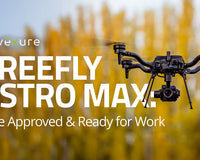
The Astro is marketed as an American-made, Blue UAS certified quadcopter that delivers versatility for critical operations.
The standard Astro carries about 1.5 kg (3.3 lbs) of payload and achieves roughly 25–37 minutes of flight time (depending on payload weight). It uses innovative 21-inch propellers and efficient motors, enabling stable flight and long endurance from a relatively compact 16-inch frame.
Freefly now also offers an upgraded Astro Max configuration, which can lift up to 6.6 lbs, similar to the IF800, by leveraging the same large prop design and higher-voltage batteries. In all cases, the Astro is built for portability—it folds down neatly into a carry case, making it easy for a research team to haul between field sites. The drone is weather-resistant (IP54) and engineered for reliability, with redundancies and high-quality components to satisfy government and defense users.
Where the Astro shines for academic use is its plug-and-play payload ecosystem. Freefly developed a Smart Dovetail mounting standard and Pixhawk-based payload bus, which allows quick swapping of sensors and accessories. For precision agriculture missions, Freefly and its partners offer multispectral payload kits that are NDAA-compliant.
The Astro offers a wide range of payload options, including high-resolution mapping cameras (61MP Sony LR1), dual thermal upgrade options, as well as lightweight LiDAR units. With up to 38 minutes of flight on two smart batteries, an Astro can map dozens of acres per flight or loiter to capture detailed spectral scans of experimental plots.
Data security and control are also a focus: the Astro integrates a U.S.-made flight controller (Auterion Skynode) running open-source PX4, and it supports encrypted radio links (e.g., the U.S.-made Doodle Labs mesh) to ensure compliance with federal IT requirements.
Precision Mapping Accessories — Emlid GNSS for RTK/PPK Workflows

High-throughput phenotyping isn’t only about spectral data; spatial accuracy matters too. Vegetation indices lose diagnostic value if plot boundaries drift by even a few centimetres between flights. Both the IF800 Tomcat and Freefly Astro support RTK/PPK corrections, but they still need a high-quality reference receiver on the ground. Enter the Emlid Reach series of multi-band GNSS stations.
Why add a dedicated base station?
RTK (real-time kinematic) corrections streamed from a local base reduce horizontal error from ≈ 1 m (standard GPS) to 1–2 cm. That level of precision:
-
Lets researchers drastically reduce ground-control-point (GCP) deployment, shaving hours off each mapping mission.
-
Keeps plot polygons perfectly aligned across time-series flights, improving the reliability of longitudinal trait analyses.
-
Enables accurate digital elevation models (DEMs) for biomass estimation or water-flow modeling.
Recommended receivers
|
Receiver |
Key features |
Why it fits phenotyping missions |
|
Dual-band GNSS + built-in IMU tilt compensation (maintains cm precision up to 60° pole tilt) |
Fast GCP collection in uneven fields and along drainage ditches—no need to level the survey pole. Works as base or rover; broadcasts UHF or NTRIP corrections straight to the drone. |
|
|
Multi-band receiver, LTE modem, baseline up to 100 km, centimeter-level RTK/PPK accuracy |
Affordable workhorse (≈ US $2.7 k) that pairs well with drone kits. Ideal for permanent base installation at a research farm or for travelling teams collecting GCPs. |
Trade-offs and Benefits: NDAA Drones vs. Lower-Cost Platforms
It’s important to acknowledge the trade-offs when choosing American-made NDAA-compliant drones like the IF800 Tomcat or Freefly Astro over Chinese-made options.
Cost is the most obvious: research groups might spend two to three times more upfront for an NDAA drone system. This higher cost can strain grants and limit how many units a lab can afford.
Additionally, some features commonly found on Chinese drones—such as omnidirectional obstacle avoidance, automated flight modes, or an integrated software ecosystem—may be less developed on the newer American platforms. For instance, flight control apps and data processing might require a bit more technical savvy if not as turnkey as DJI’s solutions.
However, the long-term benefits and mandate for compliance often outweigh these drawbacks. First and foremost, using an NDAA-compliant, Blue UAS-listed drone ensures that a university’s investment is future-proofed amidst evolving regulations.
In Conclusion
For agricultural researchers and procurement officers navigating this new drone regulatory landscape, the Inspired Flight IF800 Tomcat and Freefly Astro are both capable options to consider.
These NDAA-compliant, Blue UAS-approved drones show that it’s possible to meet federal requirements without sacrificing the benefits of advanced remote sensing. They enable universities to capture the precision data necessary for high-throughput plant phenotyping and precision agriculture, all while staying compliant.
If you need additional assistance or guidance on choosing the right platform for your university or institution, please reach out to our Enterprise Sales team today.
Sources & Further Reading
-
Ayankojo et al. (2023). Remote Sens. 15(10): Advances in Application of sUAS for HTPP.
-
Cvetkovic et al. (2023). Plant Methods 19: High-throughput phenotyping for biomass via UAV.
-
UC Davis Office of Research (2024). New Drone Prohibitions for Federal Grants.
-
Inspired Flight (2025). IF800 Tomcat Product Page.
-
Freefly Astro (2025). Freefly Astro Max Product Page.


