The commercial UAS landscape has expanded rapidly over the past few years, and so has the number of platforms marketed for inspections. Between flight time, payload specs, and evolving compliance requirements, choosing the right platform can feel overwhelming, specially if you’re evaluating drones for the first time.
What manufacturer can you rely on? How much flight time do you actually need? Do you need thermal, optical zoom, or multispectral sensors? Can you even use this system on a federally funded project? Depending on how you answer those questions, your options may vary widely.
In the spirit of clarity, this guide was created to help you make a confident, well-informed investment. The “top” drone for inspections depends entirely on the nature of your work and the technical demands of each job.
Before diving into specific platforms, let’s break down the types of structural inspections being performed, and the capabilities each one calls for.
Types of Structural Inspections
Bridge & DOT Inspections (NBIS/NBIA-aligned)
Bridge inspections require detailed visual assessments of decks, piers, joints, bearings, and other load-bearing elements. These structures often span long distances or are located in hard-to-reach areas, making manual inspection time-consuming and potentially hazardous.
Drones offer safer, faster access to these areas, capturing high-resolution visuals without lane closures or rigging. For example, contractors supporting state DOTs often rely on drone flights to reduce traffic disruptions during NBIS-compliant surveys.
What matters most:
Long endurance, RTK positioning, zoom payloads, NDAA/Blue UAS compliance, and support for structured inspection workflows.
Facade & QEWI Inspections
Facade inspections, especially in dense urban environments, demand close-range imaging of building exteriors, window systems, and architectural features. QEWI-certified inspectors in cities like New York use drones for Local Law 11 compliance to document cracks, surface degradation, and sealant failures without relying on scaffolding.
Drones reduce setup time and minimize disruptions to building occupants. Stability and precision are key, especially when operating in GPS-compromised conditions or near reflective glass.
What matters most:
Zoom optics, visual clarity, precise hover, obstacle avoidance, and compact airframes for urban missions.
Code Enforcement & Municipal Inspections
Municipal inspectors often evaluate properties for overgrowth, unpermitted construction, zoning violations, and safety hazards. Fire departments and code enforcement teams in wildfire-prone states like California frequently use drones to identify vegetation encroachments and flag properties for fire hazard abatement.
In rural regions, drones are also used to locate illegal cannabis grow operations by identifying thermal signatures or non-native vegetation patterns.
What matters most:
Fast deployment, ease of use, RGB or multispectral sensors, and zoom or thermal options depending on the mission type.
Insurance Claims & Damage Assessments
Insurance adjustors and carriers use drones to assess damage from wind, hail, fire, or flooding, especially after severe weather events. Following hurricanes in the Gulf Coast, many carriers deploy drone teams to rapidly assess hundreds of residential rooftops in a matter of hours.
Thermal and zoom cameras help detect water intrusion, heat loss, or compromised building envelopes, all without putting adjustors in unsafe conditions.
What matters most:
Thermal sensors, RGB imaging, fast flight setup, and software compatibility for image annotation or reporting.
Historical Building Surveys
Preservation teams and architectural historians often inspect structures that are fragile, aging, or structurally sensitive. For example, drone imagery has been used to document deterioration in historic adobe structures in New Mexico and Victorian-era masonry in San Francisco without requiring direct physical contact.
Drones offer a non-invasive way to collect detailed visuals of rooflines, facades, and architectural features for archival or restoration planning.
What matters most:
Stability, visual fidelity, compact form factor, and ease of flight near delicate or constrained areas.
Roof Inspections (Residential & Commercial)
Roof inspections are one of the most widespread applications for drones. Home inspectors, roofers, and insurance adjustors use them to evaluate condition, identify leaks, and check for structural damage without climbing ladders or scaffolding.
In colder climates like Minnesota or Michigan, thermal imaging helps spot insulation gaps or ice damming issues before they lead to more costly problems.
What matters most:
RGB and thermal sensors, clear imaging, ease of use, and safety for operators working in residential zones.
Top Drones for Building & Structural Inspections
DJI Matrice 4T (Thermal)

A high-end multi-sensor platform built for enterprise-grade structural inspection. The Matrice 4T features a fixed quad-camera payload combining a wide-angle, medium-telephoto, telephoto and infrared thermal imager.
-
Flight Time: Up to ~49 minutes
-
IP Rating: IP55
-
Camera / Sensing: Wide (1/1.3″ CMOS 48MP), Medium-Tele (1/1.3″ 48MP), Telephoto (1/1.5″ 48MP) plus Infrared Thermal (640×512, high-res mode up to 1280×1024)
-
Compliance: Not NDAA/Blue UAS compliant
-
Other Features: RTK support, O3 Enterprise transmission, built-in laser rangefinder (~1800m)
Best for:
Roof inspectors, insurance adjustors, code enforcement teams and private contractors who require high-resolution thermal + zoom imaging but are not constrained by federal procurement compliance.
DJI Matrice 400 RTK

DJI’s latest flagship enterprise drone brings extended flight times, robust RTK precision, and a modular payload ecosystem into one versatile airframe. The M400 is purpose-built for long-span inspections of bridges, highways, and other infrastructure projects that require endurance, sensor flexibility, and fine control.
-
Flight Time: Up to 50 minutes (with TB65 batteries)
-
IP Rating: IP55
-
Camera Compatibility: Supports L2 LiDAR, H30T, RedEdge-P, P1, and third-party payloads
-
Compliance: Not NDAA/Blue UAS compliant
-
Other Features: RTK dual-antenna support, hot-swappable batteries, intelligent flight planning, expanded payload capacity
Best for:
State DOT contractors, AEC firms, large-scale infrastructure inspectors, and engineering teams that require sensor flexibility and long-endurance flight performance.
ACSL SOTEN

A Japanese-built, compact enterprise drone platform that is NDAA compliant and designed for secure inspection workflows. It features a swappable payload ecosystem (thermal, multispectral, zoom) and an IP43 rated airframe.
-
Flight Time: Up to ~25 minutes with standard camera
-
IP Rating: IP43
-
Camera/Sensing Options: Standard 20 MP/4K camera; optional infrared + visible, optical zoom, multispectral modules
-
Compliance: NDAA compliant
-
Other Value Props: Lightweight (~1.72 kg with battery/payload); swappable payloads provide mission flexibility; strong data-security features (AES-256 encryption)
Best for:
State/local government agencies, municipal code enforcement teams, mid-sized inspection firms that require NDAA compliance but prefer a smaller, more portable airframe.
Inspired Flight IF800 TOMCAT

A U.S.-made, medium-lift enterprise drone with long endurance, modular payload flexibility and approved for sensitive procurement.
-
Flight Time: Up to 54 minutes
-
Max Payload: 6.6 lbs (~3 kg)
-
IP Rating: IP43
-
Compliance: NDAA compliant and Blue UAS cleared
-
Other Features: Hot-swappable dual batteries, compatible with a broad range of specialized payloads (optical, thermal, LiDAR, hyperspectral, geophysical), American-based support
Best for:
Federal infrastructure inspectors (rail, bridge, critical infrastructure), large-scale AEC firms and agencies who require a compliant platform with payload versatility and long endurance.
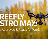
Freefly Astro Max

A U.S.-manufactured industrial drone platform built for enterprise and federal inspection workflows. This model supports NDAA/Blue UAS compliance (when configured appropriately) and offers modular payload integration with a strong hardware base.
-
Flight Time: Up to ~38-39 minutes (no payload)
-
Payload Capacity: Around 3 kg
-
IP Rating: IP43 in certain configurations
-
Compliance: NDAA and Blue UAS cleared when configured with correct radio link
-
Other Value Props: Open payload mount system (Smart Dovetail) for optical, LiDAR, thermal sensors; RTK support; made in USA
Best for:
Federal agencies, large infrastructure inspection teams (bridges, rail, highway corridors), and enterprise clients needing long endurance, heavy-duty payload flexibility, and full compliance.
DJI Mavic 3 Multispectral

A compact, foldable inspection drone focused on vegetation/land-use sensing and mapping. The Mavic 3 Multispectral integrates an RGB camera plus a four-lens multispectral array (Green, Red, RedEdge, Near-IR).
-
Flight Time: ~43 minutes
-
IP Rating: None
-
Camera / Sensing: RGB 20MP 4/3″ CMOS; Multispectral 4×5MP (G, R, RE, NIR)
-
Compliance: Not NDAA/Blue UAS compliant
-
Other Features: RTK module included, foldable portability, efficient sensor architecture for vegetation/encroachment inspection
Best for:
Code enforcement departments, municipal land-use/regulation teams, environmental/vegetation survey specialists investigating overgrowth, illegal grows, plant-health monitoring.
Choosing the Right Tool for the Job
There’s no universal best drone for structural inspection work, only the best platform for your mission profile. Whether you’re inspecting long-span bridges, surveying vegetation encroachment, or evaluating roof damage post-storm, your needs will vary based on flight endurance, payload type, regulatory requirements, and operational complexity.
Budget, compliance status, and camera capabilities all play a role, but so does after-sale support, training resources, and product reliability. That’s why it pays to work with a partner who understands the full scope of UAS inspection workflows.
At Advexure, we’ve staked our reputation on our ability to help professionals across public and private sectors find drones that fit the job and the long-term strategy. If you’re evaluating platforms or building out your inspection program, we’re here to help.
Request a Quote to speak with a UAS expert and explore the right options for your inspection team.


